Big Bluestem – Indian-grass Floodplain Grassland
System: Palustrine
Subsystem: Herbaceous
PA Ecological Group(s): River Floodplain
Global Rank:GNR
![]() rank interpretation
rank interpretation
State Rank: S3
General Description
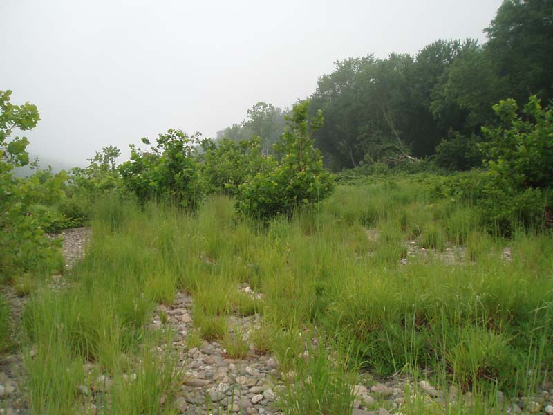
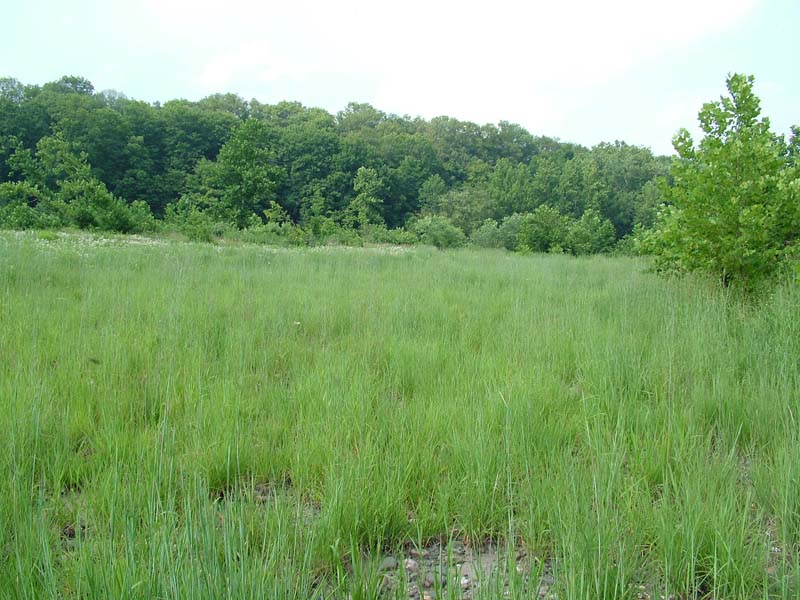
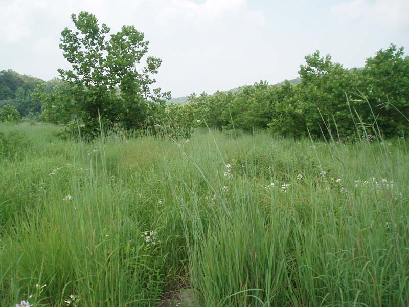
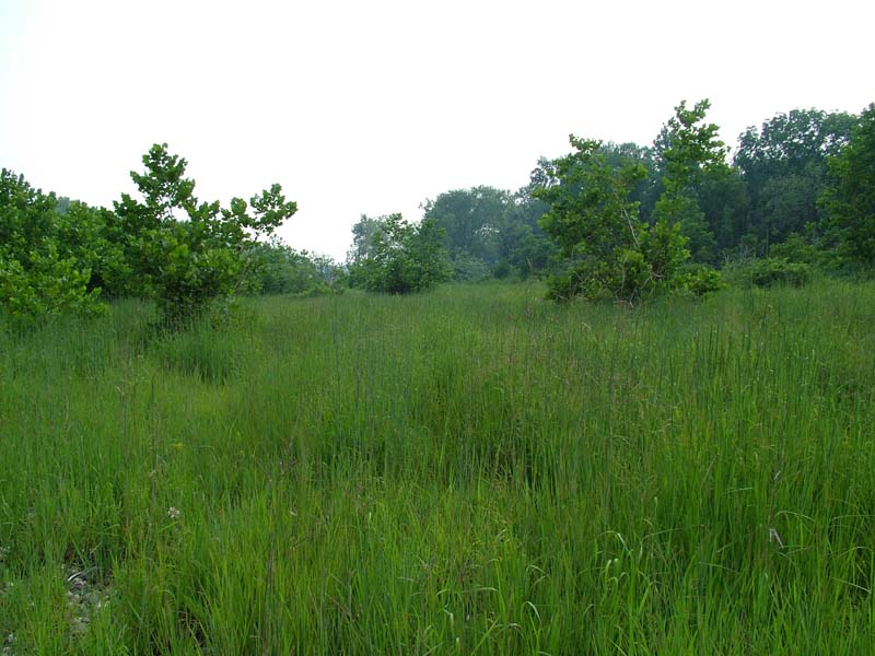
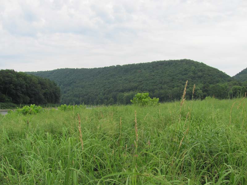
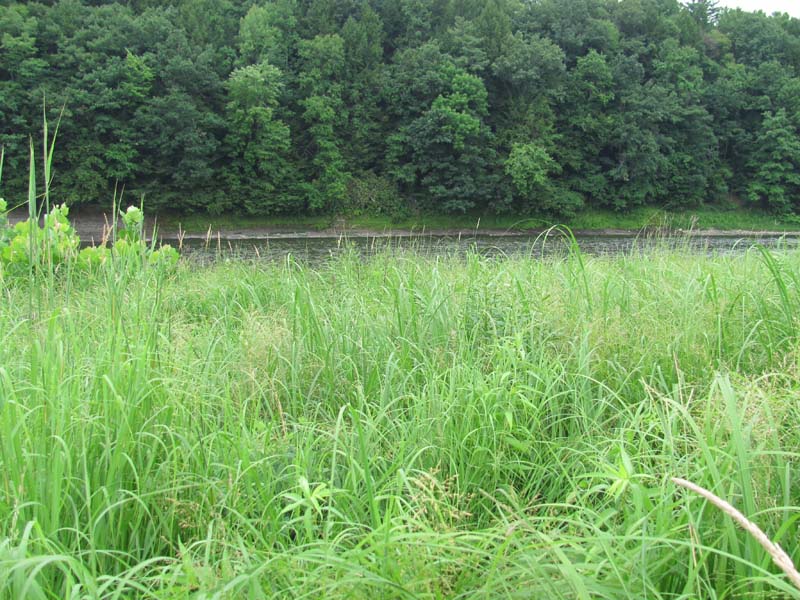
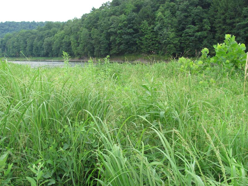
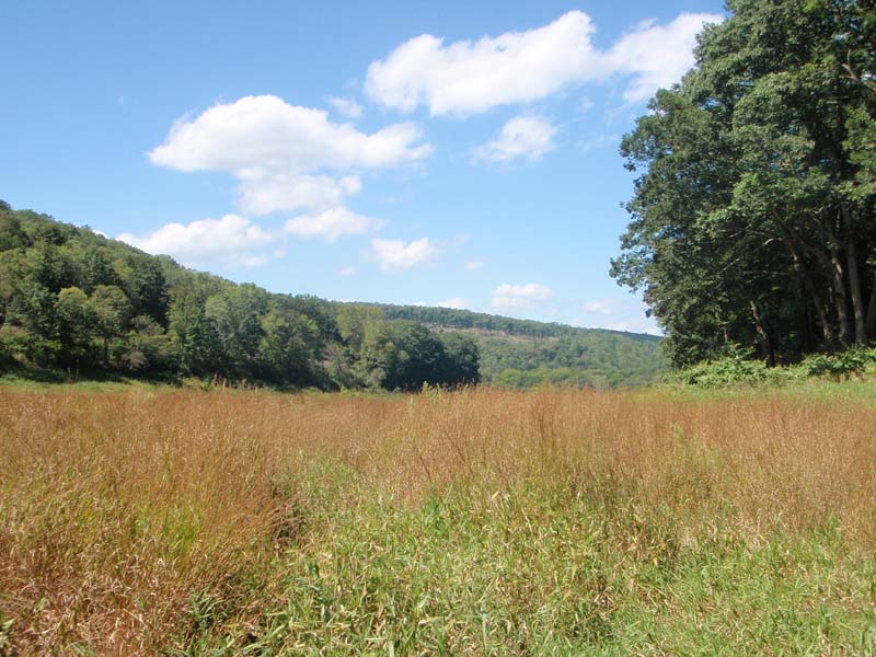
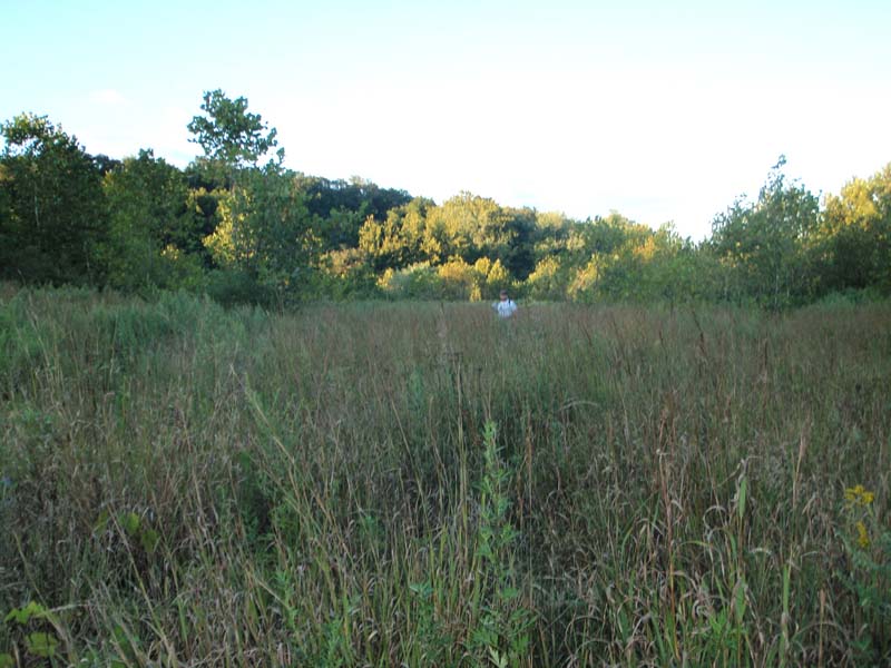
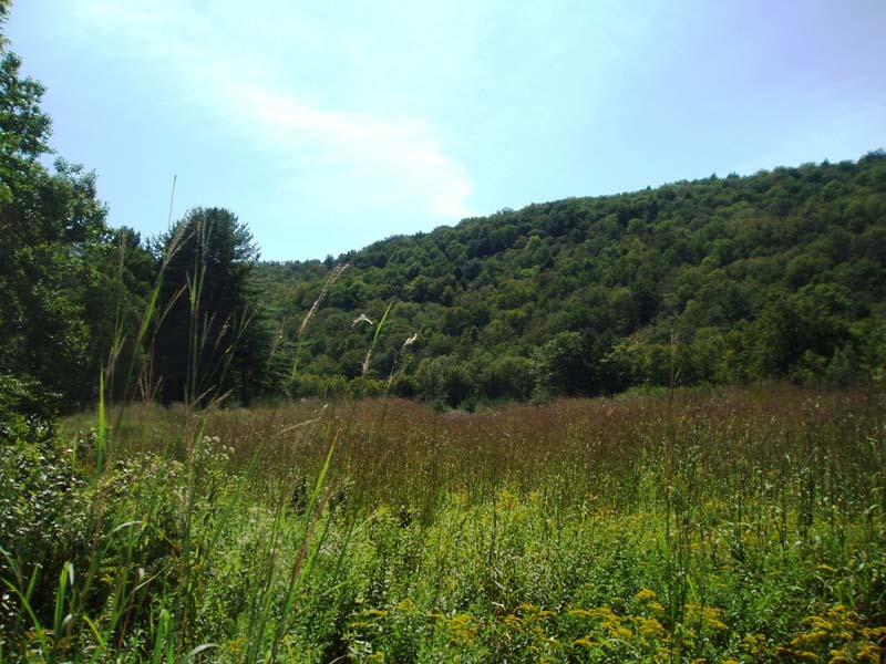
Big Bluestem – Indian-grass River Grassland occurs on sand/gravel deposits and broad cobble/boulder shores along the banks of large rivers. This community may also occur on islands within the active channel of large rivers in mountainous regions of Pennsylvania. These sites are subject to high intensity flooding and ice scour. This community is found in the Ohio, Susquehanna, and Delaware river basins of Pennsylvania. Large patches of this type are primarily found along free flowing sections of larger rivers of Pennsylvania, where river discharge, basin size, surficial geology, and stream gradient result in significant annual flooding events that restrict the growth and establishment of tree species.
This community is characterized by a dense graminoid layer with scattered short shrubs (less than 25% cover). Scattered shrubs and trees may be present, including sycamore (Platanus occidentalis), silver maple (Acer saccharinum), black willow (Salix nigra), steeplebush (Spiraea tomentosa), ninebark (Physocarpus opulifolius), and silky dogwood (Cornus amomum), but the community is predominantly composed of warm season grasses: big bluestem (Andropogon gerardii), switchgrass (Panicum virgatum), and Indian-grass (Sorghastrum nutans). Associate species include cordgrass (Spartina pectinata), water-pepper (Persicaria punctata), tearthumb (Persicaria sagittata), hedge bindweed (Calystegia sepium), rice cutgrass (Leersia oryzoides), purple-leaved willow-herb (Epilobium coloratum), Indian-hemp (Apocynum cannabinum), beggar-ticks (Bidens spp.), false nettle (Boehmeria cylindrica), jewelweed (Impatiens capensis), bugleweed (Lycopus uniflorus), late goldenrod (Solidago gigantea), wrinkle-leaf goldenrod (Solidago rugosa), grass-leaved goldenrod (Euthamia graminifolia), wild mint (Mentha arvensis), boneset (Eupatorium perfoliatum), Joe-Pye-weed (Eutrochium fistulosum), ox-eye (Heliopsis helianthoides), tall tickseed (Coreopsis tripteris), flowering spurge (Euphorbia corollata) flat-topped white aster (Doellingeria umbellata), calico aster (Symphyotrichum lateriflorum), twisted sedge (Carex torta), riverbank wild-rye (Elymus riparius), blue false-indigo (Baptisia australis), deer-tongue grass (Dichanthelium clandestinum), and common yellow wood-sorrel (Oxalis stricta). Reed canary-grass (Phalaris arundinacea), which is often present in this type, represents a significant threat as it can form large single species colonies.
Rank Justification
Vulnerable in the jurisdiction due to a restricted range, relatively few populations, recent and widespread declines, or other factors making it vulnerable to extirpation.
Identification
- Typically on broad gravel and cobble deposits of large river floodplains
- Sites are open, dominated by warm season grasses with scattered, often battered shrubs and trees
- Substrate is sandy gravel and/or cobbles
- Maintained by annual episodes of high intensity flooding and ice scour
Shrubs
Herbs
- Big bluestem (Andropogon gerardii)
- Switchgrass (Panicum virgatum)
- Indian-grass (Sorghastrum nutans)
- Freshwater cordgrass (Spartina pectinata)
- Dotted smartweed (Persicaria punctata)
- Tearthumb (Persicaria sagittata)
- Rice cutgrass (Leersia oryzoides)
- Purple-leaved willow-herb (Epilobium coloratum)
- Indian hemp (Apocynum cannabinum)
- Beggar-ticks (Bidens spp.)
- False nettle (Boehmeria cylindrica)
- Jewelweed (Impatiens capensis)
- Bugleweed (Lycopus uniflorus)
- Smooth goldenrod (Solidago gigantea)
- Grass-leaved goldenrod (Euthamia graminifolia)
- Boneset (Eupatorium perfoliatum)
- Joe-pye-weed (Eutrochium fistulosum)
- Ox-eye (Heliopsis helianthoides)
- Tall tickseed (Coreopsis tripteris)
- Flowering spurge (Euphorbia corollata)
- Flat-topped white aster (Doellingeria umbellata)
- Calico aster (Symphyotrichum lateriflorum)
- Twisted sedge (Carex torta)
- Riverbank wild-rye (Elymus riparius)
- Blue false-indigo (Baptisia australis)
- Deer-tongue grass (Dichanthelium clandestinum)
- Common yellow wood-sorrel (Oxalis stricta)
Vines
Exotic Species
* limited to sites with higher soil calcium
Vascular plant nomenclature follows Rhoads and Block (2007). Bryophyte nomenclature follows Crum and Anderson (1981).
International Vegetation Classification Associations:
USNVC Crosswalk:None
Representative Community Types:
Big Bluestem – Switchgrass – Tall Blue Wild Indigo Herbaceous Vegetation (CEGL006283)
Sandcherry / Big Bluestem – Yellow Indiangrass Herbaceous Vegetation (CEGL006518)
NatureServe Ecological Systems:
Central Appalachian River Floodplain (CES202.608)
NatureServe Group Level:
None
Origin of Concept
Zimmerman 2008, also Pennsylvania Natural Heritage Program. 2004. Classification, Assessment and Protection of Non-Forested Floodplain Wetlands of the Susquehanna Drainage. Report to: The United States Environmental Protection Agency and the Pennsylvania Department of Conservation and Natural Resources, Bureau of Forestry, Ecological Services Section. US EPA Wetlands Protection State Development Grant no. CD-98337501.
Pennsylvania Community Code*
HI : Big Bluestem – Indian Grass River Grassland
*(DCNR 1999, Stone 2006)
Similar Ecological Communities
Willow – Indian-grass Floodplain Shrub Wetland differs from the Big Bluestem – Indian-grass Floodplain Grassland in its co-dominance of woody species (shrub cover > 25%) and presence of river birch (Betula nigra). The Willow – Indian-grass Floodplain Shrub Wetland is found along the Susquehanna and Delaware rivers but not in the Ohio River Basin. Floodplain Scour Community can share many species and a prairie-like appearance with the Big Bluestem – Indian-grass Floodplain Grassland. Both are often dominated by tall, warm season grasses and species common to tall grass prairies of the upper Midwest. However substrate and hydrology (seasonally flooded rock outcrops) distinguish this type from the other riverside herbaceous types. River Scour communities are primarily found on rock outcrops and bare cobbles that are subject to winter ice scour and periodic flooding, whereas the Big Bluestem – Indian-grass River Grassland type is found on depositional sand, gravel, and cobble. Floodplain Scour Community patches are generally less-vegetated, as plants grow in the sediment that accumulates between large cobbles or cracks in the bedrock. Reed Canary-grass Floodplain Grasslands are found along river and stream reaches in Pennsylvania with slower moving water, due to lower stream gradient, smaller sub-basin, or lower discharge. This type is distinguished from the Big Bluestem – Indian-grass River Grassland by the absence of large warm-season grasses and near domination of reed canary-grass (Phalaris arundinacea). Reed Canary-grass Floodplain Grasslands are also more often found on deeper, sandy soils. Hairy-fruited Sedge (Carex trichocarpa) Floodplain Wetland differs from this community in that it has a near domination of hairy-fruit sedge (Carex trichocarpa) and the absence of large warm-season grasses. Hairy-fruit Sedge Herbaceous Riverine Communities are also more often found on deeper, sandy soils.
Fike Crosswalk
Big Bluestem - Indian Grass River Grassland
Conservation Value
The community is an important part of the river floodplain ecosystem and is rare in the state, occurring only along free flowing portions of larger rivers. Due to water flow regulation of large stretches of these rivers with dams, and widespread conversion of floodplain to agriculture and development, large patches of floodplain grasslands are uncommon in Pennsylvania and are of high conservation significance. Floodplain grasslands and meadows support rare plant and animal species, such as flat-stemmed spike-rush (Eleocharis compressa), sand cherry (Prunus pumila var. depressa), blue false-indigo (Baptisia australis), and tiger beetles (Cicindela spp.).
Threats
Alteration to the frequency and duration of flood events and development of the river floodplains are the two greatest threats to this community statewide and can lead to habitat destruction and/or shifts in community function and dynamics. Non-native invasive plants may be equally devastating as native floodplain plants are displaced. Development of adjacent land can lead to an accumulation of agricultural run-off, sedimentation and pollution.
In addition, reed canary-grass (Phalaris arundinacea), Japanese knotweed (Fallopia japonica), giant knotweed (Fallopia sachalinensis), and purple loosestrife (Lythrum salicaria) may invade sites supporting Big Bluestem – Indian-grass River Grasslands; vulnerable sites tend to be those with deeper sand deposits. Construction of flood-control and navigational dams have resulted in drastic changes to the timing and duration of flood events. These dams have, in some cases, slowed the river flow, resulting in deposition of finer sediments, favored by the invasive plants.
Management
A natural buffer to high quality examples of these floodplain wetlands should be maintained in order to minimize nutrient runoff, pollution, and sedimentation. The potential for soil erosion based on soil texture condition of the adjacent vegetation (mature forests vs. clearcuts) and the topography of the surrounding area (i.e., degree of slope) should be considered when establishing buffers. Direct impacts and habitat alteration should be avoided (e.g., roads, trails, filling of wetlands). Care should also be taken to control and prevent the spread of invasive species into high quality examples of these wetlands.
Trends
Big Bluestem – Indian-grass Floodplain Grasslands were undoubtedly more common historically along stretches of the large rivers in Pennsylvania. Construction of dam impoundments and conversion of these once expansive areas for human uses greatly impacted this type’s extent, resulting in occurrences only in the free flowing sections of the larger rivers. Alteration of the natural flooding regime (duration and frequency) has most likely been the most critical piece influencing the quality and persistence of this type. Barring construction of new flood-control and navigational dams, the relative trend for this community is likely stable. High quality examples are most likely declining with exotic species invasion.
Range Map
Pennsylvania Range
This type is found statewide. Large patches of this type are limited to free flowing sections of major rivers in Pennsylvania, primarily the Upper Allegheny, Youghiogheny, Clarion, Susquehanna, and Upper Delaware rivers.
Global Distribution
This community is found in Connecticut, Maine, Maryland, New Hampshire, New Jersey, New York, Ohio, Pennsylvania, Vermont, Virginia, and West Virginia.
Baker, M.E., and B.V. Barnes. 1998. Landscape ecosystem diversity of river floodplains in northwestern Lower Michigan, U.S.A. Canadian Journal of Forestry Research 28: 1405-1418.
Cowardin, L.M., V. Carter, F.C. Golet, and E.T. La Roe. 1979. Classification of wetlands and deepwater habitats of the United States. U.S. Fish and Wildlife Service. Washington, D.C. 131 pp.
Edinger, Gregory J., D.J. Evans, Shane Gebauer, Timothy G. Howard, David M. Hunt, and Adele M. Olivero. 2002. Ecological Communities of New York State. Second Edition. A revised and expanded edition of Carol Reschke's Ecological Communities of New York State. New York Natural Heritage Program, New York State Department of Environmental Conservation. Albany, NY. 136 pp.
Fike, J. 1999. Terrestrial and palustrine plant communities of Pennsylvania. Pennsylvania Natural Diversity Inventory. Harrisburg, PA. 86 pp.
Gregory, S.V., F.J. Swanson, W.A. McKee, and K.W. Cummins. 1991. An ecosystem perspective of riparian zones. Bioscience 41: 540-551.
NatureServe. 2009. International Ecological Classification Standard: International Vegetation Classification. Central Databases. NatureServe, Arlington, VA. Available http://www.natureserve.org/explorer.
NatureServe. 2009. NatureServe Central Databases. Arlington, Virginia. USA
Pennsylvania Department of Conservation and Natural Resources (DCNR). 1999. Inventory Manual of Procedure. For the Fourth State Forest Management Plan. Pennsylvania Bureau of Forestry, Division of Forest Advisory Service. Harrisburg, PA. 51 ppg.
Pennsylvania Natural Heritage Program. 2004. Classification, Assessment and Protection of Non-Forested Floodplain Wetlands of the Susquehanna Drainage. Report to: The United States Environmental Protection Agency and the Pennsylvania Department of Conservation and Natural Resources, Bureau of Forestry, Ecological Services Section. US EPA Wetlands Protection State Development Grant no. CD-98337501.
Rhoads, Ann F. and Timothy A. Block. 2002. Survey of Natural Areas of Delaware Canal State Park. Report submitted to DCNR, Bureau of State Parks.
Stone, B., D. Gustafson, and B. Jones. 2006 (revised). Manual of Procedure for State Game Land Cover Typing. Commonwealth of Pennsylvania Game Commission, Bureau of Wildlife Habitat Management, Forest Inventory and Analysis Section, Forestry Division. Harrisburg, PA. 79 ppg.
Ward, J.V. 1998. Riverine landscapes: Biodiversity patterns, disturbance regimes, and aquatic conservation. Biological Conservation 83: 269-278.
Zimmerman, E., and G. Podniesinski. 2008. Classification, Assessment and Protection of
Floodplain Wetlands of the Ohio Drainage. Pennsylvania Natural Heritage Program, Western Pennsylvania Conservancy, Pittsburgh, PA. Report to: The United States Environmental Protection Agency and the Pennsylvania Department of Conservation and Natural Resources, Office of Conservation Science. US EPA Wetlands Protection State Development Grant no. CD-973081-01-0.
Cite as:
Zimmerman, E. 2022. Pennsylvania Natural Heritage Program. Big Bluestem – Indian-grass Floodplain Grassland Factsheet. Available from: https://naturalheritage.state.pa.us/Community.aspx?=15999 Date Accessed: July 09, 2026