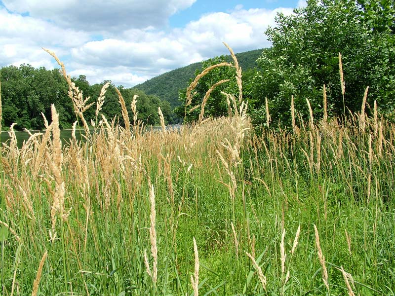
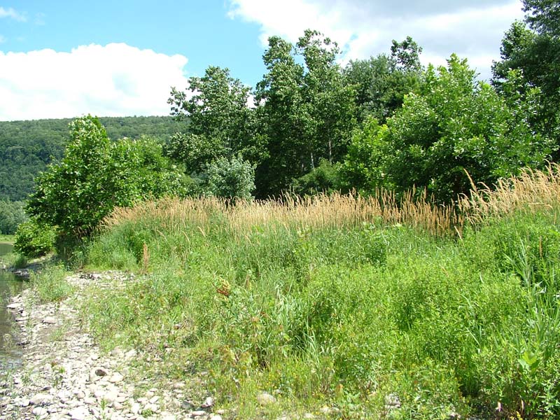
Reed Canary-grass Floodplain Grassland
System: Palustrine
Subsystem: Herbaceous
PA Ecological Group(s):
River Floodplain
Global Rank:GNR
![]() rank interpretation
rank interpretation
State Rank: S5
General Description
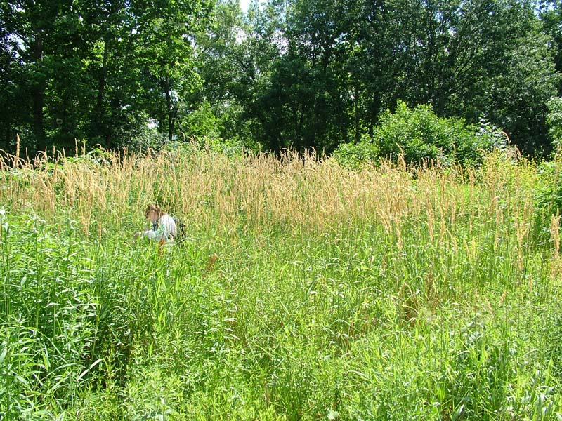
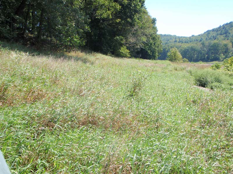
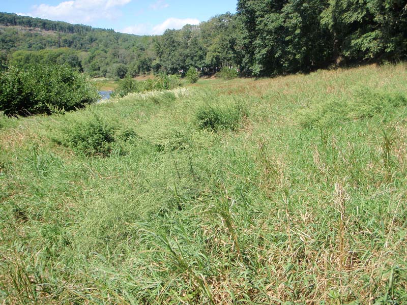
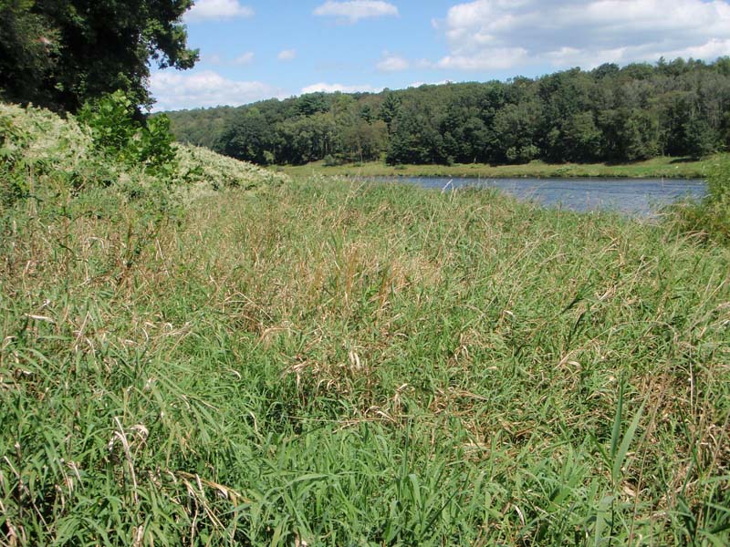
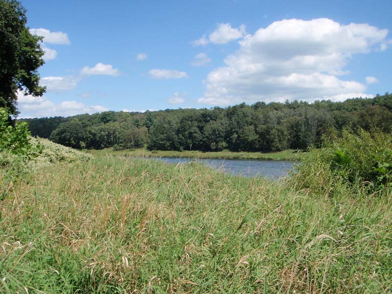
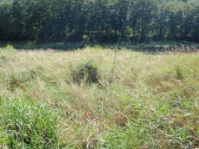
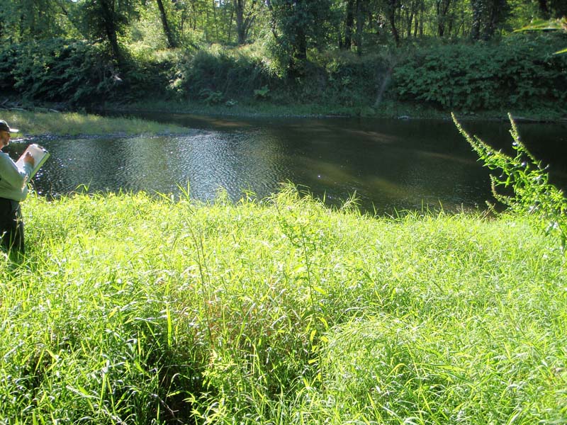
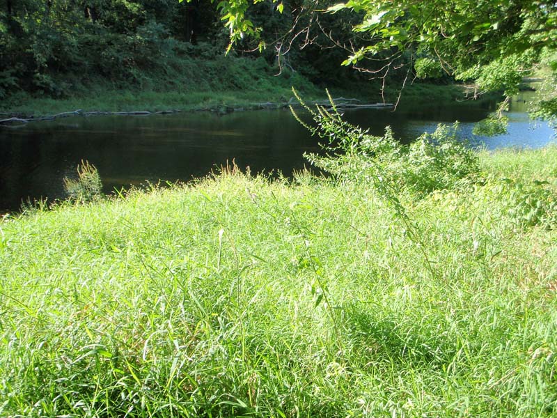
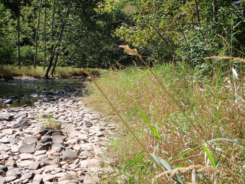
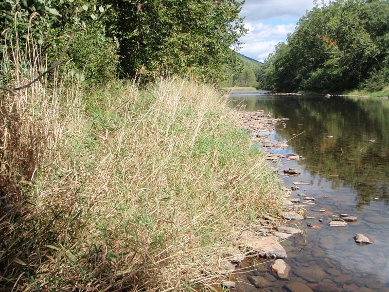
This community is typically found on sand and cobble bars attached to the banks or wide alluvial flats along tributaries. These areas are exposed to frequent floods, high stream velocity, and ice scour. The substrate is sand to sand over cobble and often represents sites where flooding frequency and duration, while still high, is less than that of the Big Bluestem – Indian-grass River Grassland or Periodically Exposed Shoreline Community. An area of sparsely vegetated cobbles often separates this community from the flowing water.
This community is characterized by thick herbaceous and graminoid vegetation, dominated by reed canary-grass (Phalaris arundinacea). Bluejoint (Calamagrostis Canadensis) or hairy-fruit sedge (Carex trichocarpa) are often present and may represent the historically dominant species of these riverine meadows prior to invasion by reed canary-grass. While the diversity of this type is often low, common associate species are Virginia cutgrass (Leersia virginica), false nettle (Boehmeria cylindrica), spotted joe-pye-weed (Eupatorium maculatum), twisted sedge (Carex torta), flatsedges (Cyperus spp.), water-pepper (Persicaria punctata), and beggar-ticks (Bidens spp.). A few scattered willows (Salix spp.) and sycamore (Platanus occidentalis) may be present as short shrubs; however, their relative cover rarely exceeds 10%.
Rank Justification
Common, widespread, and abundant in the jurisdiction.
Identification
- Clearly dominated by reed canary-grass (Phalaris arundinacea)
- Soils are alluvial and range from deep sand deposits to shallow sandy alluvium over cobble
- Occurs at or just above the flowing water
- Found on broad gravel and cobble deposits of the river floodplains of major rivers
- Maintained by annual episodes of high intensity flooding and ice scour
Herbs
- Reed canary-grass (Phalaris arundinacea)
- Canada bluejoint (Calamagrostis canadensis var. canadensis)
- Sedge (Carex trichocarpa)
- Cutgrass (Leersia virginica)
- Spotted joe-pye-weed (Eutrochium maculatum)
- Twisted sedge (Carex torta)
- Field mint (Mentha arvensis)
- Nutsedges (Cyperus spp.)
- Dotted smartweed (Persicaria punctata)
- Beggar-ticks (Bidens spp.)
* limited to sites with higher soil calcium
Vascular plant nomenclature follows Rhoads and Block (2007). Bryophyte nomenclature follows Crum and Anderson (1981).
International Vegetation Classification Associations:
USNVC Crosswalk:None
Representative Community Types:
Reed Canarygrass Wet Meadow (CEGL006044)
NatureServe Ecological Systems:
Central Appalachian River Floodplain (CES202.608)
NatureServe Group Level:
None
Origin of Concept
Zimmmerman 2008
Pennsylvania Community Code*
na : Not Available
*(DCNR 1999, Stone 2006)
Similar Ecological Communities
Floodplain Meadow and Big Bluestem – Indian-grass Riverine Grassland are similar to the Reed Canary-grass Floodplain Grassland in position on the floodplain and in soils but differs in species composition. The near monotypic stand of reed canary-grass (Phalaris arundinacea) is the most defining character for the Reed Canary-grass Floodplain Grasslands and it is often found on deeper, sandy soils.
Fike Crosswalk
None; this type is new to the Pennsylvania Plant Community Classification developed from river floodplain classification studies in the Susquehanna and Ohio River Basins.
Conservation Value
This habitat represents a modified grassland community type on the river floodplain, influenced by human disturbance, alteration of the natural flooding regime, deposition of sediment from excessive erosional events upstream and invasion of the non-native species reed canary-grass (Phalaris arundinacea). Native plants, often those of native floodplain grasslands and herbaceous communities are threatened by the expanding reed canary-grass. This invasion into native communities results in loss of habitat for a number of important and rare insect species, namely tiger beetles (genus Cicindela), and ground beetles (order Carabidae) and others. While this community is associated with decreasing native species diversity, the community also serves as a buffer for sediment and pollution runoff from adjacent developed lands by slowing the flow of surficial water, causing sediment to settle within this wetland.
Threats
This type is not threatened and represents a plant community type dominated by one plant species: reed canary-grass (Phalaris arundinacea). Invasion by non-native plants may be equally devastating as native floodplain plants are displaced and has lead to destruction and/or shifts in community function and dynamics within other plant communities. In particular, this community can completely displace Hairy-fruited Sedge (Carex trichocarpa) Floodplain Wetland and Twisted Sedge (Carex Torta) Stream Margin.
In addition to reed canary-grass, Japanese knotweed (Fallopia japonica), giant knotweed (F. sachalinensis), and purple loosestrife (Lythrum salicaria) may be present in this type. Construction of flood-control and navigational dams has resulted in drastic changes to the timing and duration of flood events. These dams have, in some cases, slowed the river flow resulting in deposition of finer sediments favored by many invasive plants.
Management
It is important to prevent the spread of this community through invasive species control (herbicide and manual removal) and to maintain a natural buffer around the wetland to minimize the spread of this community into adjacent vegetation.
Research Needs
There is need to assess and quantify soils, site hydrology, and other factors to further assess differences between floodplain grasslands on the Ohio, Delaware, and Susquehanna river basins. There continues to be a debate over the presence of native and introduced populations of reed canary-grass, suggesting the need for genetic studies.
Trends
This community type is becoming more common as reed canary-grass populations continue to expand.
Range Map
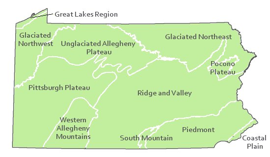
Pennsylvania Range
Statewide
Global Distribution
Colorado, Connecticut, Delaware, Idaho, Indiana, Iowa, Maine, Maryland, Massachusetts, Minnesota, Montana, New Hampshire, New Jersey, New Mexico, New York, North Dakota, Ohio, Pennsylvania, Rhode Island, Tennessee, Utah, Vermont, Virginia, Washington, West Virginia, and Wyoming. This community also occurs in Canada in Ontario, British Columbia, and Alberta.
Baker, M.E., and B.V. Barnes. 1998. Landscape ecosystem diversity of river floodplains in northwestern Lower Michigan, U.S.A. Canadian Journal of Forestry Research 28: 1405-1418.
Cowardin, L.M., V. Carter, F.C. Golet, and E.T. La Roe. 1979. Classification of wetlands and deepwater habitats of the United States. U.S. Fish and Wildlife Service. Washington, D.C. 131 pp.
Edinger, Gregory J., D.J. Evans, Shane Gebauer, Timothy G. Howard, David M. Hunt, and Adele M. Olivero. 2002. Ecological Communities of New York State. Second Edition. A revised and expanded edition of Carol Reschke's Ecological Communities of New York State. New York Natural Heritage Program, New York State Department of Environmental Conservation. Albany, NY. 136 pp.
Fike, J. 1999. Terrestrial and palustrine plant communities of Pennsylvania. Pennsylvania Natural Diversity Inventory. Harrisburg, PA. 86 pp.
Gregory, S.V., F.J. Swanson, W.A. McKee, and K.W. Cummins. 1991. An ecosystem perspective of riparian zones. Bioscience 41: 540-551.
NatureServe. 2009. International Ecological Classification Standard: International Vegetation Classification. Central Databases. NatureServe, Arlington, VA. Available http://www.natureserve.org/explorer.
NatureServe. 2009. NatureServe Central Databases. Arlington, Virginia. USA
Pennsylvania Department of Conservation and Natural Resources (DCNR). 1999. Inventory Manual of Procedure. For the Fourth State Forest Management Plan. Pennsylvania Bureau of Forestry, Division of Forest Advisory Service. Harrisburg, PA. 51 ppg.
Pennsylvania Natural Heritage Program. 2004. Classification, Assessment and Protection of Non-Forested Floodplain Wetlands of the Susquehanna Drainage. Report to: The United States Environmental Protection Agency and the Pennsylvania Department of Conservation and Natural Resources, Bureau of Forestry, Ecological Services Section. US EPA Wetlands Protection State Development Grant no. CD-98337501.
Stone, B., D. Gustafson, and B. Jones. 2006 (revised). Manual of Procedure for State Game Land Cover Typing. Commonwealth of Pennsylvania Game Commission, Bureau of Wildlife Habitat Management, Forest Inventory and Analysis Section, Forestry Division. Harrisburg, PA. 79 ppg.
Ward, J.V. 1998. Riverine landscapes: Biodiversity patterns, disturbance regimes, and aquatic conservation. Biological Conservation 83: 269-278.
Zimmerman, E., and G. Podniesinski. 2008. Classification, Assessment and Protection of
Floodplain Wetlands of the Ohio Drainage. Pennsylvania Natural Heritage Program, Western Pennsylvania Conservancy, Pittsburgh, PA. Report to: The United States Environmental Protection Agency and the Pennsylvania Department of Conservation and Natural Resources, Office of Conservation Science. US EPA Wetlands Protection State Development Grant no. CD-973081-01-0.


Cite as:
Zimmerman, E. 2022. Pennsylvania Natural Heritage Program. Reed Canary-grass Floodplain Grassland Factsheet. Available from: https://naturalheritage.state.pa.us/Community.aspx?=30016 Date Accessed: July 09, 2026