Mixed Hardwood Floodplain Thicket
System: Palustrine
Subsystem: Shrubland
PA Ecological Group(s): River Floodplain
Global Rank:G4G5
![]() rank interpretation
rank interpretation
State Rank: S4
General Description
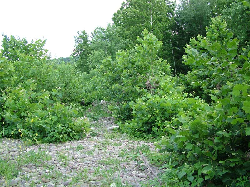
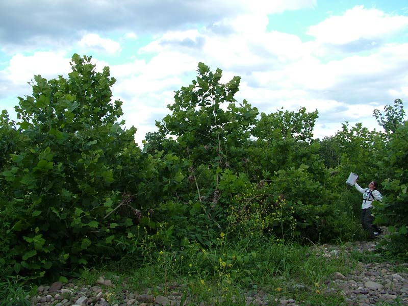
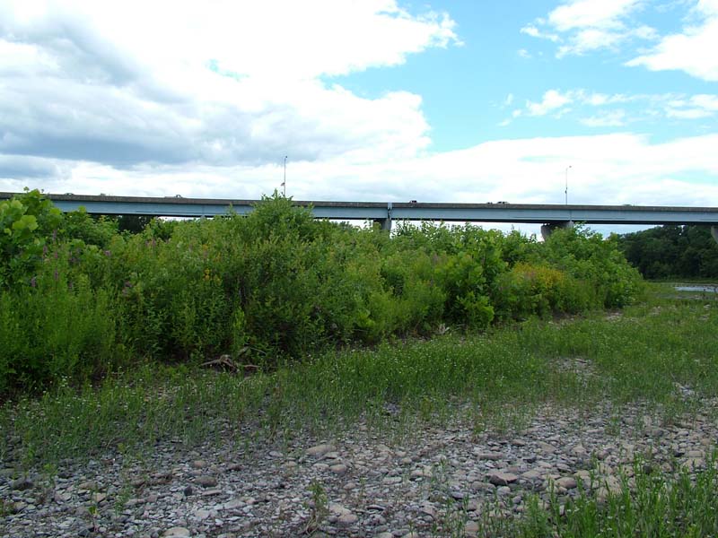
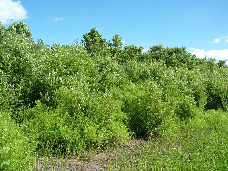
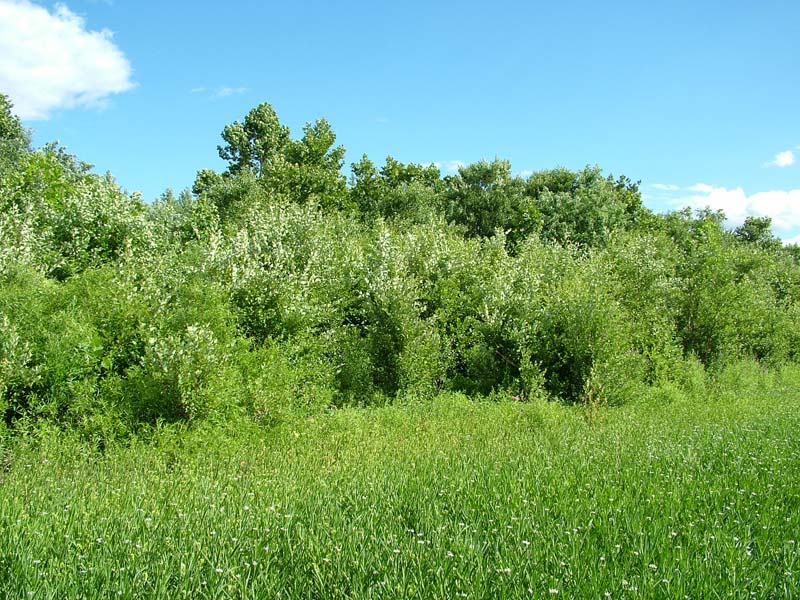
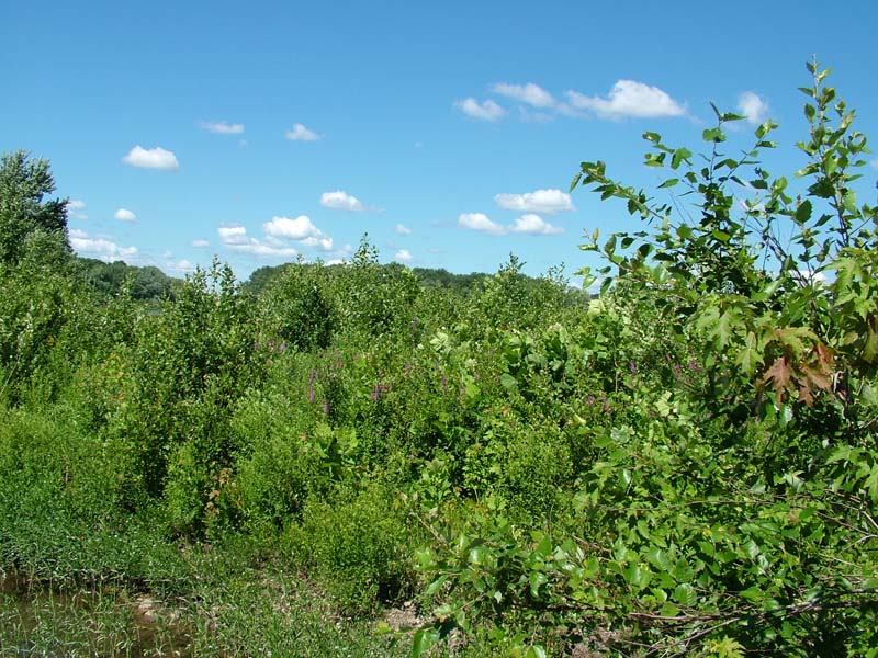
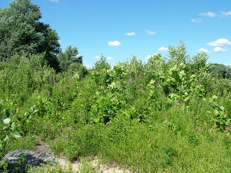
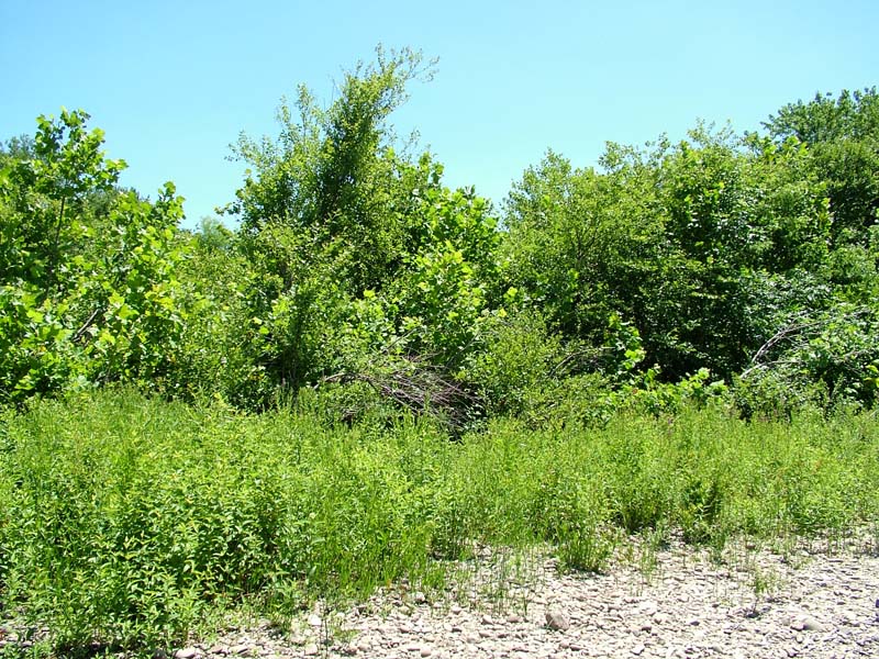
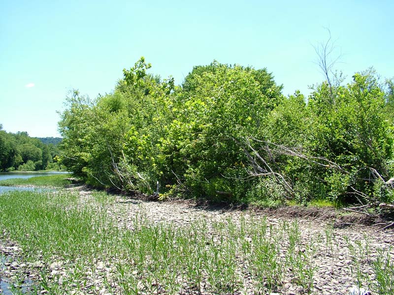
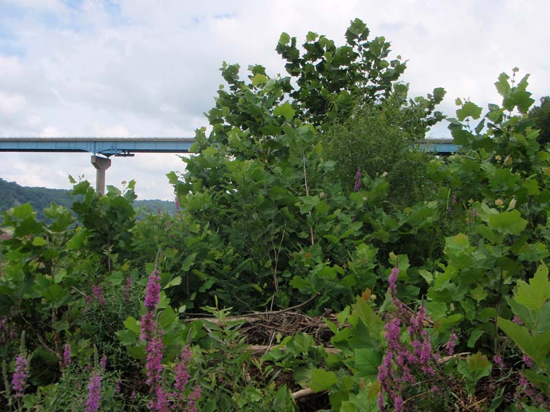
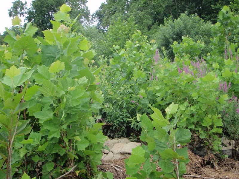
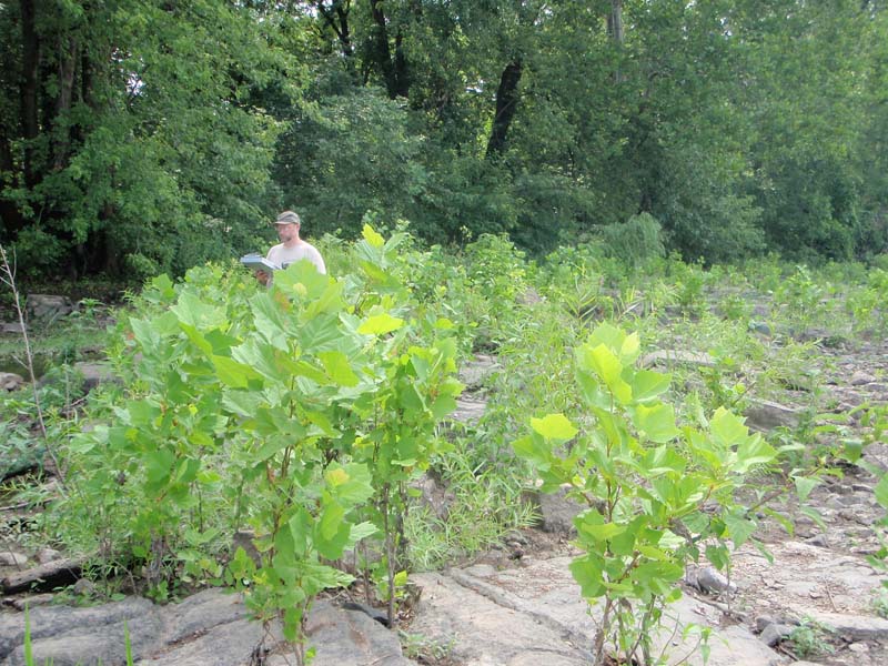
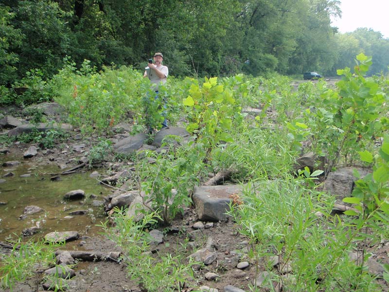
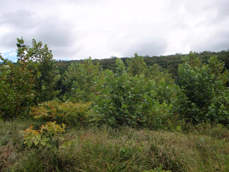
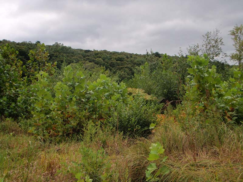
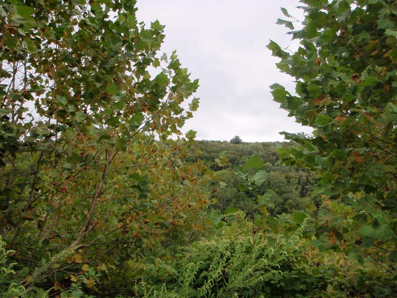
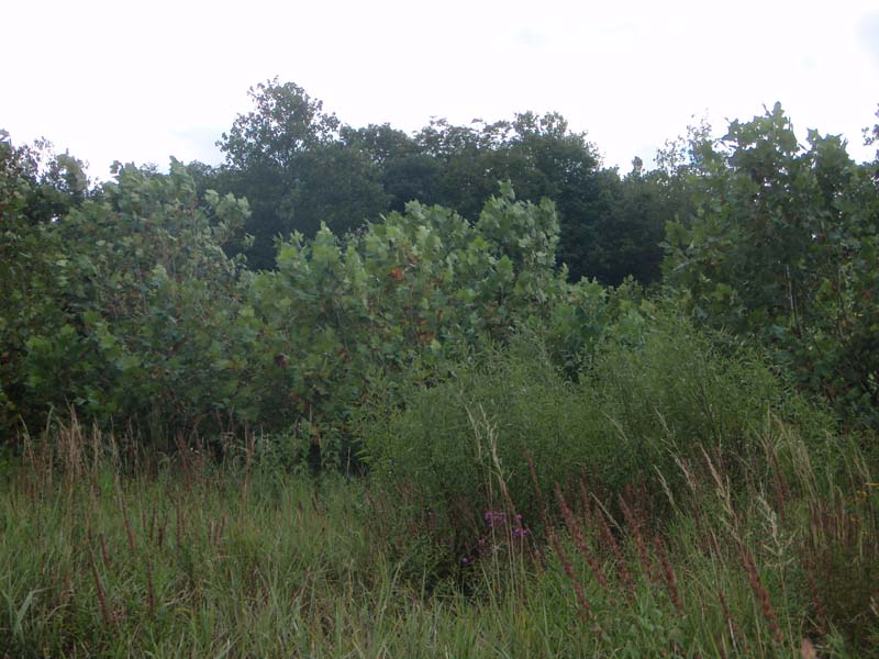
This floodplain shrubland occurs in all major river basins of Pennsylvania. They are subject to frequent floods, high stream velocity, and ice scour. Sites commonly occur on cobble bars and sand/gravel bars that are adjacent to or contiguous with the riverbank. The Periodically Exposed Shoreline Community often separates the shrubland from flowing water. In cases where the bar is attached to the shoreline, a steep forested slope or high terrace floodplain forest typically occurs on the riverbank adjacent to the shrubland. The Mixed Hardwood Floodplain Thicket can also occur towards the heads of islands in between dwarf shrublands or herbaceous communities and the floodplain forest.
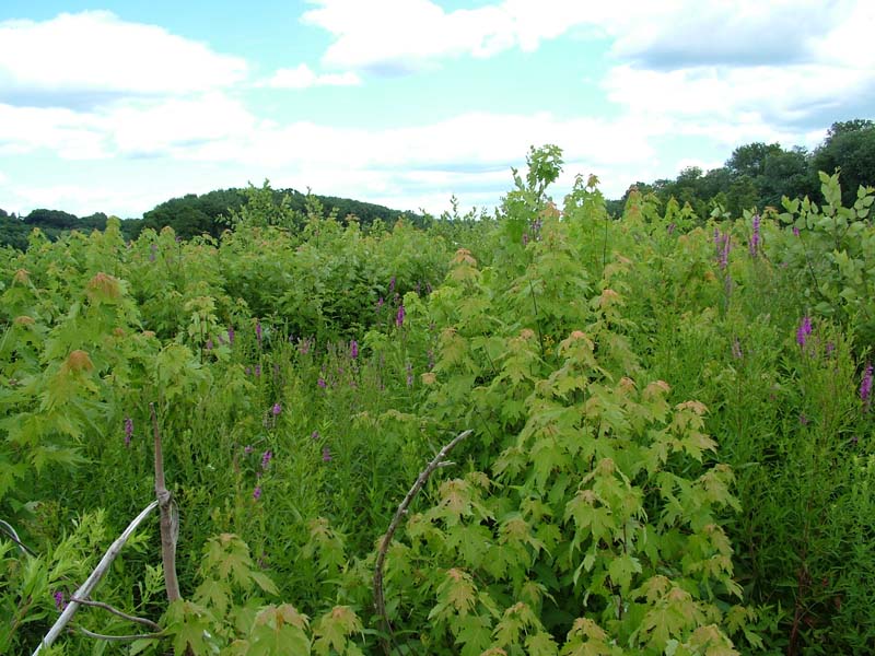
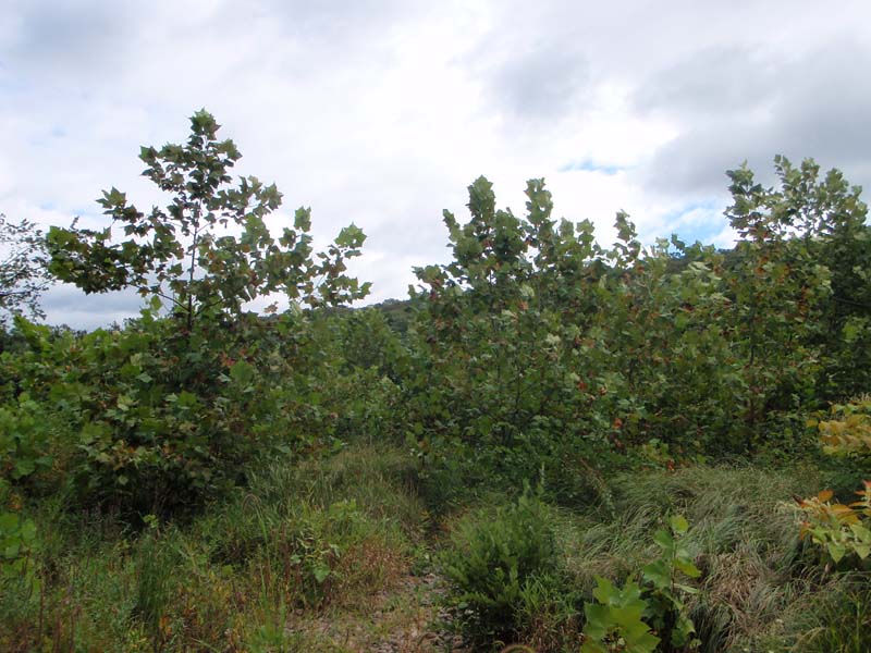
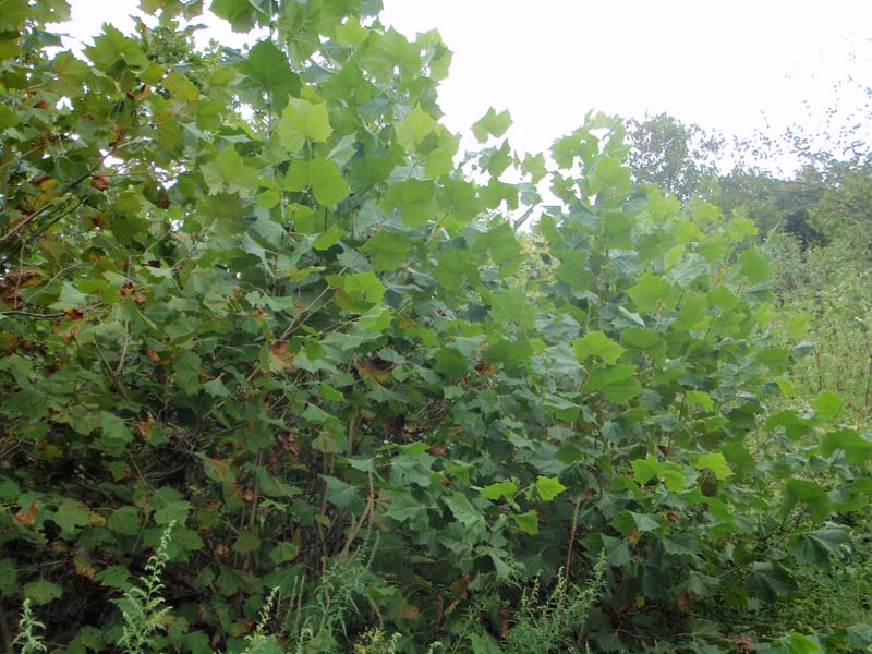
This community is characterized by an open to dense layer of tall shrubs, dominated by sycamore (Platanus occidentalis), silver maple (Acer saccharinum), eastern cottonwood (Populus deltoides), river birch (Betula nigra), black willow (Salix nigra), and other trees that rarely grow taller than shrub species due to disturbance from annual flooding and ice scour events. At times, however, there may be a sparse tree subcanopy. Associated shrub species are variable and include silky dogwood (Cornus amomum), red-osier dogwood (Cornus sericea), arrow-wood (Viburnum recognitum), ninebark (Physocarpus opulifolius), diamond willow (Salix eriocephala), silky willow (S. sericea), sandbar willow (S. exigua), red raspberry (Rubus idaeus), American elm (Ulmus americana), box-elder (Acer negundo), and buttonbush (Cephalanthus occidentalis). The herbaceous layer ranges from sparse to moderately dense and can contain a wide variety of typical wetland and prairie species. Common species include late goldenrod (Solidago gigantea var. gigantea), beggar-ticks (Bidens spp.), deer-tongue grass (Dichanthelium clandestinum), false nettle (Boehmeria cylindrica), clearweed (Pilea pumila), common sneezeweed (Helenium autumnale), Joe-Pye-weed (Eutrochium fistulosum), spotted Joe-Pye-weed (Eutrochium maculatum), boneset (Eupatorium perfoliatum), wingstem (Verbesina alternifolia), Indian-grass (Sorghastrum nutans), big bluestem (Andropogon gerardii), common yellow wood-sorrel (Oxalis stricta), Virginia cutgrass (Leersia virginica), cordgrass (Spartina pectinata), Indian-hemp (Apocynum cannabinum), and great St. John’s-wort (Hypericum pyramidatum). Vines such as virgin’s-bower (Clematis virginiana), hedge bindweed (Calystegia sepium) and grape (Vitis spp.) are often found throughout this tall sycamore-dominated shrubland.
This community is highly susceptible to colonization by Japanese knotweed (Fallopia japonica), multiflora rose (Rosa multiflora), crown-vetch (Coronilla varia), reed canary-grass (Phalaris arundinacea), and other invasive plants.
Rank Justification
Uncommon but not rare; some cause for long-term concern due to declines or other factors.
Identification
- Occurs on cobble bars and sand/gravel bars that are adjacent to or contiguous with the riverbank; near the heads and edges of islands
- Substrate is variable.
- Maintained by annual episodes of high intensity flooding and ice scour.
Trees
Shrubs
- Sycamore (Platanus occidentalis)
- Silver maple (Acer saccharinum)
- Black willow (Salix nigra)
- Eastern cottonwood (Populus deltoides)
- Sandbar willow (Salix exigua)
- Diamond willow (Salix eriocephala)
- Silky willow (Salix sericea)
- Silky dogwood (Cornus amomum)
- Speckled alder (Alnus incana ssp. rugosa)
- Smooth alder (Alnus serrulata)
- Steeple-bush (Spiraea tomentosa)
- Red-osier dogwood (Cornus sericea)
- Northern arrow-wood (Viburnum recognitum)
- Ninebark (Physocarpus opulifolius)
- Red raspberry (Rubus idaeus var. strigosus)
- American elm (Ulmus americana)
- Box-elder (Acer negundo)
- Buttonbush (Cephalanthus occidentalis)
Herbs
- Smooth goldenrod (Solidago gigantea)
- Beggar-ticks (Bidens spp.)
- Deer-tongue grass (Dichanthelium clandestinum)
- False nettle (Boehmeria cylindrica)
- Clearweed (Pilea pumila)
- Common sneezeweed (Helenium autumnale)
- Joe-pye-weed (Eutrochium fistulosum)
- Spotted joe-pye-weed (Eutrochium maculatum)
- Boneset (Eupatorium perfoliatum)
- Wingstem (Verbesina alternifolia)
- Indian-grass (Sorghastrum nutans)
- Big bluestem (Andropogon gerardii)
- Common yellow wood-sorrel (Oxalis stricta)
- Cutgrass (Leersia virginica)
- Freshwater cordgrass (Spartina pectinata)
- Indian hemp (Apocynum cannabinum)
- Great St. John's-wort (Hypericum pyramidatum)
* limited to sites with higher soil calcium
Vascular plant nomenclature follows Rhoads and Block (2007). Bryophyte nomenclature follows Crum and Anderson (1981).
International Vegetation Classification Associations:
USNVC Crosswalk:None
Representative Community Types:
Piedmont / Central Appalachian Sycamore - River Birch Scour Woodland (CEGL003896)
NatureServe Ecological Systems:
Central Appalachian River Floodplain (CES202.608)
NatureServe Group Level:
None
Origin of Concept
Pennsylvania Natural Heritage Program. 2004. Classification, Assessment and Protection of Non-Forested Floodplain Wetlands of the Susquehanna Drainage. Report to: The United States Environmental Protection Agency and the Pennsylvania Department of Conservation and Natural Resources, Bureau of Forestry, Ecological Services Section. US EPA Wetlands Protection State Development Grant no. CD-98337501.
Pennsylvania Community Code*
SY : River Birch – Sycamore Floodplain Scrub
*(DCNR 1999, Stone 2006)
Similar Ecological Communities
The Mixed Hardwood Floodplain Thicket contains a mixture of shrub species and is distinguishable from Black Willow Floodplain Thicket as it lacks the pure dominance of black willow (Salix nigra) found in the latter type. The black willow-dominated type is usually found growing in soils that are markedly more silty and saturated or flooded for much of the growing season.
Fike Crosswalk
Related to River birch - sycamore floodplain scrub. This type was modified based on results of river floodplain classification studies in the Susquehanna River Basin and changes were made to reflect a more diverse species composition observed in this community.
Conservation Value
This community is an important component of the river floodplain ecosystem, which provides significant ecosystem services such as sediment control, filtering runoff, and cooling overland flow of water, in addition to wildlife habitat. This habitat, while common, provides important habitat for a number of important and rare insect species, namely tiger beetles (genus Cicindela), ground beetles (order Carabidae), and others during the drier periods of the year.
Threats
Alteration to the frequency and duration of flood events and development of the river floodplains are the two greatest threats to this community statewide and can lead to habitat destruction and/or shifts in community function and dynamics. Non-native invasive plants may be equally devastating as native floodplain plants are displaced. Development of adjacent land can lead to an accumulation of agricultural run-off and pollution, sedimentation, and insolation/thermal pollution.
Management
A natural buffer to high quality examples of this floodplain forest wetland should be maintained in order to minimize nutrient runoff, pollution, and sedimentation. The potential for soil erosion based on soil texture, condition of the adjacent vegetation (mature forests vs. clearcuts), and the topography of the surrounding area (i.e., degree of slope) should be considered when establishing buffers. The buffer size should be increased if soils are erodible, adjacent vegetation has been logged, and the topography is steep as such factors could contribute to increased sedimentation and nutrient pollution. Direct impacts and habitat alteration should be avoided (e.g., roads, trails, filling of wetlands) and low impact alternatives (e.g., elevated footpaths, boardwalks, bridges) should be utilized in situations where accessing the wetland can not be avoided. Care should also be taken to control and prevent the spread of invasive species into high quality examples of these wetlands.
Research Needs
This type is highly variable and species present are greatly influenced by the timing and duration of inundation. Variations occur at eco-regional levels. Plot data collected during floodplain studies to characterize floodplain communities indicated that floodplain shrublands differ significantly between different drainages, most importantly, river birch (Betula nigra) shares dominance with sycamore in the Susquehanna drainage. Differences in soils, site hydrology, stream order and landscape position, and other factors contribute to differences in species composition between this type, primarily found in the Susquehanna and Delaware river basins, and the similar mixed hardwood floodplain shrublands associated with the Ohio River Basin. As this type requires high velocity flows, alteration of the natural flooding regime (duration and frequency) has most likely been the most critical factor influencing the quality and persistence of this type.
Trends
Mixed Hardwood Floodplain Thickets were undoubtedly more common historically and have declined due to dam impoundments, human development, and farming; modification of the adjacent upland has further impacted the quality of this type. The relative trend for this community is likely stable or may be declining slightly due to development; however, new alterations to river hydrology could result in significant changes to this type. High quality examples are most likely declining with invasion of exotic plant species, lack of recruitment due to deer browsing, and lack of periodic flooding events.
Range Map
Pennsylvania Range
Statewide.
Global Distribution
This community occurs throughout the mid-Atlantic U.S. and has been identified in plant community classifications from Pennsylvania, New York, Maryland, and Delaware.
Cowardin, L.M., V. Carter, F.C. Golet, and E.T. La Roe. 1979. Classification of wetlands and deepwater habitats of the United States. U.S. Fish and Wildlife Service. Washington, D.C. 131 pp.
Fike, J. 1999. Terrestrial and palustrine plant communities of Pennsylvania. Pennsylvania Natural Diversity Inventory. Harrisburg, PA. 86 pp.
NatureServe. 2009. International Ecological Classification Standard: International Vegetation Classification. Central Databases. NatureServe, Arlington, VA. Available http://www.natureserve.org/explorer.
Pennsylvania Department of Conservation and Natural Resources (DCNR). 1999. Inventory Manual of Procedure. For the Fourth State Forest Management Plan. Pennsylvania Bureau of Forestry, Division of Forest Advisory Service. Harrisburg, PA. 51 ppg.
Pennsylvania Natural Heritage Program. 2004. Classification, Assessment and Protection of Non-Forested Floodplain Wetlands of the Susquehanna Drainage. Report to: The United States Environmental Protection Agency and the Pennsylvania Department of Conservation and Natural Resources, Bureau of Forestry, Ecological Services Section. US EPA Wetlands Protection State Development Grant no. CD-98337501.
Stone, B., D. Gustafson, and B. Jones. 2006 (revised). Manual of Procedure for State Game Land Cover Typing. Commonwealth of Pennsylvania Game Commission, Bureau of Wildlife Habitat Management, Forest Inventory and Analysis Section, Forestry Division. Harrisburg, PA. 79 ppg.
Zimmerman, E., and G. Podniesinski. 2008. Classification, Assessment and Protection of
Floodplain Wetlands of the Ohio Drainage. Pennsylvania Natural Heritage Program, Western Pennsylvania Conservancy, Pittsburgh, PA. Report to: The United States Environmental Protection Agency and the Pennsylvania Department of Conservation and Natural Resources, Office of Conservation Science. US EPA Wetlands Protection State Development Grant no. CD-973081-01-0.

Cite as:
Zimmerman, E. 2022. Pennsylvania Natural Heritage Program. Mixed Hardwood Floodplain Thicket Factsheet. Available from: https://naturalheritage.state.pa.us/Community.aspx?=30013 Date Accessed: July 09, 2026