Great Lakes Sparsely Vegetated Shore
System: Palustrine
Subsystem: Sparse Vegetation
PA Ecological Group(s):
Sparse Vegetation and Great Lakes
Global Rank:GNR
![]() rank interpretation
rank interpretation
State Rank: S1
General Description
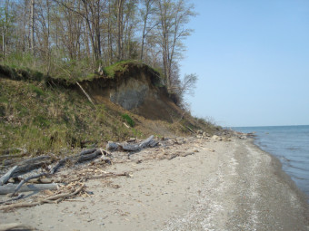
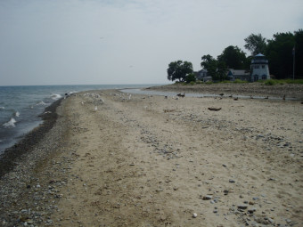
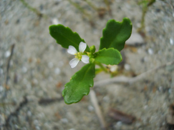
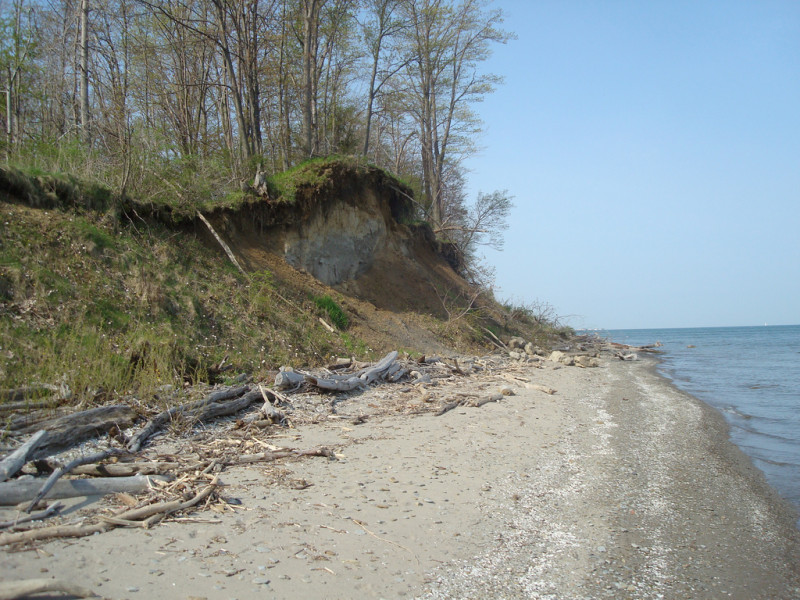
This community occupies the cobble, sand, and gravel shores from the normal water line to the upper limit of winter storms. The substrate is very unstable and subject to wave action and ice scour. The vegetation is sparse (usually less than 25% total cover). The most characteristic species are American beachgrass (Ammophila breviligulata), sea-rocket (Cakile edentula), Canada wild-rye (Elymus canadensis), silverweed (Potentilla anserina), and cocklebur (Xanthium strumarium).
Rank Justification
Critically imperiled in the nation or state because of extreme rarity (often 5 or fewer occurrences) or because of some factor(s) such as very steep declines making it especially vulnerable to extirpation from the state.
Identification
- In Pennsylvania, found only in the along the Erie coastline
- Sparsely vegetated herbaceous community with plants growing in the sand-filled crevasses between boulders
Herbs
Vines
* limited to sites with higher soil calcium
Vascular plant nomenclature follows Rhoads and Block (2007). Bryophyte nomenclature follows Crum and Anderson (1981).
International Vegetation Classification Associations:
USNVC Crosswalk:None
Representative Community Types:
Great Lakes Shore Sparse Vegetation (CEGL005162)
Inland Freshwater Strand Beach Sparse Vegetation (CEGL002310)
NatureServe Ecological Systems:
Great Lakes Alkaline Rocky Shore and Cliff (CES201.995)
NatureServe Group Level:
None
Origin of Concept
Fike, J. 1999. Terrestrial and palustrine plant communities of Pennsylvania. Pennsylvania Natural Diversity Inventory. Pennsylvania Department of Conservation and Recreation, Bureau of Forestry, Harrisburg, PA. 86 pp.
Pennsylvania Community Code*
na : Not Available
*(DCNR 1999, Stone 2006)
Similar Ecological Communities
This sparsely vegetated community is distinguished from the Great Lakes Palustrine Sandplain by substrate, vegetation, and geographical location. The Lake Erie Sparsely Vegetated Shore is primarily cobble substrate, nearly devoid of vegetation, and is found along the entirety of the Lake Erie Shore. The Great Lakes Palustrine Sandplain is found primarily on the Presque Isle Peninsula, is sandy, and is more densely vegetated as these sites are more protected from wave and ice scour than the Great Lakes Sparsely Vegetated Shore.
The Periodically Exposed Shoreline Community, which differs from this type in geographic location, is found along river, creek, and lake margins in Pennsylvania; the Great Lakes Sparsely Vegetated Shore is limited to the Lake Erie Coast.
Fike Crosswalk
Great Lakes Region sparsely vegetated beach
Conservation Value
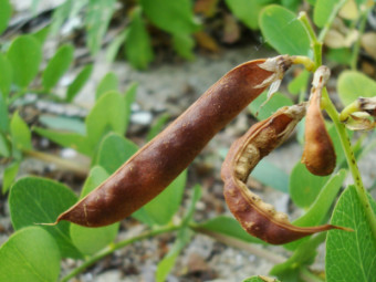
There is limited Lake Erie shoreline in Pennsylvania. The Lake Erie shoreline is a combination of cobble, bedrock, sand and gravel. The Presque Isle Peninsula, a sand-spit that extends into Lake Erie, is one of the only areas where sand is the dominant substrate. Sand beaches are also present at the mouths of the larger creeks flowing into Lake Erie. The Great Lakes Sparsely Vegetated Shore supports a wide variety of plant species, some unique to shoreline areas of the Great Lakes, including American beachgrass (Ammophila breviligulata), sea-rocket (Cakile edentula), beach pea (Lathyrus japonicus), and silverweed (Potentilla anserina).
The lake shore also hosts a unique suite of invertebrates such as tiger beetles, spiders, and sand wasps. It is an important refuge for migrating waterbirds and shorebirds and nesting habitat for others. This type provides important nesting habitat for shorebirds, such as the Piping Plover.
Threats
The greatest threat to the cobble shorelines of the Great Lakes Sparsely Vegetated Shore is from lake shore development and continued impeding of sand migration along the shore. Recreational use is also a major threat to the plants and animals of the Lake Erie Shore. Presque Isle State Park is a popular destination for tourists and receives millions of visitors each year. Beach grooming and foot traffic reduce the amount of habitat available to plants on the small beaches at the mouths of creeks. Non-native plants, such as crown-vetch (Coronilla varia) and Japanese knotweed (Fallopia japonica) may invade some areas.
Management
Shoreline stabilization efforts have altered natural erosion and deposition processes that develop the lake shoreline. The shoreline development is part of the long-term physical process that creates the sandplain habitat behind the leading dune. The jetty at Conneaut, Ohio is a large obstruction to the natural flow of sediments. Recreation is a major focus of management at Presque Isle State Park and other sites along the Erie Coast. Control of non-native plant species are also important for managers at Presque Isle State Park.
Research Needs
Insects, including beetles and lepidopterans, may form a substantial part of the biodiversity of these communities. Open gravel and cobble areas along the coast should be inventoried for rare plants and animals, especially insects.
Trends
The current extent of this community in Pennsylvania and in the larger Great Lakes region fairly well known. Long, continuous examples of this community have been fragmented by development and their acreage in Pennsylvania has declined as a result of development and recreation.
Long-term management of the Erie Shoreline could benefit from a better understanding of the natural erosion and deposition processes, as well as how these processes may be affected by artificially created barriers such as breakwaters and jetties.
Range Map
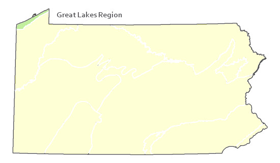
Pennsylvania Range
Northwestern Pennsylvania.
Global Distribution
Northeastern Ohio to New York along the southern shore of Lake Erie.
Albert, D. A. 2004. Between Land and Lake: Michigan’s Great Lake Coastal Wetlands. MSUE bulletin E2902, Michigan Natural Features Inventory, Lansing, MI.
Albert, D. A., and L. Simonson. 2004. Coastal wetland inventory of the Great Lakes region (GIS coverage of entire U.S. Great Lakes: www.glc.org/wtlands/inventory.html), Great Lakes Consortium, Great Lakes Commission, Ann Arbor, MI.
Albert, D. A., Wilcox, D. A., Ingram, J. W., and T. A. Thompson. 2006. Hydrogeomorphic classification for Great Lakes coastal wetlands. Journal of Great Lakes Research. 31 (Suppliment 1): 129-146.
Beach, David. (Ed.) 2007. A Legacy of Living Places: conserving the diversity of nature in the Lake Erie Allegheny ecoregion. Lake Erie Allegheny Partnership for Biodiversity: Cleveland, OH.
Bissell, J. K., and C. W. Bier. 1987. Presque Isle State Park: Botanical Survey and Natural Community Classification. The Cleveland Museum of Natural History and Western Pennsylvania Conservancy, Pittsburgh, PA.
Dodge, D, O. Maple, R. Kavetsky. 1994. Aquatic habitat and wetlands of the Great Lakes. SOLEC 1994 State of the Lakes Ecosystem Conference Background Paper. Environment Canada United States Environmental Protection Agency EPA 905-R-95-014.
Fike, J. 1999. Terrestrial and palustrine plant communities of Pennsylvania. Pennsylvania Natural Diversity Inventory. Harrisburg, PA. 86 pp.
Herdendorf, CE. 1992. Lake erie coastal wetlands: an overview. Journal of Great Lakes Research 18: 533-551.
Pennsylvania Department of Conservation and Natural Resources (DCNR). 1999. Inventory Manual of Procedure. For the Fourth State Forest Management Plan. Pennsylvania Bureau of Forestry, Division of Forest Advisory Service. Harrisburg, PA. 51 ppg.
Stone, B., D. Gustafson, and B. Jones. 2006 (revised). Manual of Procedure for State Game Land Cover Typing. Commonwealth of Pennsylvania Game Commission, Bureau of Wildlife Habitat Management, Forest Inventory and Analysis Section, Forestry Division. Harrisburg, PA. 79 ppg.
Cite as:
Zimmerman, E. 2022. Pennsylvania Natural Heritage Program. Great Lakes Sparsely Vegetated Shore Factsheet. Available from: https://naturalheritage.state.pa.us/Community.aspx?=16077 Date Accessed: January 11, 2026

