Great Lakes Palustrine Sandplain
System: Palustrine
Subsystem: Herbaceous
PA Ecological Group(s): Great Lakes Region Wetland
Global Rank:GNR
![]() rank interpretation
rank interpretation
State Rank: S1
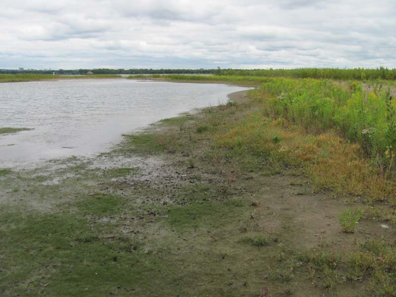
General Description
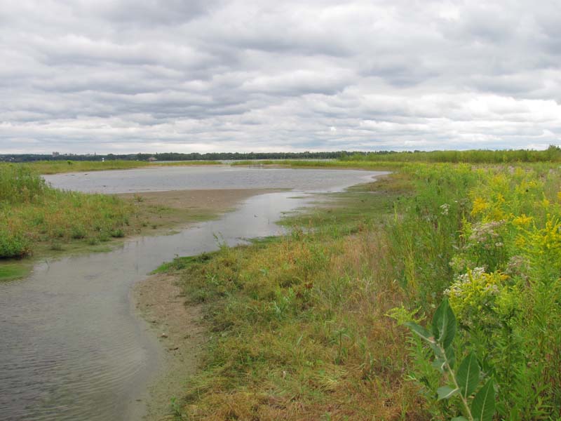
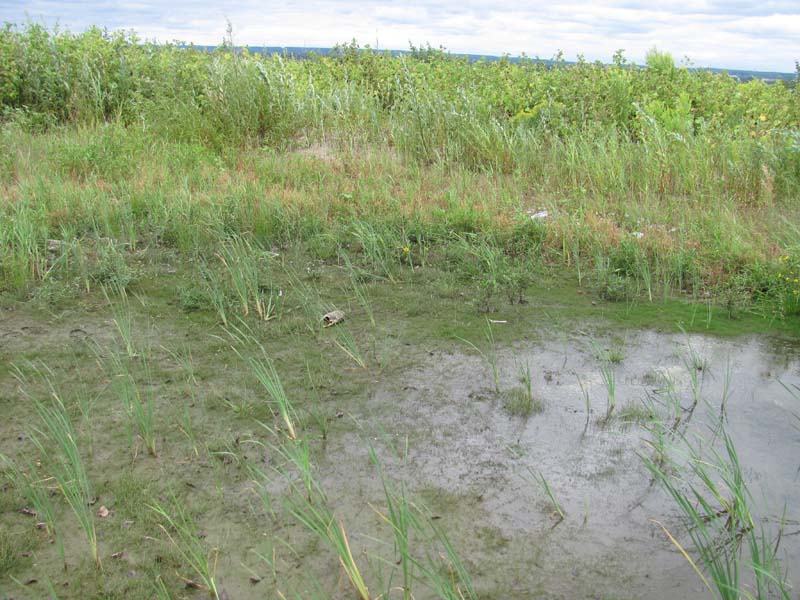
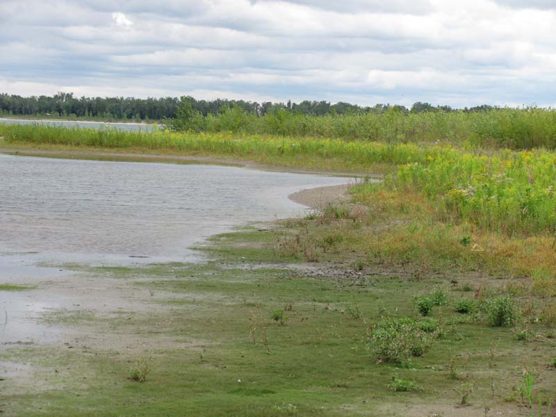
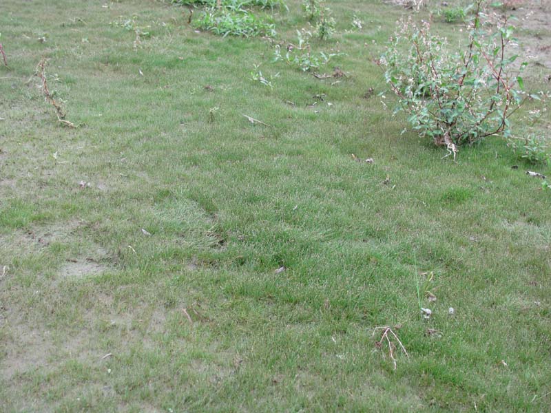
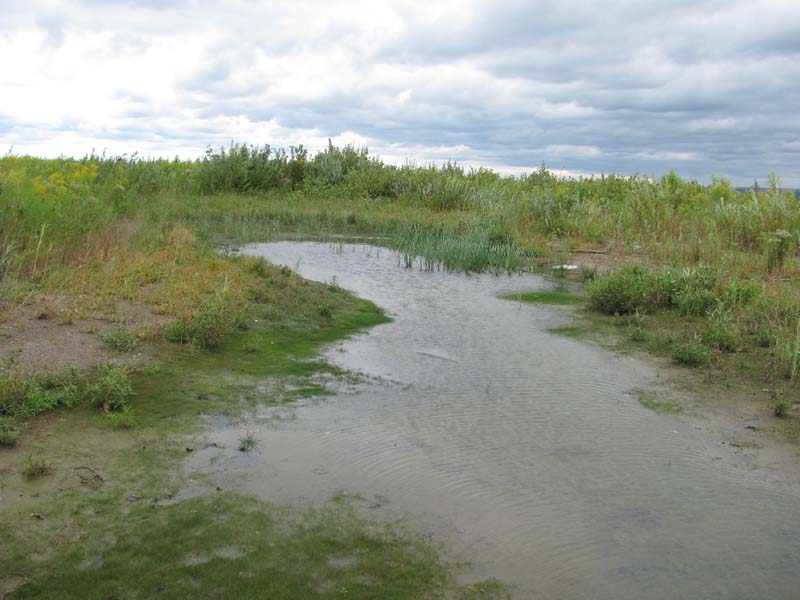
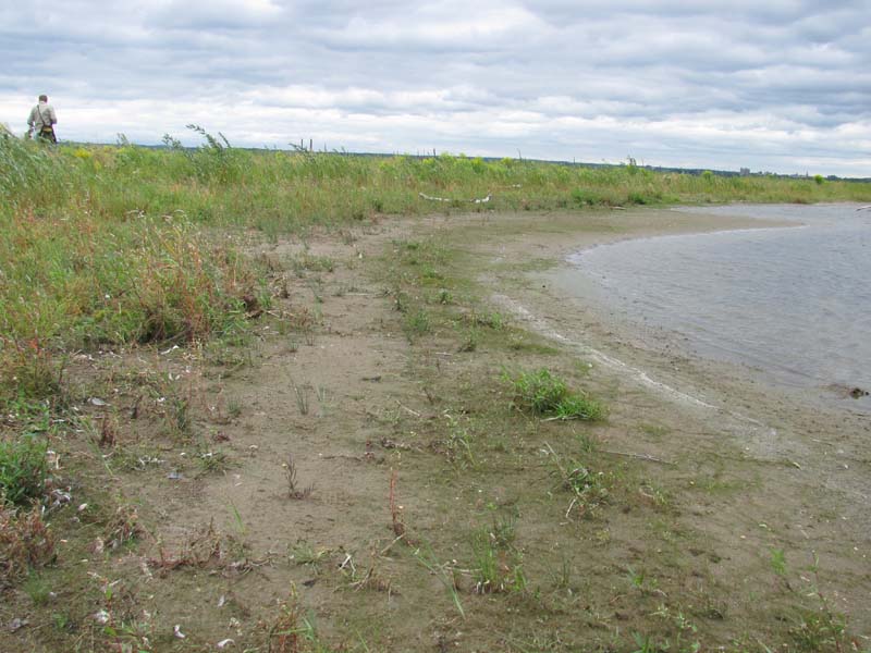
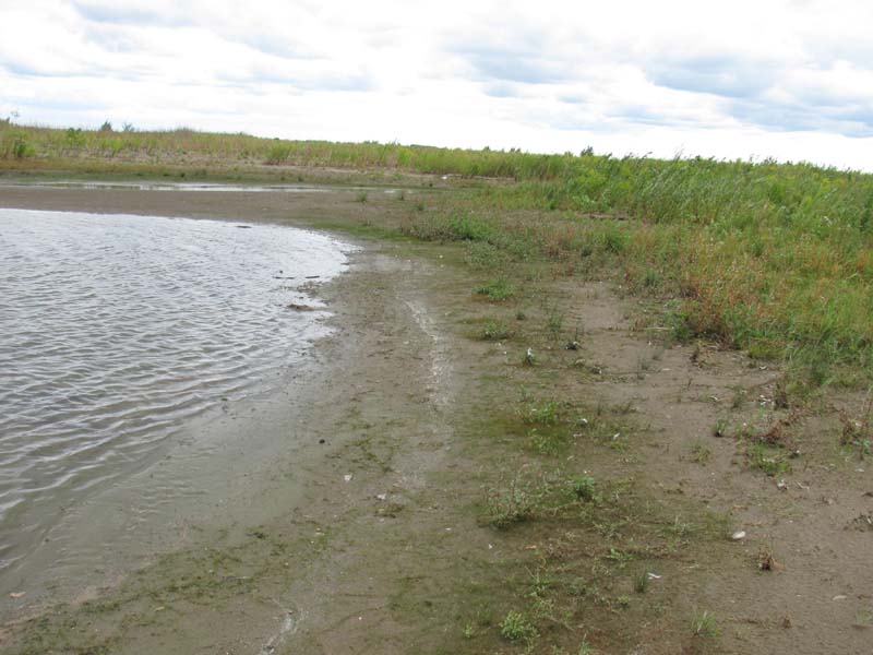
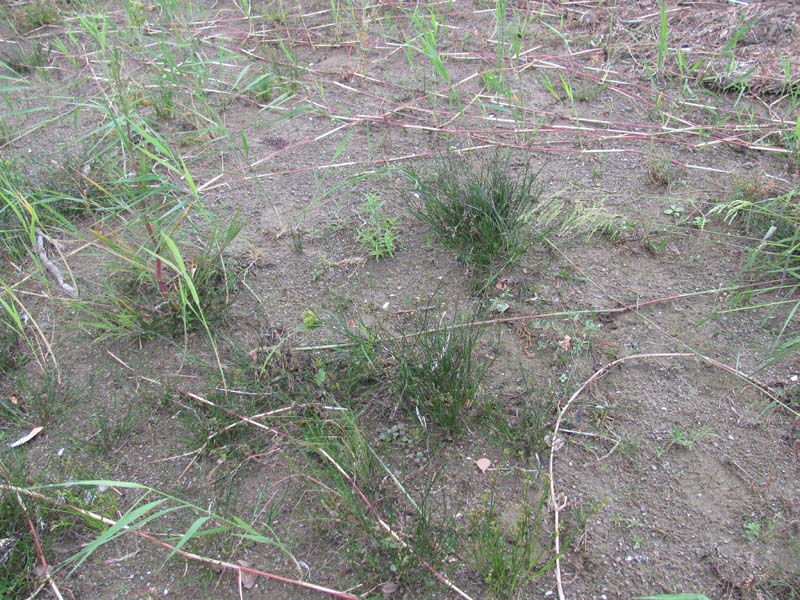
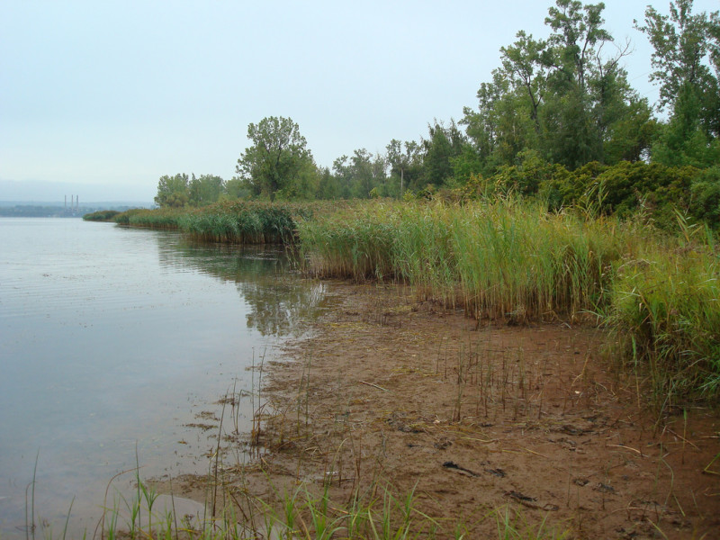
In Pennsylvania, this community type occurs only on Presque Isle, on the shore of Lake Erie. This is a sparsely vegetated herbaceous community that occurs on moist sandy flats. These typically occur behind the leading dune or as a zone surrounding a swale pond. The sandplain may be saturated in some areas, or may appear dry, with water levels below the surface but accessible to plant roots. This complex occurs on a substrate of glacial sand and gravel deposits. This material is constantly being eroded and re-deposited by the action of currents, waves, and storm events. The dynamic nature of the substrate maintains a variety of successional stages. Additionally, the porous nature of the substrate causes the water table to respond quickly to changes in lake level. As a result, natural communities occur as a complicated mosaic of different hydrologic conditions, seral stages, physiognomies, and floristic assemblages that shift over time. The community is composed primarily by rushes (Juncus spp.), sedges (Carex spp.), and umbrella/nut-sedges (Cyperus spp.) including jointed rush (Juncus articulatus), umbrella sedge (Cyperus bipartitus), umbrella sedge (Cyperus flavescens), and larger Canadian St. John’s-wort (Hypericum majus). This type contains many rare species due to its limited extent in Pennsylvania including alpine rush (Juncus alpinoarticulatus ssp. nodulosus), Baltic rush (Juncus arcticus var. littoralis), small-flowered gerardia (Agalinis paupercula), green sedge (Carex viridula var. viridula), and elk sedge (Carex garberi).
Rank Justification
Critically imperiled in the jurisdiction because of extreme rarity or because of some factor(s) such as very steep declines making it especially vulnerable to extirpation.
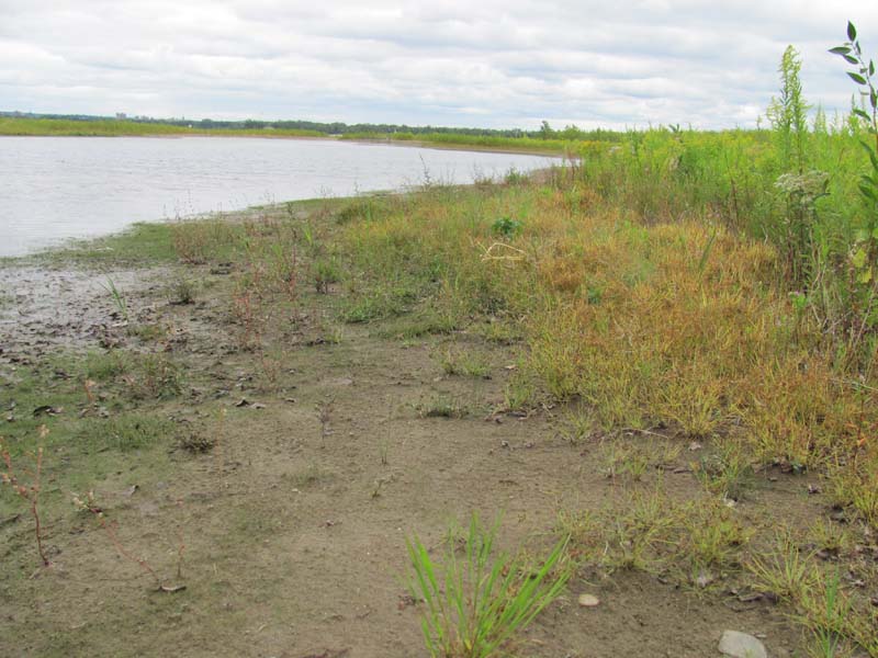
Identification
- Sparsely to moderately densely vegetated, comprised of rushes, sedges, and opportunistic herbaceous species
- Limited to wet sandy-expanses of shoreline along the coast of Lake Erie, primarily on the Presque Isle Peninsula
- Substrate may be saturated in some areas, or may appear dry, with water levels below the surface but accessible to plant roots
Herbs
- Alpine rush (Juncus alpinoarticulatus ssp. nodulosus)
- Baltic rush (Juncus arcticus var. littoralis)
- Jointed rush (Juncus articulatus)
- Umbrella sedge (Cyperus bipartitus)
- Umbrella sedge (Cyperus flavescens)
- Purple gerardia (Agalinis paupercula)
- Elk sedge (Carex garberi)
- Brook lobelia (Lobelia kalmii)
- Canadian St. John's-wort (Hypericum majus)
* limited to sites with higher soil calcium
Vascular plant nomenclature follows Rhoads and Block (2007). Bryophyte nomenclature follows Crum and Anderson (1981).
International Vegetation Classification Associations:
USNVC Crosswalk:None
Representative Community Types:None
NatureServe Ecological Systems:
Great Lakes Wooded Dune and Swale (CES201.726)
NatureServe Group Level:
None
Origin of Concept
Beach, David. (Ed.) 2007. A Legacy of Living Places: conserving the diversity of nature in the Lake Erie Allegheny ecoregion. Lake Erie Allegheny Partnership for Biodiversity: Cleveland, OH.
Pennsylvania Community Code*
na : Not Available
*(DCNR 1999, Stone 2006)
Similar Ecological Communities
The Great Lakes Region Dry Sandplain is drier and less sparse, with dry-adapted species predominating instead of wetland indicators. Scattered trees and shrubs may be present. Because of the sandy soils on which both types occur, the wetter type may appear dry for much of the year.
Fike Crosswalk
Great Lakes Palustrine Sandplain
Conservation Value
This community is only found along the shores of the Great Lakes. Pennsylvania has a limited extent of shoreline along Lake Erie, and the only large remaining examples of this community in Pennsylvania are found at Presque Isle State Park. The lake shore habitat, with its sandy substrate and fluctuating water levels, hosts a substantially different flora and fauna than other Pennsylvania habitats. Due to the limited extent of the shoreline in Pennsylvania, many of these species are rare in the state. In addition to plants, the lakeshore hosts a unique suite of invertebrates such as tiger beetles, spiders, and sand wasps. It is important nesting and foraging habitat for shorebirds and refuge for migrating species, including migrating passerine bird species, which cross the lake at the narrow point between Presque Isle and Long Point on the north shore.
Threats
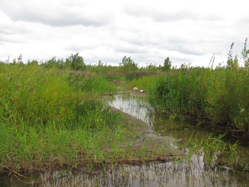
The invasive exotic subspecies of common reed (Phragmites australis ssp. australis) is a major threat to the palustrine sandplain community. It establishes in shallow water zones and can spread out onto the sandplain flats. Management efforts should ensure proper identification of the exotic subspecies so that the native subspecies, Phragmites australis spp. americanus, is not targeted, as it is of conservation concern. Presque Isle State Park is heavily used for recreation; in some areas overuse damages plant communities.
Management
Shoreline stabilization efforts have altered natural erosion and deposition processes that develop the lake shoreline. The shoreline development is part of the long-term physical process that creates the sandplain habitat behind the leading dune. The jetty at Conneaut, Ohio is a large obstruction to the natural flow of sediments.
Research Needs
Long-term management of Presque Isle could benefit from a better understanding of the natural erosion and deposition processes, as well as how these processes may be affected by artificially created barriers such as breakwaters and jettys.
It is understood that the natural communities of Presque Isle are highly dynamic, affected by movement of the substrate by wind, currents, and storms; and by changes in the water level over seasons and decades. However, there remains much to learn about how these processes affect communities over longer time scales, including the frequency of disturbances, the rate of movement of communities on the landscape, and the process of succession in plant communities.
Trends
Because the shorelines of the Great Lakes have been extensively developed for industry, recreation, and residences, the extent of natural wetland communities has been greatly diminished. Pennsylvania has limited shoreline area along Lake Erie, and most of it is composed of cobble below steep Lake Erie bluffs; flatter areas were often developed. Presque Isle State Park is the only remaining area that hosts the palustrine sandplain community, and it is unlikely there were other historic examples in Pennsylvania. While the site is protected as a state park, the community may currently be experiencing some declines in quality and extent from invasive species and recreational overuse. The current extent of this community in the larger Great Lakes region is not known, but it is likely limited, as sandplain topography is somewhat unusual. The percentage of historic wetland area lost in the Great Lakes states is the closest available approximation of trends over time for this community. Wetland loss, measured from pre-settlement times to 1990, has occurred at a higher rate in Great Lakes states (60%) than the national average of 53% (Dahl 1990, Dodge et al. 1994). In recent years, the rate of wetland loss has slowed (the acreage of wetland area lost between 1998 and 2004 was one-quarter of the acreage that was lost between 1974 and1984), but wetland loss continues to be higher in the Great Lakes region than in other parts of the country (Dahl 2006).
Range Map
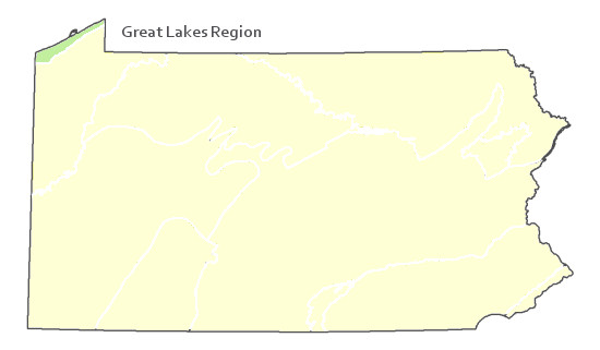
Pennsylvania Range
Found only at Presque Isle State Park.
Global Distribution
Great Lakes shorelines, mainly eastern Lake Erie.
Albert, D. A. 2004. Between Land and Lake: Michigan’s Great Lake Coastal Wetlands. MSUE bulletin E2902, Michigan Natural Features Inventory, Lansing, MI.
Albert, D. A., and L. Simonson. 2004. Coastal wetland inventory of the Great Lakes region (GIS coverage of entire U.S. Great Lakes: www.glc.org/wtlands/inventory.html), Great Lakes Consortium, Great Lakes Commission, Ann Arbor, MI.
Albert, D. A., Wilcox, D. A., Ingram, J. W., and T. A. Thompson. 2006. Hydrogeomorphic classification for Great Lakes coastal wetlands. Journal of Great Lakes Research. 31 (Suppliment 1): 129-146.
Beach, David. (Ed.) 2007. A Legacy of Living Places: conserving the diversity of nature in the Lake Erie Allegheny ecoregion. Lake Erie Allegheny Partnership for Biodiversity: Cleveland, OH.
Bissell, J. K., and C. W. Bier. 1987. Presque Isle State Park: Botanical Survey and Natural Community Classification. The Cleveland Museum of Natural History and Western Pennsylvania Conservancy, Pittsburgh, PA.
Dahl, T.E. 1990. Wetland losses in the United States: 1780's to 1980's. U.S. Fish and Wildlife Service, Washington, D.C. 21 pp.
http://www.fws.gov/wetlands/_documents/gSandT/OtherInformation/HistoryWetlandsConterminousUS.pdf
Dahl, T.E. 2006. Status and trends of wetlands in the conterminous United States 1998 to 2004. Washington, DC: U.S. Department of the Interior, Fish and Wildlife Service. http://wetlandsfws.er.usgs.gov/status_trends/index.html
Dodge, D, O. Maple, R. Kavetsky. 1994. Aquatic habitat and wetlands of the Great Lakes. SOLEC 1994 State of the Lakes Ecosystem Conference Background Paper. Environment Canada United States Environmental Protection Agency EPA 905-R-95-014.
Fike, J. 1999. Terrestrial and palustrine plant communities of Pennsylvania. Pennsylvania Natural Diversity Inventory. Pennsylvania Department of Conservation and Recreation. Bureau of Forestry. Harrisburg, PA.
Herdendorf, CE. 1992. Lake erie coastal wetlands: an overview. Journal of Great Lakes Research 18: 533-551.
NatureServe 2010. NatureServe Explorer: An online encyclopedia of life Version 7.1. NatureServe, Arlington, VA. Available http://www.natureserv.org/explorer (accessed: 23 November 2011).
Pennsylvania Department of Conservation and Natural Resources (DCNR). 1999. Inventory Manual of Procedure. For the Fourth State Forest Management Plan. Pennsylvania Bureau of Forestry, Division of Forest Advisory Service. Harrisburg, PA. 51 ppg.
Stone, B., D. Gustafson, and B. Jones. 2006 (revised). Manual of Procedure for State Game Land Cover Typing. Commonwealth of Pennsylvania Game Commission, Bureau of Wildlife Habitat Management, Forest Inventory and Analysis Section, Forestry Division. Harrisburg, PA. 79 ppg.
Cite as:
Mcpherson, J. 2022. Pennsylvania Natural Heritage Program. Great Lakes Palustrine Sandplain Factsheet. Available from: https://naturalheritage.state.pa.us/Community.aspx?=16003 Date Accessed: July 09, 2026