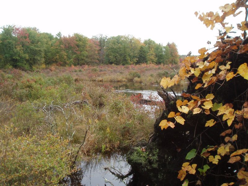
Highbush Blueberry – Meadow-sweet Wetland
System: Palustrine
Subsystem: Shrubland
PA Ecological Group(s): Basin Wetland
Global Rank:GNR
![]() rank interpretation
rank interpretation
State Rank: S5
General Description
This community type usually occurs in small upland depressions or in basins surrounding small streams and drainages. The substrate is typically very poorly drained but lacks a thick organic layer. These wetlands are seasonally to permanently flooded, often influenced by beaver or other impoundments. The pH of these wetlands is less acidic to circumneutral.
Highbush blueberry (Vaccinium corymbosum) and meadow-sweet (either Spiraea latifolia or Spiraea alba) are usually both present. Additional woody species include shadbush (Amelanchier spp.), speckled alder (Alnus incana ssp. rugosa), arrow-wood (Viburnum recognitum), steeplebush (Spiraea tomentosa), swamp dewberry (Rubus hispidus), winterberry (Ilex verticillata), elderberry (Sambucus canadensis), and seedling and sapling size red maple (Acer rubrum). The herbaceous layer is generally dominated by graminoids such as tussock sedge (Carex stricta), rushes (Juncus spp.), and spike-rushes (Eleocharis spp.), and by ferns, especially cinnamon fern (Osmunda cinnamomea), royal fern (O. regalis), sensitive fern (Onoclea sensibilis), and marsh fern (Thelypteris palustris). Forbs like marsh St. John's-wort (Triadenum virginicum), skunk-cabbage (Symplocarpus foetidus), and jewelweed (Impatiens spp.) may also occur. Sphagnum either forms a continuous layer or occurs on hummocks.
Rank Justification
Common, widespread, and abundant in the jurisdiction.
Identification
- Occurs on saturated soils in small upland depressions or basins surrounding small streams and drainages
- Soils are typically very poorly drained shallow peat or mineral soils that lack a thick organic layer
- The pH of this wetland type ranges from less acidic to circumneutral
- Highbush blueberry (Vaccinium corymbosum) and meadow-sweet (either Spiraea latifolia or Spirea alba) are usually both present and dominant in the shrub layer along with other less abundant shrub species
- A sphagnum layer is present
Shrubs
- Highbush blueberry (Vaccinium corymbosum)
- Meadow-sweet (Spiraea alba)
- Meadow-sweet (Spiraea latifolia)
- Speckled alder (Alnus incana ssp. rugosa)
- Northern arrow-wood (Viburnum recognitum)
- Swamp dewberry (Rubus hispidus)
- Winterberry (Ilex verticillata)
- American elder (Sambucus canadensis)
- Red maple (Acer rubrum)
- Shadbush (Amelanchier spp.)
Herbs
Bryophytes
* limited to sites with higher soil calcium
Vascular plant nomenclature follows Rhoads and Block (2007). Bryophyte nomenclature follows Crum and Anderson (1981).
International Vegetation Classification Associations:
USNVC Crosswalk:None
Representative Community Types:
Highbush Blueberry – Swamp Azalea – Coastal Sweet-pepperbush Shrubland (CEGL006371)
Highbush Blueberry Bog Thicket (CEGL006190)
NatureServe Ecological Systems:
North-Central Interior and Appalachian Acidic Peatland (CES202.606)
Northern Atlantic Coastal Plain Basin Peat Swamp (CES203.522)
NatureServe Group Level:
None
Origin of Concept
Fike, J. 1999. Terrestrial and palustrine plant communities of Pennsylvania. Pennsylvania Natural Diversity Inventory. Pennsylvania Department of Conservation and Recreation, Bureau of Forestry, Harrisburg, PA. 86 pp.
Pennsylvania Community Code*
SH : Highbush Blueberry – Meadow-Sweet Wetland
*(DCNR 1999, Stone 2006)
Similar Ecological Communities
The Highbush Blueberry – Sphagnum Wetland is a similar community type to the Highbush Blueberry – Meadow-sweet Wetland but the Highbush Blueberry -Sphagnum Wetland is found in more acidic conditions, is more often glacial in origin, and has a stronger heath component such as swamp azalea (Rhododendron viscosum) and leatherleaf (Chamaedaphne calyculata var. angustifolia).
Fike Crosswalk
Highbush blueberry - meadow-sweet wetland
Conservation Value
Plant species of conservation concern found in this community may include screwstem (Bartonia paniculata). This community also serves as a buffer for sediment and pollution runoff from adjacent developed lands by slowing the flow of surficial water causing sediment to settle within this wetland.
Threats
Highbush Blueberry – Meadow-sweet Wetlands are threatened by habitat alteration (e.g., conversion to agricultural land, logging in adjacent uplands), deposition (e.g., sedimentation, nutrient loading), and alterations to the hydrological regime (e.g., removal of beaver dams or other impoundments, lowering of the water table). Invasive species such as reed canary-grass (Phalaris arundinacea) may alter the species composition of this community type.
Management
A natural buffer around the wetland should be maintained in order to minimize nutrient runoff, pollution, and sedimentation. The potential for soil erosion based on soil texture, condition of the adjacent vegetation (mature forests vs. clearcuts), and the topography of the surrounding area (e.g., degree of slope) should be considered when establishing buffers. The buffer size should be increased if soils are erodible, adjacent vegetation has been logged, and the topography is steep as such factors could contribute to increased sedimentation and nutrient pollution. Direct impacts and habitat alteration should be avoided (e.g., roads, trails, filling of wetlands) and low impact alternatives (e.g., elevated footpaths, boardwalks, bridges) should be utilized in situations where accessing the wetland cannot be avoided. Care should also be taken to control and prevent the spread of invasive species within the wetland. Alterations to groundwater sources should be minimized.
Research Needs
Research is needed to fill information gaps about the longevity of this community type since, under some conditions, it may represent a successional community type.
Trends
Wetland protection has most likely stabilized the decline of these communities. The relative trend for this community is most likely stable or may decline slightly due to hydrological alteration or ecological succession, although this community can be created through beaver impoundments.
Range Map
Pennsylvania Range
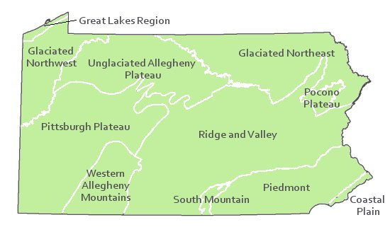
Statewide
Global Distribution
Connecticut, Delaware, Maine, Massachusetts, New Hampshire, New Jersey New York, Pennsylvania, and Rhode Island
Edinger, G.J., D.J. Evans, S. Gebauer, T.G. Howard, D.M. Hunt, and A. M. Olivero (editors). 2002. Ecological Communities of New York. Second Edition. A revised and expanded edition of Carol Reschke’s Ecological Communities of New York State. New York Natural Heritage Program, New York State department of Environmental Conservation. Albany, NY. 136pp.
Fike, J. 1999. Terrestrial and palustrine plant communities of Pennsylvania. Pennsylvania Natural Diversity Inventory. Harrisburg, PA 79 pp.
Horvath, Jamie L., Timothy A. Block, and Ann F. Rhoads. 2008. Description of the population, canopy cover, and associated vegetation of the globally rare sedge Carex polymorpha (Cyperaceae) in Nescopeck State Park, Pennsylvania. In Sedges: Uses, Diversity, and Systematics of the Cyperaceae, eds. R. Naczi and B. Ford. Missouri Botanical Garden Press, St. Louis, MO.
NatureServe. 2005. NatureServe Central Databases. Arlington, Virginia. USA.
Pennsylvania Department of Conservation and Natural Resources (DCNR). 1999. Inventory Manual of Procedure. For the Fourth State Forest Management Plan. Pennsylvania Bureau of Forestry, Division of Forest Advisory Service. Harrisburg, PA. 51 ppg.
Perles, S.J., G.S. Podniesinski, E. Eastman, L.A. Sneddon, and S.C. Gawler. 2007. Classification and mapping of vegetation and fire fuel models at Delaware Water Gap National Recreation Area: Volume 2 of 2 – Appendix G. Technical Report NPS/NER/NRTR – 2007/076. National Park Service. Philadelphia, PA.
Rhoads, Ann F. and Timothy A. Block. 1999. Natural Areas Inventory of Bucks County, Pennsylvania. Bucks County Commissioners, Doylestown, PA.
Rhoads, Ann F. and Timothy A. Block. 2002. Nescopeck State Park; Inventory of PNDI-listed Plants and Plant Communities. Report submitted to DCNR, Bureau of State Parks.
Rhoads, Ann F. and Timothy A. Block. 2003. Lower Morrisville Road Wetlands, Natural Resourced Inventory ahd Management Recommendations. Report submitted to the Falls Township Board of Supervisors.
Rhoads, Ann F. and Timothy A. Block. 2005. Varden Conservation Area Vegetation Inventory. Report submitted to DCNR, Bureauof State Parks.
Rhoads, Ann F. and Timothy A. Block. 2006. Vegetation Inventory of Gouldsboro State Park. Report submitted to DCNR, Bureau of State Parks.
Stone, B., D. Gustafson, and B. Jones. 2006 (revised). Manual of Procedure for State Game Land Cover Typing. Commonwealth of Pennsylvania Game Commission, Bureau of Wildlife Habitat Management, Forest Inventory and Analysis Section, Forestry Division. Harrisburg, PA. 79 ppg.

Cite as:
Furedi, M. 2022. Pennsylvania Natural Heritage Program. Highbush Blueberry – Meadow-sweet Wetland Factsheet. Available from: https://naturalheritage.state.pa.us/Community.aspx?=16037 Date Accessed: July 09, 2026