Green Ash – Mixed Hardwood Floodplain Forest
System: Palustrine
Subsystem: Forest
PA Ecological Group(s): River Floodplain
Global Rank:GNR
![]() rank interpretation
rank interpretation
State Rank: S4
General Description
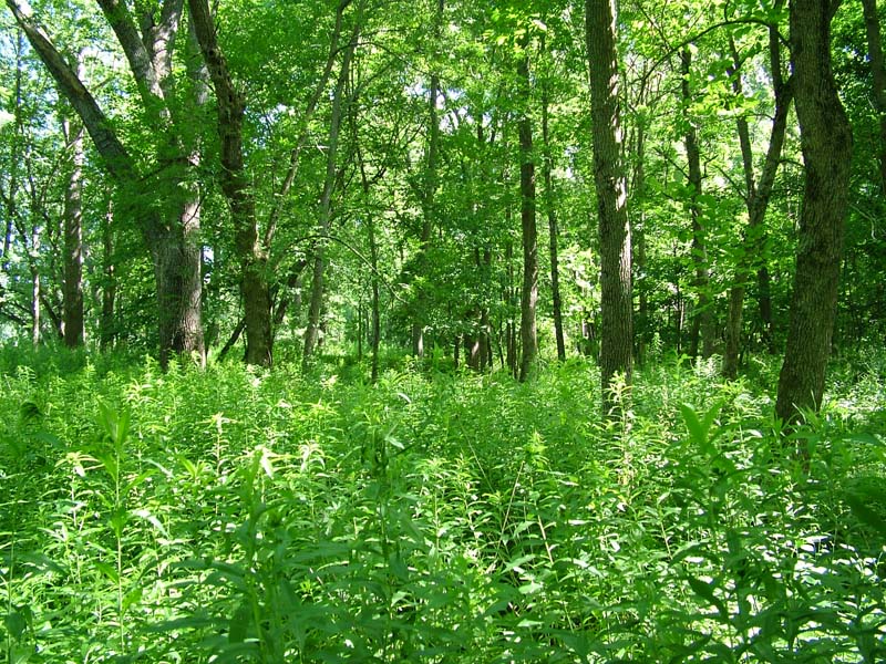
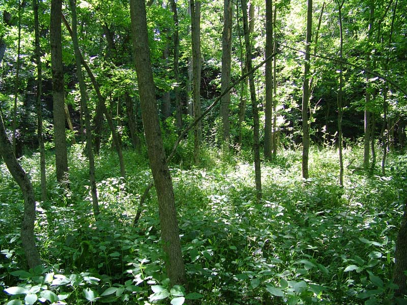
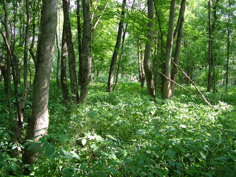
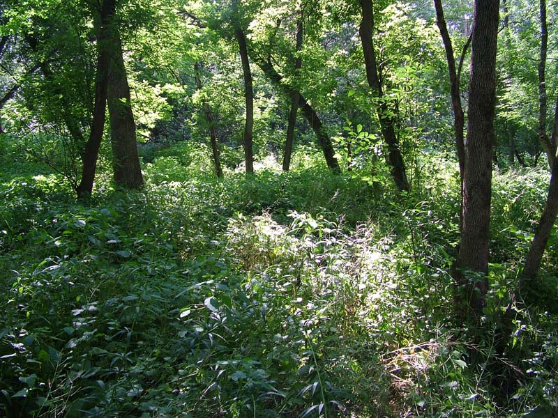
The Green Ash – Mixed Hardwood Floodplain Forest occurs behind levees and on low terraces which may frequently be temporarily flooded but with a shorter duration of flooding than the Silver Maple Floodplain Forest. However, soil characteristics suggest that the ground water level is high for much of the growing season (hydric soil indicators present, soils typically somewhat poorly drained to poorly drained). Soil texture varies from silt to clay loam. On more exposed sites with higher flood flow velocities and coarser substrates, this community may more closely resemble the Sycamore – Mixed Hardwood Floodplain Forest.
The canopy of this community is dominated by green ash (Fraxinus pennsylvanica) and may contain one or more other hardwood species as sub-dominants, including black walnut (Juglans nigra) and sycamore (Platanus occidentalis). Other less common canopy species include American elm (Ulmus americana), hackberry (Celtis occidentalis), red maple (Acer rubrum), silver maple (Acer saccharinum), and pin oak (Quercus palustris). The subcanopy and shrub layers are often sparse (occasionally dense at some sites) and are characterized by regeneration of canopy tree species and some shrub species such as spicebush (Lindera benzoin). Where exotic species are not rampant, the herbaceous layer is characterized by jewelweed (Impatiens spp.), wood nettle (Laportea canadensis), wingstem (Verbesina alternifolia), Canadian waterleaf (Hydrophyllum canadense), poison ivy (Toxicodendron radicans), and Virginia creeper (Parthenocissus quinquefolia). A number of examples of this community have been heavily impacted by exotic herbaceous species, which may attain a total cover in excess of 90 percent. Common exotic species include multiflora rose (Rosa multiflora), Morrow’s honeysuckle (Lonicera morrowii), common privet (Ligustrum vulgare), Japanese barberry (Berberis thunbergii), Japanese stiltgrass (Microstegium vimineum), Japanese knotweed (Fallopia japonica), dame’s-rocket (Hesperis matronalis), gill-over-the-ground (Glechoma hederacea), and garlic-mustard (Alliaria petiolata).
Rank Justification
Uncommon but not rare; some cause for long-term concern due to declines or other factors.
Identification
- Dominated by green ash (Fraxinus pennsylvanica) and co-dominated by black walnut (Juglans nigra) and sycamore (Platanus occidentalis)
- Occurs behind levees and on low floodplain terraces
- Soil texture varies from silt to clay loam
Trees
Shrubs
Herbs
Exotic Species
- Multiflora rose (Rosa multiflora)
- Morrow's honeysuckle (Lonicera morrowii)
- Common privet (Ligustrum vulgare)
- Japanese barberry (Berberis thunbergii)
- Japanese stiltgrass (Microstegium vimineum)
- Japanese knotweed (Fallopia japonica)
- Dame's-rocket (Hesperis matronalis)
- Gill-over-the-ground (Glechoma hederacea)
- Garlic-mustard (Alliaria petiolata)
* limited to sites with higher soil calcium
Vascular plant nomenclature follows Rhoads and Block (2007). Bryophyte nomenclature follows Crum and Anderson (1981).
International Vegetation Classification Associations:
USNVC Crosswalk:None
Representative Community Types:
Green Ash - Mixed Hardwood Floodplain Forest (CEGL006575)
NatureServe Ecological Systems:
Central Appalachian River Floodplain (CES202.608)
NatureServe Group Level:
None
Origin of Concept
Zimmerman, E., and G. Podniesinski. 2008. Classification, Assessment and Protection of Floodplain Wetlands of the Ohio Drainage. Pennsylvania Natural Heritage Program, Western Pennsylvania Conservancy, Pittsburgh, PA. Report to: The United States Environmental Protection Agency and the Pennsylvania Department of Conservation and Natural Resources, Office of Conservation Science. US EPA Wetlands Protection State Development Grant no. CD-973081-01-0.
Pennsylvania Community Code*
SX : Miscellaneous Palustrine/Floodplain Forest
*(DCNR 1999, Stone 2006)
Similar Ecological Communities
Green Ash – Mixed Hardwood Floodplain Forest shares many species with other palustrine forests but is distinguishable from other floodplain forests due to the clear dominance of green ash (Fraxinus pennsylvanica) whereas the Silver Maple Floodplain Forest is dominated by silver maple (Acer saccharinum), Oak – Mixed Hardwood Palustrine Forest is dominated by oaks (Quercus spp.), and Sycamore Mixed Hardwood Floodplain Forest is dominated by sycamore (Platanus occidentalis). On more exposed sites with higher flood flow velocities and coarser substrates, this community may more closely resemble the Sycamore – Mixed Hardwood Floodplain Forest.
Fike Crosswalk
None. This type is new to the Pennsylvania Plant Community Classification developed from river floodplain classification studies in the Susquehanna and Ohio River Basins.
Conservation Value
While this type itself is not rare in Pennsylvania, large contiguous forested floodplains along stretches of free flowing river are uncommon. Due to the widespread conversion to agriculture and development, large patches of floodplain forest are uncommon in Pennsylvania and hold conservation significance. This community also serves as a buffer for sediment and pollution runoff from adjacent developed lands by slowing the flow of surficial water causing sediment to settle within this wetland.
Threats
Alteration to the frequency and duration of flood events and development of the river floodplains are the two greatest threats to this community statewide and can lead to habitat destruction and/or shifts in community function and dynamics. Non-native invasive plants may be equally devastating as native floodplain plants are displaced. Development of adjacent land can lead to an accumulation of agricultural run-off and pollution, sedimentation, and insolation/thermal pollution.
Management
Direct impacts to the floodplain ecosystems (e.g., road construction, development, filling of wetlands) have greatly altered their composition, structure, and function region-wide. Further impacts that alter riparian function of the remaining areas should therefore be avoided. When development is unavoidable, low impact alternatives (e.g., elevated footpaths, boardwalks, bridges, pervious paving) that maintain floodplain processes should be utilized to minimize impacts to natural areas and the plant and animal species within them. Maintenance of natural buffers surrounding high quality examples of floodplain wetlands is recommended in order to minimize nutrient runoff, pollution, and sedimentation. Care should also be taken to control and prevent the spread of invasive species into high quality sites.
As floodplains are dependent on periodic disturbance, natural flooding frequency and duration should be maintained and construction of new dams, levees, or other in-stream modifications should be avoided. Activities resulting in destabilization of the banks or alteration of the disturbance patterns of the site should be avoided. Numerous land use planning recommendations have been proposed to reduce the negative impacts of changing land use on riparian systems. These include protecting riparian buffer habitat, retaining natural areas in developed landscapes, compensating for lost habitat, excluding livestock grazing from riparian areas, providing corridors between riparian and upland habitats, avoiding constructing roads and utility lines through riparian habitat areas, and restoring degraded riparian habitat. Providing the river system some scope to maintain itself may be more cost-effective in the long run than attempts at controlling natural functions through human intervention.
Research Needs
Variations may occur at ecoregional levels. There is a need to collect additional plot data to characterize variations and guide further classification of this community.
Trends
Green Ash – Mixed Hardwood Floodplain Forests were undoubtedly more common but have declined due to dam impoundments, human development, and farming; modification of the adjacent upland has further impacted the quality of this type. As this type requires lower velocity flows, alteration of the natural flooding regime (duration and frequency) has most likely been the most critical factor influencing the quality and persistence of this type. The relative trend for this community is likely stable or may be declining slightly due to development; however, new alterations to river hydrology could result in significant changes to this type. High quality examples are most likely declining with invasion of exotic plant species, lack of recruitment due to deer browsing, and lack of periodic flooding events.
Range Map
Pennsylvania Range
Statewide
Global Distribution
Delaware, Maryland, New Jersey, New York, and Pennsylvania
Pennsylvania Department of Conservation and Natural Resources (DCNR). 1999. Inventory Manual of Procedure. For the Fourth State Forest Management Plan. Pennsylvania Bureau of Forestry, Division of Forest Advisory Service. Harrisburg, PA. 51 ppg.
Stone, B., D. Gustafson, and B. Jones. 2006 (revised). Manual of Procedure for State Game Land Cover Typing. Commonwealth of Pennsylvania Game Commission, Bureau of Wildlife Habitat Management, Forest Inventory and Analysis Section, Forestry Division. Harrisburg, PA. 79 ppg.

Cite as:
Zimmerman, E. 2022. Pennsylvania Natural Heritage Program. Green Ash – Mixed Hardwood Floodplain Forest Factsheet. Available from: https://naturalheritage.state.pa.us/Community.aspx?=30008 Date Accessed: July 09, 2026