Circumneutral Mixed Shrub Wetland
System: Palustrine
Subsystem: Shrubland
PA Ecological Group(s): Basin Wetland
Global Rank:GNR
![]() rank interpretation
rank interpretation
State Rank: S3
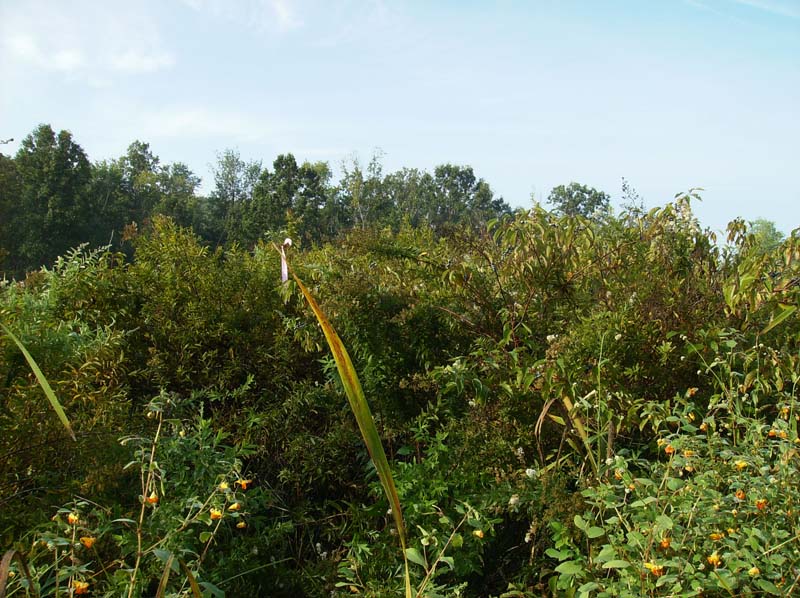
General Description
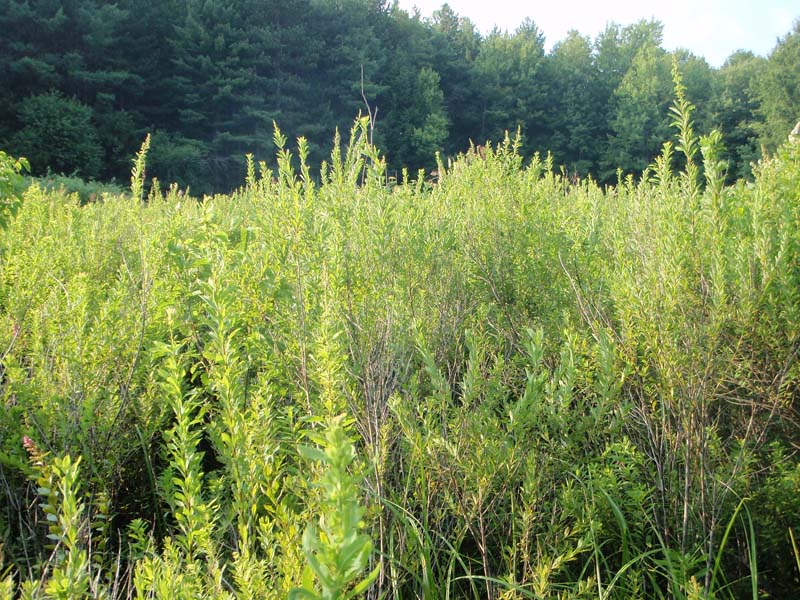
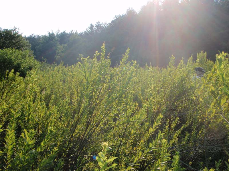
This shrub-dominated wetland community occurs in a variety of palustrine settings, including the upland edge of marshes, at the wetter edge of red maple wetlands, in small upland depressions, stream floodplains, and at the base of slopes. The community may represent a successional stage between abandoned agricultural land and a forest community. The substrate is generally very poorly drained shallow peat or mineral soil with a thin organic layer. These wetlands are generally seasonally flooded and may remain saturated for much of the growing season. Nutrient enrichment is generally the result of discharge from groundwater or inflow from the surrounding watershed. The pH of these systems is broadly circumneutral to somewhat calcareous, and calciphiles may be present. Many of these wetlands were or currently are influenced by beaver activity or other impoundments. Grazing (past and present) and previous land use history (e.g., farming) may also be a factor. Community size ranges from small inclusions to extensive acreage.
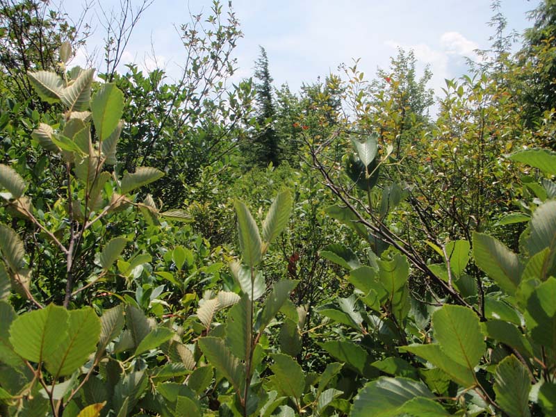
The community is characterized by a substantial tall-shrub layer that may be dominated by a single shrub species or a patchwork of mixed shrubs. Shrub species typically found in this community include: smooth alder (Alnus serrulata), speckled alder (A. incana ssp. rugosa), ninebark (Physocarpus opulifolius), willows (Salix spp.), American elder (Sambucus canadensis), dogwoodc (Cornus spp.), water-willow (Decodon verticillatus), buttonbush (Cephalanthus occidentalis), winterberry (Ilex verticillata), viburnum (Viburnum spp.), meadow-sweet (Spiraea spp.), and swamp rose (Rosa palustris). Scattered seedling/sapling sized trees may be present such as red maple (Acer rubrum). The herbaceous layer can be dense and contains a variety of species, including royal fern (Osmunda regalis), marsh fern (Thelypteris palustris), common cat-tail (Typha latifolia), arrow-arum (Peltandra virginica), tussock sedge (Carex stricta), and bedstraw (Galium spp.). A sphagnum (Sphagnum spp.) layer is usually minimal to absent.
Rank Justification
Vulnerable in the nation or state due to a restricted range, relatively few populations (often 80 or fewer), recent and widespread declines, or other factors making it vulnerable to extirpation.
Identification
- Occurs on saturated soils in a variety of palustrine settings, including the upland edge of marshes, at the wetter edge of red maple wetlands, in small upland depressions, stream floodplains, and at the base of slopes
- Soils are generally very poorly drained shallow peat or mineral soil with a thin organic layer
- The pH of this wetland type is circumneutral to somewhat calcareous and is reflected in vegetational composition
- Shrub layer may be dominated by a single species or consists of a mix of shrub species that may form clonal patches within the community
Shrubs
- Viburnum (Viburnum spp.)
- Smooth alder (Alnus serrulata)
- Speckled alder (Alnus incana ssp. rugosa)
- Ninebark (Physocarpus opulifolius)
- Willows (Salix spp.)
- American elder (Sambucus canadensis)
- Silky dogwood (Cornus amomum)
- Gray dogwood (Cornus racemosa)
- Red-osier dogwood (Cornus sericea)
- Water-willow (Decodon verticillatus)
- Buttonbush (Cephalanthus occidentalis)
- Winterberry (Ilex verticillata)
- Swamp rose (Rosa palustris)
- Meadow-sweet (Spiraea spp.)
Herbs
- Royal fern (Osmunda regalis)
- Marsh fern (Thelypteris palustris)
- Common cat-tail (Typha latifolia)
- Arrow-arum (Peltandra virginica)
- Tussock sedge (Carex stricta)
- Bedstraw (Galium spp.)
- Jewelweed (Impatiens capensis)
- Pale jewelweed (Impatiens pallida)
- False nettle (Boehmeria cylindrica)
- Wood-nettle (Laportea canadensis)
- Stinging nettle (Urtica dioica)
- Smartweeds (Persicaria spp.)
- Rice cutgrass (Leersia oryzoides)
- Cutgrass (Leersia virginica)
* limited to sites with higher soil calcium
Vascular plant nomenclature follows Rhoads and Block (2007). Bryophyte nomenclature follows Crum and Anderson (1981).
International Vegetation Classification Associations:
USNVC Crosswalk:None
Representative Community Types:
Smooth Alder Swamp (CEGL005082)
NatureServe Ecological Systems:
Laurentian-Acadian Wet Meadow-Shrub Swamp (CES201.582)
NatureServe Group Level:
None
Origin of Concept
Zimmerman, E., and G. Podniesinski. 2008. Classification, Assessment and Protection of Floodplain Wetlands of the Ohio Drainage. Pennsylvania Natural Heritage Program, Western Pennsylvania Conservancy, Pittsburgh, PA. Report to: The United States Environmental Protection Agency and the Pennsylvania Department of Conservation and Natural Resources, Office of Conservation Science. US EPA Wetlands Protection State Development Grant no. CD-973081-01-0.
Pennsylvania Community Code*
SN : Alder – Ninebark Wetland
*(DCNR 1999, Stone 2006)
Similar Ecological Communities
Circumneutral Mixed Shrub Wetland differs from Buttonbush Wetland in that buttonbush may be a component of the Circumneutral Mixed Shrub Wetland but is not the dominant shrub type. If buttonbush is the dominant shrub species, the community is classified as Buttonbush Wetland.
Circumneutral Mixed Shrub Wetland differs from Acidic Mixed Shrub – Sphagnum Wetland in that the pH of Circumneutral Mixed Shrub Wetland is circumneutral to somewhat calcareous while the latter occupies the lower end of the pH spectrum. The associate species reflect this shift, with shrubs like ninebark and silky dogwood occurring in a circumneutral environment, while [acid-loving] heaths like highbush blueberry (Vaccinium corymbosum) and maleberry (Lyonia ligustrina) are more typical under acidic conditions. The presence of a substantial sphagnum layer is a distinguishing characteristic that differentiates the two community types.
Fike Crosswalk
Alder - Ninebark Wetland
Conservation Value
This community may serve as important habitat for breeding birds, including woodcocks (Scolopax minor). Plant species of conservation concern may include screwstem (Bartonia paniculata), broad-winged sedge (Carex alata), Bebb’s sedge (Carex bebbii), lesser panicled sedge (Carex diandra), cloud sedge (Carex haydenii), many-fruited sedge (Carex lasiocarpa), Wood’s sedge (Carex tetanica), Indian paintbrush (Castilleja coccinea), marsh willow-herb (Epilobium palustre), downy willow-herb (Epilobium strictum), slender cotton-grass (Eriophorum gracile), cleavers (Galium trifidum), small-headed rush (Juncus brachycephalus), marsh pea (Lathyrus palustris), swamp lousewort (Pedicularis lanceolata), broad-leaved willow (Salix myricoides), autumn willow (Salix serissima), bog goldenrod (Solidago uliginosa), shining ladies’-tresses (Spiranthes lucida), and highbush-cranberry (Viburnum trilobum).
Threats
Circumneutral Mixed Shrub Wetlands are threatened by habitat alteration (e.g., conversion to agricultural land, logging in adjacent uplands), deposition (e.g., sedimentation, nutrient loading), and alterations to the hydrological regime (e.g., removal of beaver dams or other impoundments, lowering of the water table, changes in streamflow). Invasive species such as reed canary-grass (Phalaris arundinacea), Morrow’s honeysuckle (Lonicera morrowii), and multiflora rose (Rosa multiflora) may alter the species composition of this community type.
Management
A natural buffer around the wetland should be maintained in order to minimize nutrient runoff, pollution, and sedimentation. Soil erodibility in terms of the soil texture, condition of the adjacent vegetation (mature forests vs. clearcuts) and the topography of the surrounding area (i.e. degree of slope) should be considered when establishing buffers. Impervious surfaces surrounding the wetland should be minimized to prevent thermal pollution. Direct impacts and habitat alteration should be avoided (e.g., roads, trails, filling of wetland) and low impact alternatives (e.g., elevated footpaths, boardwalks, bridges) should be utilized in situations where accessing the wetland cannot be avoided. Care should also be taken to control and prevent the spread of invasive species within the wetland. Alterations to groundwater sources should be minimized. If the community is found streamside, streambed alteration could affect community longevity.
Circumneutral Mixed Shrub Wetland is one example of declining shrubland habitat found in Pennsylvania. Shrubland habitats are early successional plant communities, often formed by disturbance event(s), which represent a short-lived transitional stage between more stable community types. Repeated disturbance events over time (either natural or anthropogenic) are needed to reset the community back to its earlier successional state. In the absence of disturbance, shrubland habitats may only remain a component of the landscape for 15-20 years before reverting to young forests. Shrublands provide habitat for many early successional-dependent species such as birds. Management activities such as removal of tree species, assisted disturbance, and invasive species control may be needed to maintain this community type.
Research Needs
Variations may occur at eco-regional levels. There is a need to collect community plot data to examine eco-regional differences that may help to further refine the classification of this community.
Trends
Wetland protection has most likely stabilized the decline of this community type. Because some examples of this community type may represent a successional stage between fallow farmland and forest, this community may have increased as a result of abandoned agricultural land.
Range Map
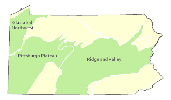
Pennsylvania Range
Glaciated Northwest, Pittsburgh Plateau, and Ridge and Valley
Global Distribution
Connecticut, Delaware, Maine, Maryland, Massachusetts, New Hampshire, New Jersey, New York, Ohio, Pennsylvania, Rhode Island, Vermont, Virginia, West Virginia, and extends into eastern Canada.
Edinger, G.J., D.J. Evans, S. Gebauer, T.G. Howard, D.M. Hunt, and A. M. Olivero (editors). 2002. Ecological Communities of New York. Second Edition. A revised and expanded edition of Carol Reschke’s Ecological Communities of New York State. New York Natural Heritage Program, New York State department of Environmental Conservation. Albany, NY. 136pp.
Fike, J. 1999. Terrestrial and palustrine plant communities of Pennsylvania. Pennsylvania Natural Diversity Inventory. Harrisburg, PA 79 pp.
NatureServe. 2005. NatureServe Central Databases. Arlington, Virginia. USA.
Pennsylvania Department of Conservation and Natural Resources (DCNR). 1999. Inventory Manual of Procedure. For the Fourth State Forest Management Plan. Pennsylvania Bureau of Forestry, Division of Forest Advisory Service. Harrisburg, PA. 51 ppg.
Perles, S.J., G.S. Podniesinski, E. Eastman, L.A. Sneddon, and S.C. Gawler. 2007. Classification and mapping of vegetation and fire fuel models at Delaware Water Gap National Recreation Area: Volume 2 of 2 – Appendix G. Technical Report NPS/NER/NRTR – 2007/076. National Park Service. Philadelphia, PA.
Stone, B., D. Gustafson, and B. Jones. 2006 (revised). Manual of Procedure for State Game Land Cover Typing. Commonwealth of Pennsylvania Game Commission, Bureau of Wildlife Habitat Management, Forest Inventory and Analysis Section, Forestry Division. Harrisburg, PA. 79 ppg.

Cite as:
Eichelberger, B.
2022. Pennsylvania Natural Heritage Program. Circumneutral Mixed Shrub Wetland Factsheet. Available from: https://naturalheritage.state.pa.us/Community.aspx?=16166 Date Accessed: July 09, 2026