Red Maple – Magnolia Palustrine Forest
System: Palustrine
Subsystem: Forest
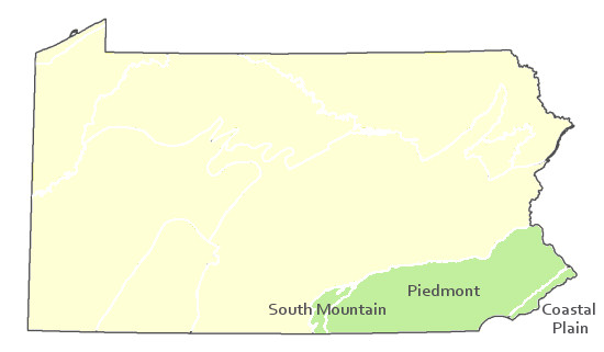
PA Ecological Group(s): River Floodplain and Basin Wetland and Coastal Plain
Global Rank:G3?
![]() rank interpretation
rank interpretation
State Rank: S1
General Description
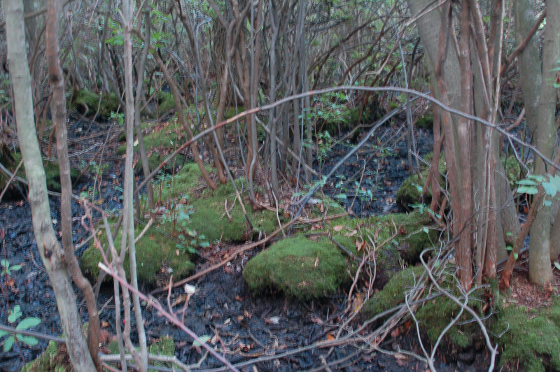
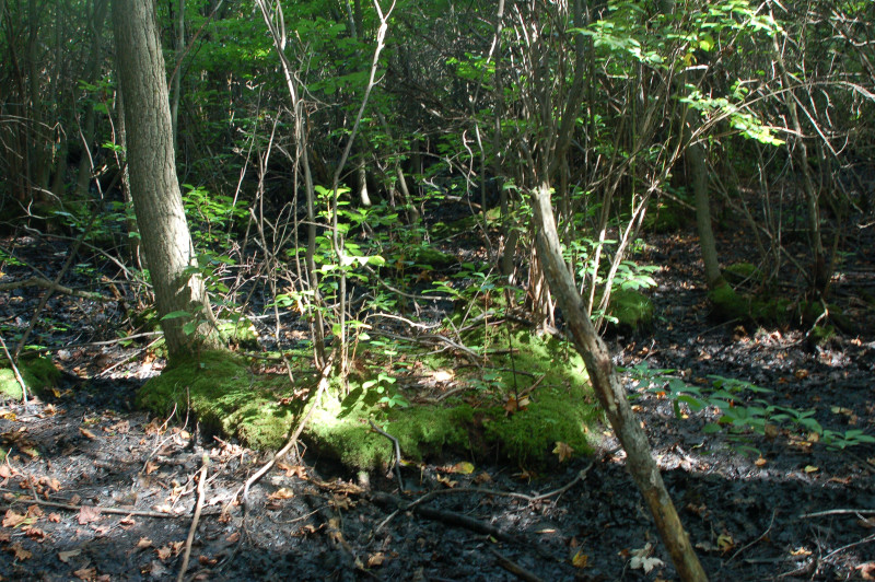
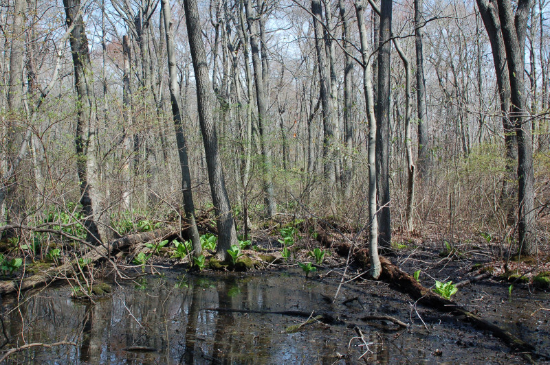
This community type is largely restricted to low-lying areas of the Coastal Plain, with outliers occurring in the Piedmont and South Mountain sections. The dominant trees are red maple (Acer rubrum), sweet-bay magnolia (Magnolia virginiana), blackgum (Nyssa sylvatica), sweetgum (Liquidambar styraciflua), and swamp white oak (Quercus bicolor). Shrubs include sweet pepperbush (Clethra alnifolia), fetter-bush (Leucothoe racemosa), winterberry (Ilex verticillata), smooth winterberry (Ilex laevigata), highbush blueberry (Vaccinium corymbosum), swamp azalea (Rhododendron viscosum), and possum-haw (Viburnum nudum). The herbaceous layer is often sparse; species include marsh St. John's-wort (Triadenum virginicum) in openings, violets (Viola spp.), royal fern (Osmunda regalis), cinnamon fern (Osmunda cinnamomea), and other ferns, sedges, and sphagnum.
Rank Justification
Critically imperiled in the jurisdiction because of extreme rarity or because of some factor(s) such as very steep declines making it especially vulnerable to extirpation .
Identification
- Nutrient poor, acidic swamp forest
- Found on the Coastal Plain and some areas in the Piedmont
- Groundwater fed
- Moderately deep to deep muck over mineral soils with standing water
- Co-dominance of red maple (Acer rubrum) with sweet-bay magnolia (Magnolia virginiana), sweetgum (Liquidambar styraciflua), and blackgum (Nyssa sylvatica)
Trees
Shrubs
Herbs
Bryophytes
* limited to sites with higher soil calcium
Vascular plant nomenclature follows Rhoads and Block (2007). Bryophyte nomenclature follows Crum and Anderson (1981).
International Vegetation Classification Associations:
USNVC Crosswalk:None
Representative Community Types:
Southern Red Maple - Blackgum Swamp Forest (CEGL006238)
NatureServe Ecological Systems:
Northern Atlantic Coastal Plain Stream and River (CES203.070)
Northern Atlantic Coastal Plain Pitch Pine Lowland (CES203.374)
NatureServe Group Level:
None
Origin of Concept
Fike, J. 1999. Terrestrial and palustrine plant communities of Pennsylvania. Pennsylvania Natural Diversity Inventory. Pennsylvania Department of Conservation and Recreation, Bureau of Forestry, Harrisburg, PA. 86 pp.
Fike, J. 1999. Terrestrial and palustrine plant communities of Pennsylvania. Pennsylvania Natural Diversity Inventory. Pennsylvania Department of Conservation and Recreation, Bureau of Forestry, Harrisburg, PA. 86 pp.
Pennsylvania Community Code*
SX : Miscellaneous Palustrine/Floodplain Forest
*(DCNR 1999, Stone 2006)
Similar Ecological Communities
The presence of red maple (Acer rubrum) with sweet-bay magnolia (Magnolia virginiana), sweetgum (Liquidambar styraciflua), and other coastal plain species clearly distinguishes the Red Maple – Magnolia Palustrine Forest from other red maple dominated palustrine forests such as Red Maple – Blackgum Palustrine Forest and Red Maple – Black Ash Palustine Forest.
Fike Crosswalk
Red maple - magnolia coastal plain palustrine forest
Conservation Value
Red Maple – Magnolia Palustrine Forest is a rare community within the state and rare plant species found in this community may include sweet-bay magnolia (Magnolia virginiana), fetter-bush (Leucothoe racemosa), and possum-haw (Viburnum nudum).
Threats
Alteration to the hydrological regime and development are the major threats to this community (e.g., impoundments, beaver dams) and can lead to habitat destruction and/or shifts in community function and dynamics. Clearing and development of adjacent land can lead to an accumulation of agricultural run-off and pollution, as well as sedimentation. Invasive plant species such as tree-of-heaven (Ailanthus altissima), Japanese barberry (Berberis thunbergii), multiflora rose (Rosa multiflora), purple loosestrife (Lythrum salicaria), and common reed (Phragmites australis spp. australis ) can dominate this community.
Management
A natural buffer around the wetland should be maintained in order to minimize nutrient runoff, pollution, and sedimentation. The potential for soil erosion based on soil texture, condition of the adjacent vegetation (mature forests vs. clearcuts), and the topography of the surrounding area (i.e., degree of slope) should be considered when establishing buffers. The buffer size should be increased if soils are erodible, adjacent vegetation has been logged, and the topography is steep as such factors could contribute to increased sedimentation and nutrient pollution. Direct impacts and habitat alteration should be avoided (e.g., roads, trails, filling of wetlands) and low impact alternatives (e.g., elevated footpaths, boardwalks, bridges) should be utilized in situations where accessing the wetland can not be avoided. Care should also be taken to control and prevent the spread of invasive species within the wetland.
Research Needs
Variations may occur at ecoregional levels. There is a need to collect plot data to characterize variations and guide further classification of this community.
Trends
These wetlands were probably more common but declined due to wetland draining/filling and clearing of the adjacent lands leading to increased sedimentation and altered hydrology. The development of the Coastal Plain in Pennsylvania contributed to the decline of this community. The relative trend for this community is likely stable or may be declining slightly due to hydrological alterations and habitat destruction.
Range Map
Pennsylvania Range
Coastal Plain, Piedmont, South Mountain.
Global Distribution
Delaware, New Jersey, Maryland, and Pennsylvania.
Fike, J. 1999. Terrestrial and palustrine plant communities of Pennsylvania. Pennsylvania Natural Diversity Inventory. Pennsylvania Department of Conservation and Recreation. Bureau of Forestry. Harrisburg, PA.
NatureServe 2010. NatureServe Explorer: An online encyclopedia of life Version 7.1. NatureServe, Arlington, VA. Available http://www.natureserv.org/explorer (accessed: 23 November 2011).
Pennsylvania Department of Conservation and Natural Resources (DCNR). 1999. Inventory Manual of Procedure. For the Fourth State Forest Management Plan. Pennsylvania Bureau of Forestry, Division of Forest Advisory Service. Harrisburg, PA. 51 ppg.
Rhoads, Ann F. and Timothy A. Block. 1999. Natural Areas Inventory of Bucks County, Pennsylvania. Bucks County Commissioners, Doylestown, PA.
Rhoads, Ann F. and Timothy A. Block. 2003. Lower Morrisville Road Wetlands, Natural Resourced Inventory ahd Management Recommendations. Report submitted to the Falls Township Board of Supervisors.
Rhoads, Ann F. and Timothy A. Block. 2008. Natural Areas Inventory Update, Montgomery County, Pennsylvania. Montgomery County Planning Commission, Norristown, PA.
Stone, B., D. Gustafson, and B. Jones. 2006 (revised). Manual of Procedure for State Game Land Cover Typing. Commonwealth of Pennsylvania Game Commission, Bureau of Wildlife Habitat Management, Forest Inventory and Analysis Section, Forestry Division. Harrisburg, PA. 79 ppg.
Cite as:
Eichelberger, B. 2022. Pennsylvania Natural Heritage Program. Red Maple – Magnolia Palustrine Forest Factsheet. Available from: https://naturalheritage.state.pa.us/Community.aspx?=16024 Date Accessed: July 09, 2026