Elm – Ash – Maple Lakeplain Forest
System: Palustrine
Subsystem: Forest
PA Ecological Group(s):
Great Lakes Region Wetland
Global Rank:G4?
![]() rank interpretation
rank interpretation
State Rank: S1
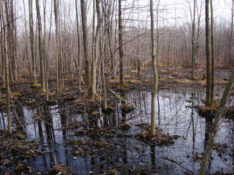
General Description
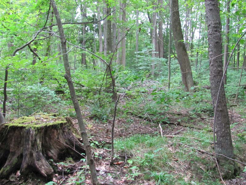
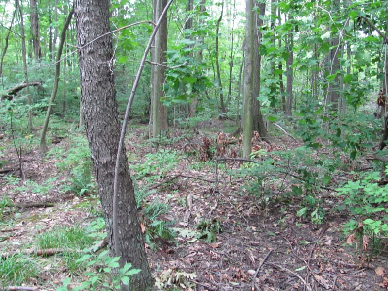
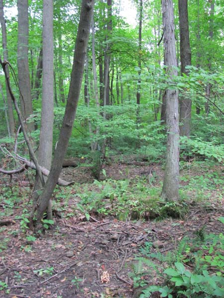
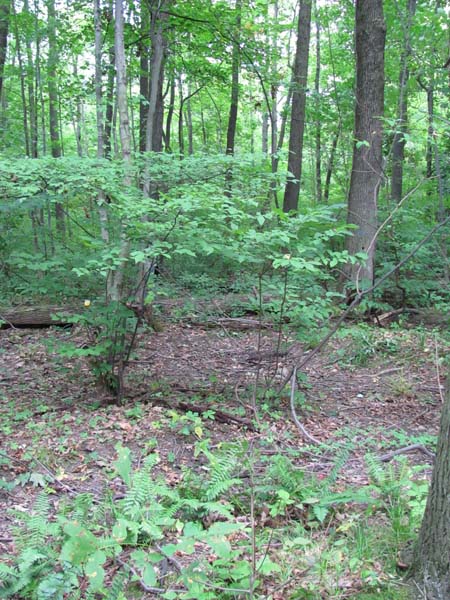
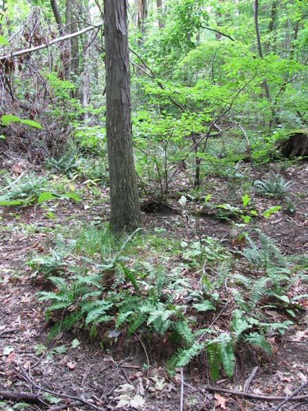
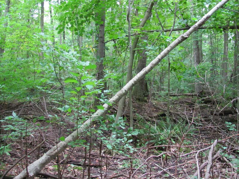
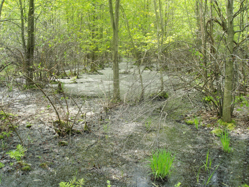
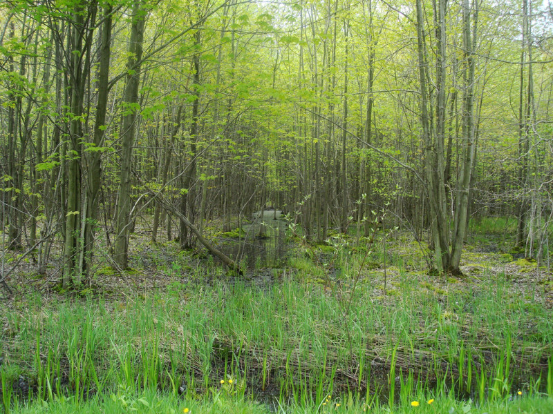
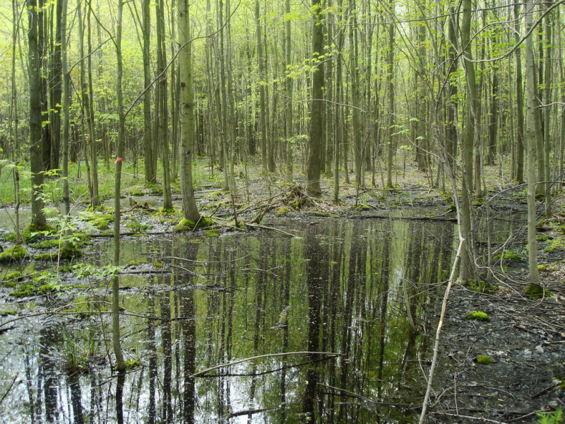
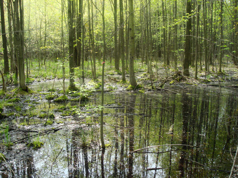
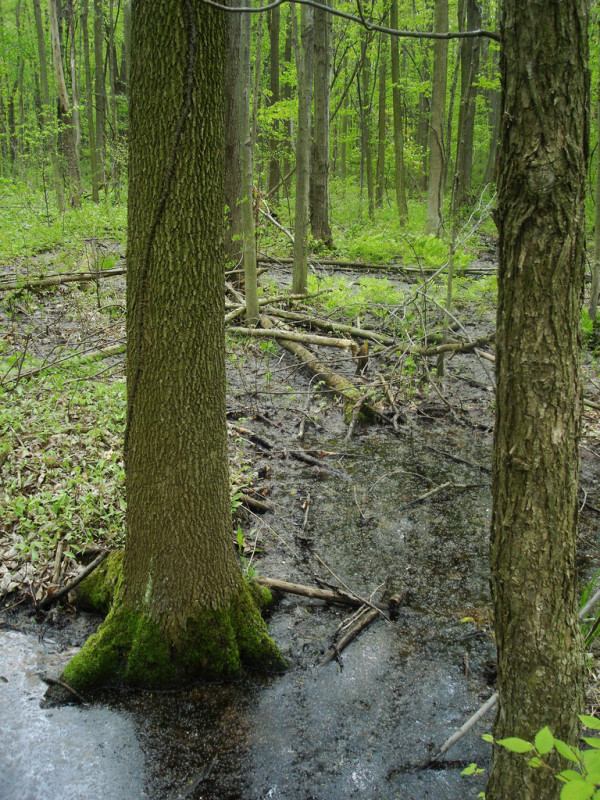
These wetlands are specific to the Erie Lake Plain. While the usual aspect is that of a forest, on wetter and/or more recently disturbed sites, there may be a more open canopy. The topography is flat overall with a hummock and hollow microtopography, often with small vernal ponds scattered throughout. The water table is near the surface most of the year. The dominant tree species are American elm (Ulmus americana), red green ash (Fraxinus pennsylvanica), pumpkin ash (Fraxinus profunda), and silver maple (Acer saccharinum). Other trees commonly present include red maple (Acer rubrum), eastern cottonwood (Populus deltoides), basswood (Tilia americana var. americana), yellow birch (Betula alleghaniensis), and sourgum blackgum (Nyssa sylvatica). The shrub layer is usually dominated by spicebush (Lindera benzoin), although this is likely a result of deer over-browsing. The herbaceous layer may be very diverse, representative species include sedge (Carex bromoides), sedge (Carex intumescens), short hair sedge (Carex crinita var. crinita), spinulose wood fern (Dryopteris carthusiana), sensitive fern (Onoclea sensibilis), purplecress (Cardamine douglassii), cinnamon fern (Osmunda cinnamomea), and blue marsh violet (Viola cucullata). This community type in Pennsylvania remains on only a handful of sites.
Rank Justification
Critically imperiled in the nation or state because of extreme rarity (often 5 or fewer occurrences) or because of some factor(s) such as very steep declines making it especially vulnerable to extirpation from the state.
Identification
- Wetland depressions on flat plain
- Found only in Erie Lake Plain
- Presence of pumpkin ash (Fraxinus profunda)
- Hummock and hollow microtopography
Trees
Shrubs
Herbs
* limited to sites with higher soil calcium
Vascular plant nomenclature follows Rhoads and Block (2007). Bryophyte nomenclature follows Crum and Anderson (1981).
International Vegetation Classification Associations:
USNVC Crosswalk:None
Representative Community Types:
Maple - Ash - Elm Swamp Forest (CEGL005038)
NatureServe Ecological Systems:
North-Central Interior and Appalachian Rich Swamp (CES202.605)
NatureServe Group Level:
None
Origin of Concept
Fike, J. 1999. Terrestrial and palustrine plant communities of Pennsylvania. Pennsylvania Natural Diversity Inventory. Pennsylvania Department of Conservation and Recreation, Bureau of Forestry, Harrisburg, PA. 86 pp.
Western Pennsylvania Conservancy. 2005. Rapid Inventory and Assessment of Landscape, Ecological and Biodiversity Resources Relative to Management Options
Pennsylvania Community Code*
SX : Miscellaneous Palustrine/Floodplain Forest
*(DCNR 1999, Stone 2006)
Similar Ecological Communities
In Pennsylvania this type is restricted to the Erie Lake Plain. It shares species with both floodplain forest types and rich upland types, but is distinguishable by its setting, by the presence of pumpkin ash (Fraxinus profunda) on most sites, and by the unusual combination of tree species.
Fike Crosswalk
Great lakes region lakeplain palustrine forest
Conservation Value
Rare plant species found in this community include pumpkin ash (Fraxinus profunda). This community also serves as a buffer for sediment and pollution runoff from adjacent developed lands by slowing the flow of surficial water causing sediment to settle within the wetland.
Threats
Alteration to the hydrological regime and development are the major threats to this community (e.g., impoundments, beaver dams) and can lead to habitat destruction and/or shifts in community function and dynamics. Clearing and development of adjacent land can lead to an accumulation of agricultural run-off, pollution, and sedimentation. Invasive plant species such as Japanese barberry (Berberis thunbergii), multiflora rose (Rosa multiflora), purple loosestrife (Lythrum salicaria), and common reed (Phragmites australis ssp. australis) can dominate shrub and herb layers this community.
Management
A natural buffer around the wetland should be maintained in order to minimize nutrient runoff, pollution, and sedimentation. The potential for soil erosion based on soil texture, condition of the adjacent vegetation (mature forests vs. clearcuts), and the topography of the surrounding area (i.e., degree of slope) should be considered when establishing buffers. The buffer size should be increased if soils are erodible, adjacent vegetation has been logged, and the topography is steep as such factors could contribute to increased sedimentation and nutrient pollution. Direct impacts and habitat alteration should be avoided (e.g., roads, trails, filling of wetlands) and low impact alternatives (e.g., elevated footpaths, boardwalks, bridges) should be utilized in situations where accessing the wetland can not be avoided. Care should also be taken to control and prevent the spread of invasive species within the wetland.
Research Needs
There is a need to collect plot data to characterize variations and guide further classification of this community.
Trends
These wetlands were probably more common but declined due to wetland draining/filling and clearing of the adjacent lands leading to increased evaporation of the standing water and sedimentation. Agricultural development of the lake plain in the Great Lakes Region of Pennsylvania contributed to the decline of this community. The relative trend for this community is likely declining slightly due to hydrological alterations, forest fragmentation, and tree mortality resulting from the emerald ash borer (Agrilus planipennis).
Range Map
Pennsylvania Range
Great Lakes Region.
Global Distribution
Indiana, Illinois, Michigan, Pennsylvania, Ohio, Ontario, Wisconsin
Pennsylvania Department of Conservation and Natural Resources (DCNR). 1999. Inventory Manual of Procedure. For the Fourth State Forest Management Plan. Pennsylvania Bureau of Forestry, Division of Forest Advisory Service. Harrisburg, PA. 51 ppg.
Stone, B., D. Gustafson, and B. Jones. 2006 (revised). Manual of Procedure for State Game Land Cover Typing. Commonwealth of Pennsylvania Game Commission, Bureau of Wildlife Habitat Management, Forest Inventory and Analysis Section, Forestry Division. Harrisburg, PA. 79 ppg.

Cite as:
Eichelberger, B. and Zimmerman, E. 2022. Pennsylvania Natural Heritage Program. Elm – Ash – Maple Lakeplain Forest Factsheet. Available from: https://naturalheritage.state.pa.us/Community.aspx?=16020 Date Accessed: July 09, 2026