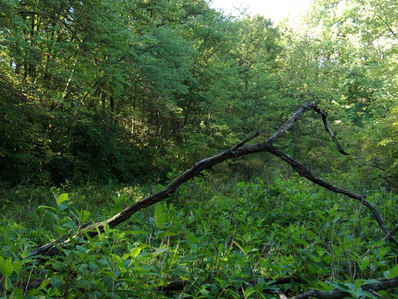
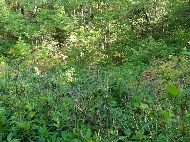
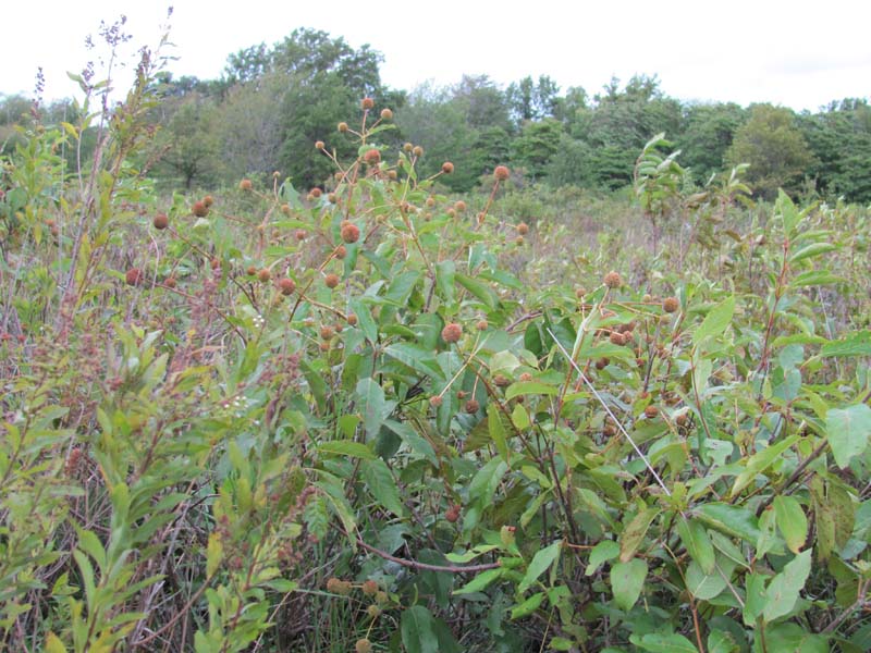
Buttonbush Wetland
System: Palustrine
Subsystem: Shrubland
PA Ecological Group(s): River Floodplain and Basin Wetland and Vernal Pool
Global Rank:GNR
![]() rank interpretation
rank interpretation
State Rank: S4
General Description
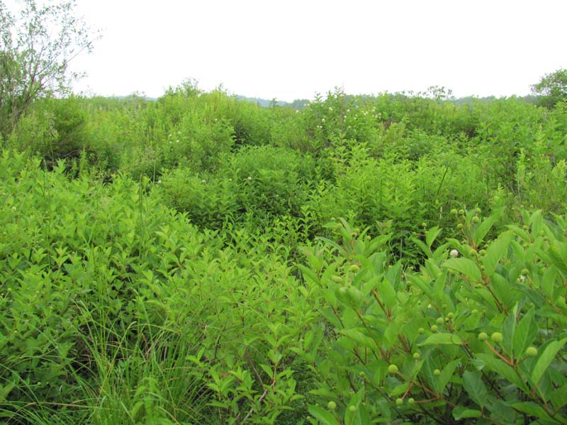
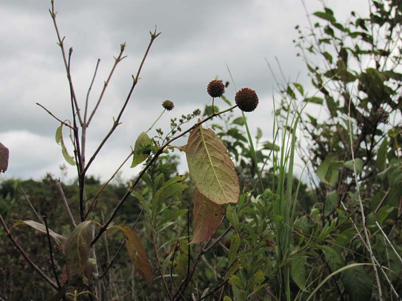
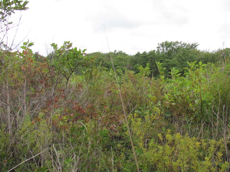
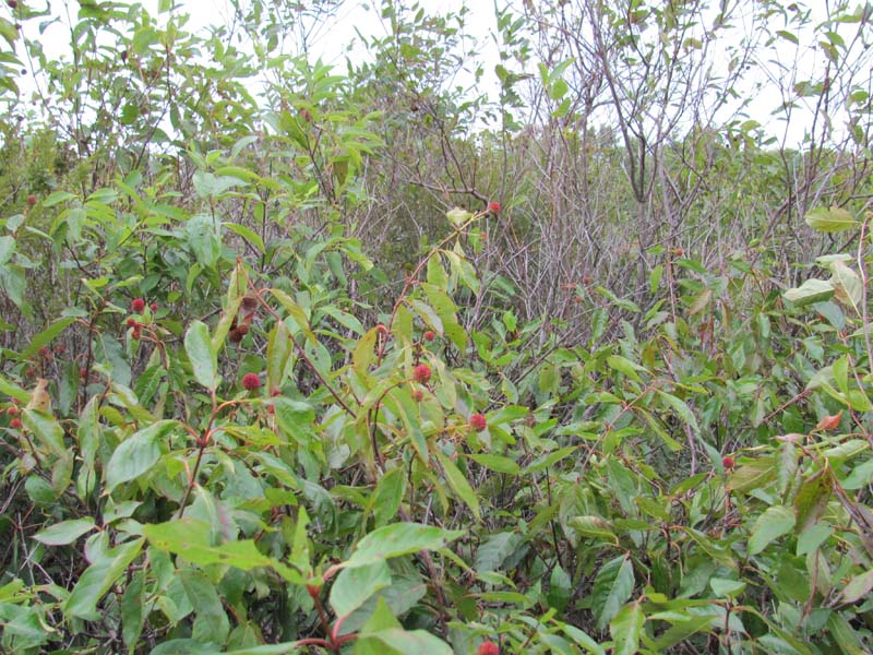
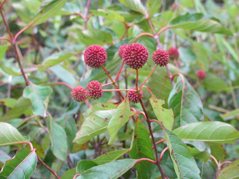
These wetlands are characterized by prolonged or semi-permanent flooding. The substrate may be organic or mineral soil. This community type may occur in shallow water along lake or pond shores, associated with river systems in oxbows, in wet swales or along floodplains, or in upland depressions. In some cases, this community represents a zone of vegetation between forest on the upland side and herbaceous vegetation downslope. Other shrubs, such as water-willow (Decodon verticillatus), swamp azalea (Rhododendron viscosum), silky dogwood (Cornus amomum), red-osier dogwood (Cornus sericea), silky willow (Salix sericea), diamond willow (Salix eriocephala), elderberry (Sambucus canadensis), highbush blueberry (Vaccinium corymbosum), and red maple (Acer rubrum) seedlings and saplings may occur, but buttonbush (Cephalanthus occidentalis) is usually a clear dominant. It is not uncommon for buttonbush to occur in near monotypic stands. Characteristic herbs include three-way sedge (Dulichium arundinaceum var. arundinaceum), marsh St. John's-wort (Triadenum virginicum), bugleweed (Lycopus uniflorus), spatterdock (Nuphar advena/ N. variegata), false water-pepper (Persicaria hydropiperoides), water-pepper (Persicaria punctata), water smartweed (Persicaria amphibia), common mermaid-weed (Proserpinaca palustris var. crebra), sedges (Carex lurida, Carex vesicaria), wool-grass (Scirpus cyperinus), Virginia chain fern (Woodwardia virginica), and marsh fern (Thelypteris palustris).
Rank Justification
Uncommon but not rare; some cause for long-term concern due to declines or other factors.
Identification
- Shallow water along lake or pond shores, associated with river systems in oxbows, in wet swales or along floodplains, or in upland depressions
- Clear dominance of buttonbush (Cephalanthus occidentalis)
- Mucky substrate
- Seasonal to semi-permanent flooding
Shrubs
- Buttonbush (Cephalanthus occidentalis)
- Red-osier dogwood (Cornus sericea)
- Water-willow (Decodon verticillatus)
- Swamp azalea (Rhododendron viscosum)
- Silky dogwood (Cornus amomum)
- Silky willow (Salix sericea)
- Diamond willow (Salix eriocephala)
- American elder (Sambucus canadensis)
- Highbush blueberry (Vaccinium corymbosum)
- Swamp rose (Rosa palustris)
- Red maple (Acer rubrum)
Herbs
- Three-way sedge (Dulichium arundinaceum var. arundinaceum)
- Marsh St. John's-wort (Triadenum virginicum)
- Bugleweed (Lycopus uniflorus)
- Spatterdock (Nuphar advena)
- Spatterdock (Nuphar variegata)
- Mild water-pepper (Persicaria hydropiperoides)
- Dotted smartweed (Persicaria punctata)
- Water smartweed (Persicaria amphibia)
- Common mermaid-weed (Proserpinaca palustris var. crebra)
- Sedge (Carex lurida)
- Sedge (Carex vesicaria)
- Sedge (Carex lupulina)
- Short hair sedge (Carex crinita var. crinita)
- Wool-grass (Scirpus cyperinus)
- Bulrush (Scirpus georgianus)
- Black bulrush (Scirpus atrovirens)
- Virginia chain fern (Woodwardia virginica)
- Marsh fern (Thelypteris palustris)
- Royal fern (Osmunda regalis)
- Pale meadowgrass (Torreyochloa pallida)
Bryophytes
* limited to sites with higher soil calcium
Vascular plant nomenclature follows Rhoads and Block (2007). Bryophyte nomenclature follows Crum and Anderson (1981).
International Vegetation Classification Associations:
USNVC Crosswalk:None
Representative Community Types:
Northeastern Buttonbush Shrub Swamp (CEGL006069)
NatureServe Ecological Systems:
Central Appalachian River Floodplain (CES202.608)
NatureServe Group Level:
None
Origin of Concept
Zimmerman, E., and G. Podniesinski. 2008. Classification, Assessment and Protection of Floodplain Wetlands of the Ohio Drainage. Pennsylvania Natural Heritage Program, Western Pennsylvania Conservancy, Pittsburgh, PA. Report to: The United States Environmental Protection Agency and the Pennsylvania Department of Conservation and Natural Resources, Office of Conservation Science. US EPA Wetlands Protection State Development Grant no. CD-973081-01-0.
Pennsylvania Community Code*
SB : Buttonbush Wetland
*(DCNR 1999, Stone 2006)
Similar Ecological Communities
The Circumneutral Mixed Shrub Wetland can occur in similar environmental settings and may also contain buttonbush (Cephalanthus occidentalis) but it is not the clear dominant shrub species that characterizes the Buttonbush Wetland.
Buttonbush Wetland and Water-willow Shrub Wetland occur in similar environmental settings and both contain buttonbush (Cephalanthus occidentalis) but it is not the clear dominant shrub species that characterizes the Buttonbush Wetland.
Fike Crosswalk
Buttonbush Wetland
Conservation Value
This community type can be associated with vernal pools and serve as important habitat for reptile and amphibian species such as wood frogs (Rana sylvatica), spotted salamander (Ambystoma maculatum), marbled salamander (Ambystoma opacum), and Jefferson salamander (Ambystoma jeffersonianum). This community also serves as a buffer for sediment and pollution runoff from adjacent developed lands by slowing the flow of surficial water causing sediment to settle within this wetland.
Threats
Alteration to the hydrological regime is a major threat to this community (e.g., impoundments, beaver dams) and can lead to habitat destruction and/or shifts in community function and dynamics. Clearing and development of adjacent land can lead to an accumulation of agricultural run-off and pollution as well as sedimentation. Invasive plant species such as cat-tails (Typha spp.) can dominate this community. Heavy logging upslope of buttonbush-dominated wetlands may impact value to reptiles and amphibians.
Management
A natural buffer around the wetland should be maintained in order to minimize nutrient runoff, pollution, and sedimentation. The potential for soil erosion based on soil texture, condition of the adjacent vegetation (mature forests vs. clearcuts), and the topography of the surrounding area (i.e., degree of slope) should be considered when establishing buffers. The buffer size should be increased if soils are erodible, adjacent vegetation has been logged, and the topography is steep as such factors could contribute to increased sedimentation and nutrient pollution. Direct impacts and habitat alteration should be avoided (e.g., roads, trails, filling of wetlands) and low impact alternatives (e.g., elevated footpaths, boardwalks, bridges) should be utilized in situations where accessing the wetland can not be avoided. Care should also be taken to control and prevent the spread of invasive species within the wetland.
Research Needs
Variations may occur at eco-regional levels. There is a need to collect plot data to characterize variations and guide further classification of this community.
Trends
Buttonbush Wetlands were probably more common but declined due to dam impoundments, wetland draining/filling, and sedimentation. Wetland protection has most likely stabilized the decline of these communities. The relative trend for this community is likely stable or may be declining slightly due to hydrological alterations and exotic species invasions.
Range Map
Pennsylvania Range
Statewide.
Global Distribution
Connecticut, Delaware, Maine, Maryland, Massachusetts, New Hampshire, New Jersey, Pennsylvania, Rhode Island, Virginia, Vermont, and West Virginia.
Edinger, G.J., D.J. Evans, S. Gebauer, T.G. Howard, D.M. Hunt, and A. M. Olivero (editors). 2002. Ecological Communities of New York. Second Edition. A revised and expanded edition of Carol Reschke’s Ecological Communities of New York State. New York Natural Heritage Program, New York State department of Environmental Conservation. Albany, NY. 136pp.
Fike, J. 1999. Terrestrial and palustrine plant communities of Pennsylvania. Pennsylvania Natural Diversity Inventory. Harrisburg, PA 79 pp.
Horvath, Jamie L., Timothy A. Block, and Ann F. Rhoads. 2008. Description of the population, canopy cover, and associated vegetation of the globally rare sedge Carex polymorpha (Cyperaceae) in Nescopeck State Park, Pennsylvania. In Sedges: Uses, Diversity, and Systematics of the Cyperaceae, eds. R. Naczi and B. Ford. Missouri Botanical Garden Press, St. Louis, MO.
NatureServe. 2005. NatureServe Central Databases. Arlington, Virginia. USA.
Pennsylvania Department of Conservation and Natural Resources (DCNR). 1999. Inventory Manual of Procedure. For the Fourth State Forest Management Plan. Pennsylvania Bureau of Forestry, Division of Forest Advisory Service. Harrisburg, PA. 51 ppg.
Perles, S.J., G.S. Podniesinski, E. Eastman, L.A. Sneddon, and S.C. Gawler. 2007. Classification and mapping of vegetation and fire fuel models at Delaware Water Gap National Recreation Area: Volume 2 of 2 – Appendix G. Technical Report NPS/NER/NRTR – 2007/076. National Park Service. Philadelphia, PA.
Rhoads, Ann F. and Timothy A. Block. 1999. Natural Areas Inventory of Bucks County, Pennsylvania. Bucks County Commissioners, Doylestown, PA.
Rhoads, Ann F. and Timothy A. Block. 2002. Nescopeck State Park; Inventory of PNDI-listed Plants and Plant Communities. Report submitted to DCNR, Bureau of State Parks.
Rhoads, Ann F. and Timothy A. Block. 2002. Survey of Tidal Marsh Natural Area, Neshaminy State Park. Report submitted to DCNR, Bureau of State Parks.
Rhoads, Ann F. and Timothy A. Block. 2004. East Goshen Township Wetlands; Vegetation Inventory and Management Recommendations. Reoprt submitted to East Goshen Township, Chester County, PA.
Rhoads, Ann F. and Timothy A. Block. 2006. Vegetation Inventory of Gouldsboro State Park. Report submitted to DCNR, Bureau of State Parks.
Rhoads, Ann F. and Timothy A. Block. 2008. Natural Areas Inventory Update, Montgomery County, Pennsylvania. Montgomery County Planning Commission, Norristown, PA.
Rhoads, Ann F. and Timothy A. Block. 2008. Vegetation of Ridley Creek State Park. Report submitted to DCNR, Bureau of State Parks.
Stone, B., D. Gustafson, and B. Jones. 2006 (revised). Manual of Procedure for State Game Land Cover Typing. Commonwealth of Pennsylvania Game Commission, Bureau of Wildlife Habitat Management, Forest Inventory and Analysis Section, Forestry Division. Harrisburg, PA. 79 ppg.

Cite as:
Eichelberger, B. and Zimmerman, E. 2022. Pennsylvania Natural Heritage Program. Buttonbush Wetland Factsheet. Available from: https://naturalheritage.state.pa.us/Community.aspx?=16036 Date Accessed: April 19, 2024