Red Maple – Elm – Willow Floodplain Forest
System: Palustrine
Subsystem: Forest
PA Ecological Group(s): River floodplain
Global Rank:G4
![]() rank interpretation
rank interpretation
State Rank: S2
General Description
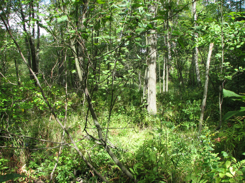
This palustrine forest type is primarily associated with major rivers, often located in old oxbows along the floodplain, or in depressions behind natural levees. These systems are subject to periodic flooding, may stay inundated for substantial periods of time, and may also receive groundwater enrichment and/or surface water from adjacent uplands. Characteristic species include red maple (Acer rubrum), green ash (Fraxinus pennsylvanica), American elm (Ulmus americana), red elm (Ulmus rubra), pin oak (Quercus palustris), swamp white oak (Quercus bicolor), bitternut hickory (Carya cordiformis), black willow (Salix nigra), silky willow (Salix sericea), arrow-wood (Viburnum recognitum), silky dogwood (Cornus amomum), spicebush (Lindera benzoin), riverbank grape (Vitis riparia), elderberry (Sambucus canadensis), sensitive fern (Onoclea sensibilis), ostrich fern (Matteuccia struthiopteris), and smartweeds (Polygonum and Persicaria spp.).
Rank Justification
Imperiled in the nation or state because of rarity due to very restricted range, very few populations (often 20 or fewer), steep declines, or other factors making it very vulnerable to extirpation from the nation or state.
Identification
- Occurs along major rivers, often located in old oxbows along the floodplain, or in depressions behind natural levees
- Dominated by red maple (Acer rubrum) with green ash (Fraxinus pennsylvanica), American elm (Ulmus americana), red elm (Ulmus rubra), and willows (Salix spp.) as co-dominants.
Trees
Shrubs
Herbs
* limited to sites with higher soil calcium
Vascular plant nomenclature follows Rhoads and Block (2007). Bryophyte nomenclature follows Crum and Anderson (1981).
International Vegetation Classification Associations:
USNVC Crosswalk:None
Representative Community Types:
Northern Piedmont / Central Appalachian Maple-Ash Swamp Forest (CEGL006548)
NatureServe Ecological Systems:
Central Appalachian River Floodplain (CES202.608)
NatureServe Group Level:
None
Origin of Concept
Fike, J. 1999. Terrestrial and palustrine plant communities of Pennsylvania. Pennsylvania Natural Diversity Inventory. Pennsylvania Department of Conservation and Recreation, Bureau of Forestry, Harrisburg, PA. 86 pp.
Pennsylvania Community Code*
SC : Red Maple – Elm – Willow Floodplain Swamp
*(DCNR 1999, Stone 2006)
Similar Ecological Communities
The other floodplain forest types, Sycamore Mixed Hardwood Floodplain Forest, Green Ash – Mixed Hardwood Floodplain Forest, and Silver Maple Floodplain Forest generally occur in areas that respond more quickly to changes in river level, and do not hold water for substantial periods of time following flooding. This palustrine forest type is primarily associated with major rivers, often located in old oxbows along the floodplain or in depressions behind natural levees, and has red maple (Acer rubrum) with green ash (Fraxinus pennsylvanica), American elm (Ulmus americana), red elm (Ulmus rubra), and willows (Salix spp.) as co-dominants tree species.
Fike Crosswalk
Red maple - elm - willow floodplain swamp
Conservation Value
The community is an important part of the river floodplain ecosystem, which provides significant ecosystem services such as sediment control, filtering runoff, and cooling overland flow of water, in addition to wildlife habitat. Great blue heron (Adrea herodias) nest in colonies on river floodplains near their riverine foraging areas. Standing dead trees (snags) provide cavities for bats, wood ducks (Aix sponsa), and other cavity nesting species. Large contiguous floodplain forests provide important habitat for wildlife species requiring large blocks of interior forest, such as neotropical migrants.
Threats
Alteration to the frequency and duration of flood events and development of the river floodplains are the two greatest threats to this community statewide and can lead to habitat destruction and/or shifts in community function and dynamics. Non-native invasive plants may be equally devastating as native floodplain plants are displaced. Development of adjacent land can lead to an accumulation of agricultural run-off, sedimentation, and pollution.
Management
Direct impacts to the floodplain ecosystems (e.g., road construction, development, filling of wetlands) altered their composition, structure, and function region-wide. Further impacts that alter riparian function of the remaining areas should therefore be avoided. When development is unavoidable, low impact alternatives (e.g., elevated footpaths, boardwalks, bridges, pervious paving) that maintain floodplain processes should be utilized to minimize impacts to natural areas and the plant and animal species within them. Maintenance of natural buffers surrounding high quality examples of floodplain wetlands is recommended in order to minimize nutrient runoff, pollution, and sedimentation.
Care should also be taken to control and prevent the spread of invasive species into high quality sites.
As floodplains are dependent on periodic disturbance, natural flooding frequency and duration should be maintained, and construction of new dams, levees, or other in-stream modifications should be avoided. Activities resulting in destabilization of the banks or alteration of the disturbance patterns of the site should be avoided. Numerous land use planning recommendations have been proposed to reduce the negative impacts of changing land use on riparian systems. These include protecting riparian buffer habitat, retaining natural areas in developed landscapes, compensating for lost habitat, excluding livestock grazing from riparian areas, providing corridors between riparian and upland habitats, avoiding constructing roads and utility lines through riparian habitat areas, and restoring degraded riparian habitat. In general, unaltered and intact river systems are more resilient to environmental stress than human-impacted or engineered river systems.
Research Needs
More work should be done to document and describe the species composition, environmental settings and distribution of this community type. Additionally, there is need to monitor high quality examples of this community to determine the impact of invasive species within this type.
Trends
Lack of historical information regarding this community type makes it difficult to determine trends. This community type is likely stable but may be decreasing due to hydrological alterations.
Range Map
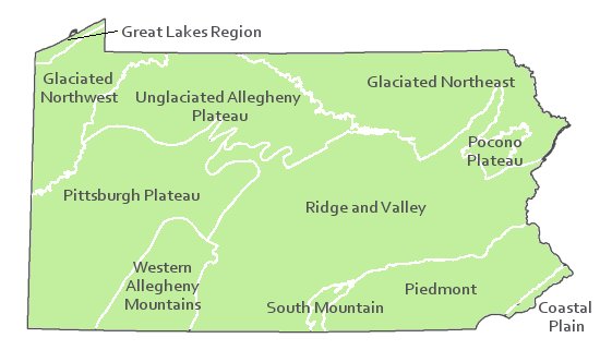
Pennsylvania Range
Statewide
Global Distribution
Kentucky, Maryland, New Jersey, Pennsylvania, Virginia, and West Virginia.
Pennsylvania Department of Conservation and Natural Resources (DCNR). 1999. Inventory Manual of Procedure. For the Fourth State Forest Management Plan. Pennsylvania Bureau of Forestry, Division of Forest Advisory Service. Harrisburg, PA. 51 ppg.
Stone, B., D. Gustafson, and B. Jones. 2006 (revised). Manual of Procedure for State Game Land Cover Typing. Commonwealth of Pennsylvania Game Commission, Bureau of Wildlife Habitat Management, Forest Inventory and Analysis Section, Forestry Division. Harrisburg, PA. 79 ppg.
_forested wetland.jpg)
.jpg)
_seasonal wetland.jpg)
.jpg)
Cite as:
Zimmerman, E. 2022. Pennsylvania Natural Heritage Program. Red Maple – Elm – Willow Floodplain Forest Factsheet. Available from: https://naturalheritage.state.pa.us/Community.aspx?=16021 Date Accessed: April 19, 2024