Serpentine Seep
System: Palustrine
Subsystem: Herbaceous
PA Ecological Group(s): Seepage Wetland
Global Rank:GNR
![]() rank interpretation
rank interpretation
State Rank: S1
General Description
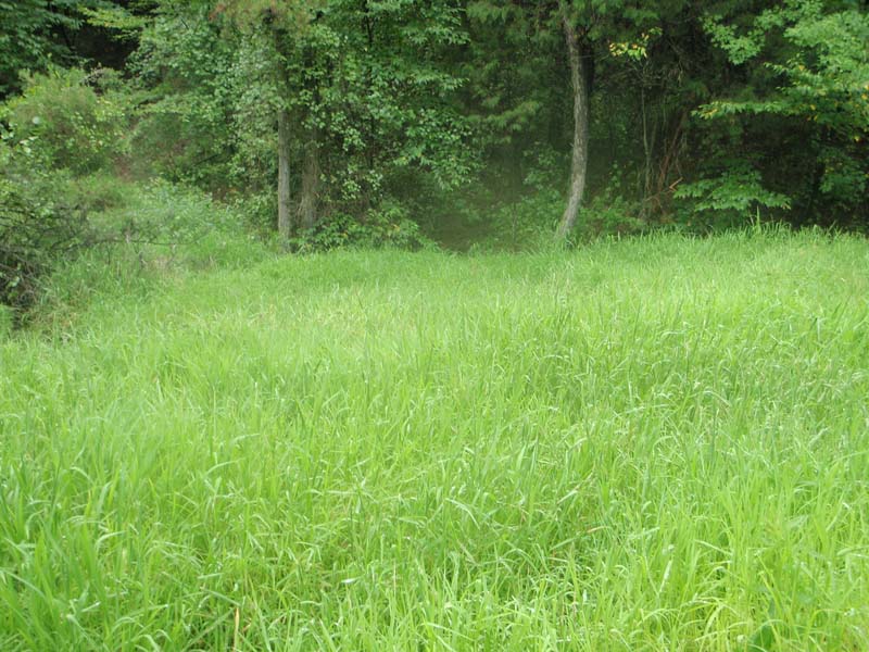
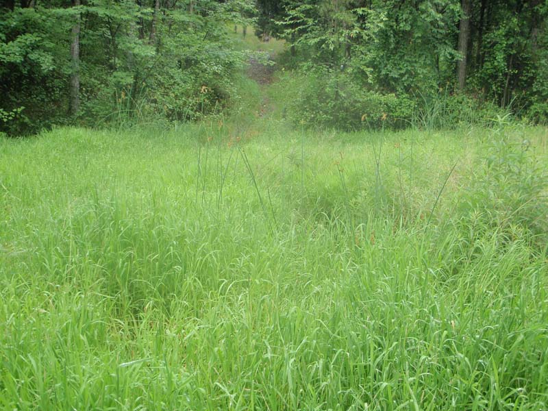
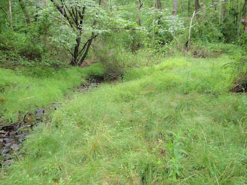
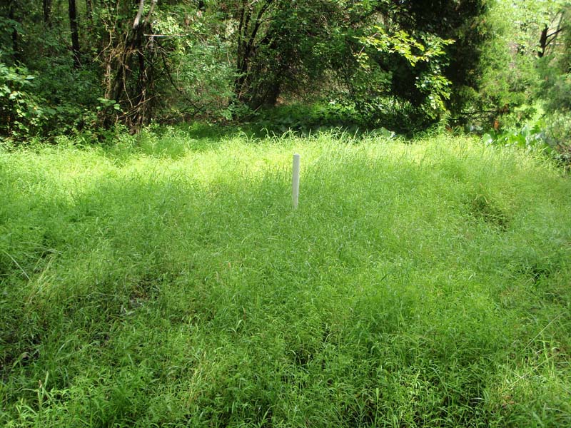
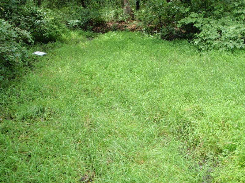
This community type is restricted to areas underlain by serpentinite bedrock. Seeps occur on gentle slopes at the base of low hills and are adjacent to streams or may be stream headwater areas. Groundwater enriched with magnesium and various heavy metals (i.e., chromium and nickel) saturates the surface for a substantial portion of the growing season. Graminoids dominate; tufted hairgrass (Deschampsia cespitosa), rice cutgrass (Leersia oryzoides), spike-rush (Eleocharis tenuis var. pseudoptera), and deer-tongue grass (Dichanthelium clandestinum) are common. Other species that are characteristic of these seeps include straw-colored nutsedge (Cyperus strigosus), muhly (Muhlenbergia mexicana), swamp thistle (Cirsium muticum), smartweeds (Polygonum spp.), bugleweed (Lycopus uniflorus), a moss (Philonotis capillaris), Indian-grass (Sorghastrum nutans), whip-grass (Scleria triglomerata), purple gerardia (Agalinis purpurea), American burnet (Sanguisorba canadensis), and boneset (Eupatorium perfoliatum). This community type is part of the serpentine barrens complex.
Rank Justification
Critically imperiled in the jurisdiction because of extreme rarity or because of some factor(s) such as very steep declines making it especially vulnerable to extirpation.
Identification
- Groundwater seep areas of low slope (1-3 degrees) and variable aspect
- Soils are typically very wet thin sapric peats (muck) (saturated) and clay loams derived from serpentine bedrock
- Soil depth is generally greater than 30 cm and can exceed 60 cm
- Only occurs on serpentinite bedrock
- Dominated by grasses and rushes such as tufted hairgrass (Deschampsia cespitosa), rice cutgrass (Leersia oryzoides), spike-rush (Eleocharis tenuis var. pseudoptera), and deer-tongue grass (Dichanthelium clandestinum)
Herbs
- Tufted hairgrass (Deschampsia cespitosa)
- Rice cutgrass (Leersia oryzoides)
- Slender spike-rush (Eleocharis tenuis var. pseudoptera)
- Deer-tongue grass (Dichanthelium clandestinum)
- False nutsedge (Cyperus strigosus)
- Muhly (Muhlenbergia mexicana)
- Swamp thistle (Cirsium muticum)
- Smartweeds (Persicaria spp.)
- Bugleweed (Lycopus uniflorus)
- Indian-grass (Sorghastrum nutans)
- Whip-grass (Scleria triglomerata)
- False-foxglove (Agalinis purpurea)
- American burnet (Sanguisorba canadensis)
- Boneset (Eupatorium perfoliatum)
Bryophytes
* limited to sites with higher soil calcium
Vascular plant nomenclature follows Rhoads and Block (2007). Bryophyte nomenclature follows Crum and Anderson (1981).
International Vegetation Classification Associations:
USNVC Crosswalk:None
Representative Community Types:
Serpentine Emergent Wetland (CEGL006316)
NatureServe Ecological Systems:
Eastern Serpentine Woodland (CES202.347)
NatureServe Group Level:
None
Origin of Concept
Fike, J. 1999. Terrestrial and palustrine plant communities of Pennsylvania. Pennsylvania Natural Diversity Inventory. Pennsylvania Department of Conservation and Recreation, Bureau of Forestry, Harrisburg, PA. 86 pp.
Pennsylvania Community Code*
HE : Serpintine Seepage Wetland
*(DCNR 1999, Stone 2006)
Similar Ecological Communities
This community is distinguished from other types of seeps primarily by its landscape context. This type occurs exclusively in areas underlain by serpentinite bedrock and influenced by groundwater rich in calcium, magnesium, chromium, nickel, and iron.
Fike Crosswalk
Serpentine Seepage Wetland
Conservation Value
This community is rare in the state and serves as important habitat for reptile and amphibian species such as wood frogs (Rana sylvatica), spotted salamander (Ambystoma maculatum), marbled salamander (Ambystoma opacum), and Jefferson salamander (Ambystoma jeffersonianum).
Threats
Alteration to the hydrological regime and development are the major threats to this community and can lead to habitat destruction and/or shifts in community function and dynamics. Clearing and development of adjacent land can lead to an accumulation of agricultural run-off and pollution, and sedimentation. This community is limited to areas where serpentine bedrock is near the surface, resulting in a limited range of potential habitats.
Management
Extraction, drilling, mining, or other activities that impact the bedrock or flow of groundwater should not be undertaken within half a mile of a seepage wetland without a thorough understanding of bedrock layers and groundwater flows. A natural buffer around the wetland should be maintained in order to minimize nutrient runoff, pollution, and sedimentation. The potential for soil erosion based on soil texture, condition of the adjacent vegetation (mature forests vs. clearcuts), and the topography of the surrounding area (i.e., degree of slope) should be considered when establishing buffers. The buffer size should be increased if soils are erodible, adjacent vegetation has been logged, and the topography is steep as such factors could contribute to increased sedimentation and nutrient pollution. Direct impacts and habitat alteration should be avoided (e.g., roads, trails, filling of wetlands) and low impact alternatives (e.g., elevated footpaths, boardwalks, bridges) should be utilized in situations where accessing the wetland can not be avoided. Care should also be taken to control and prevent the spread of invasive species within the wetland.
Research Needs
There is a need to collect plot data to characterize variations and guide further classification of this community.
Trends
The general trend has been decline as many of the smaller serpentine barrens have been lost to development and agriculture. Most extant occurrences are likely on protected public or private lands and are relatively secure.
Range Map
Pennsylvania Range
Southeastern Pennsylvania.
Global Distribution
Pennsylvania, possibly in Maryland.
Eastern Ecology Working Group of NatureServe. No date. International Ecological Classification Standard: International Vegetation Classification. Terrestrial Vegetation. NatureServe, Boston, MA.
Fike, J. 1999. Terrestrial and palustrine plant communities of Pennsylvania. Pennsylvania Natural Diversity Inventory. Pennsylvania Department of Conservation and Recreation. Bureau of Forestry. Harrisburg, PA. 86 pp.
NatureServe 2010. NatureServe Explorer: An online encyclopedia of life Version 7.1. NatureServe, Arlington, VA. Available http://www.natureserv.org/explorer (accessed: 23 November 2011).
Pennsylvania Department of Conservation and Natural Resources (DCNR). 1999. Inventory Manual of Procedure. For the Fourth State Forest Management Plan. Pennsylvania Bureau of Forestry, Division of Forest Advisory Service. Harrisburg, PA. 51 ppg.
Podniesinski, G., A. Leimanis, and J. Ebert. 1999. Unpublished data. Serpentine Plant Community Classification. Western Pennsylvania Conservancy, Pittsburgh, PA. 14 pp.
Stone, B., D. Gustafson, and B. Jones. 2006 (revised). Manual of Procedure for State Game Land Cover Typing. Commonwealth of Pennsylvania Game Commission, Bureau of Wildlife Habitat Management, Forest Inventory and Analysis Section, Forestry Division. Harrisburg, PA. 79 ppg.
Cite as:
Eichelberger, B. 2022. Pennsylvania Natural Heritage Program. Serpentine Seep Factsheet. Available from: https://naturalheritage.state.pa.us/Community.aspx?=16014 Date Accessed: April 18, 2024