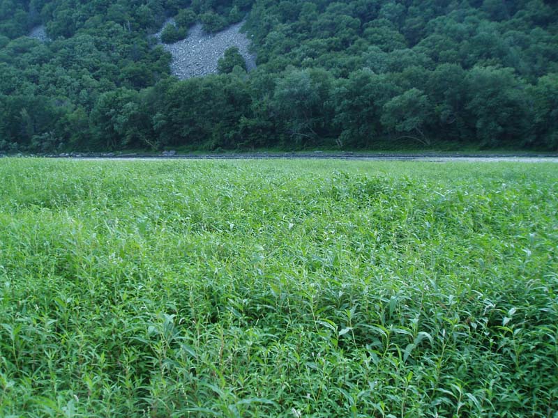
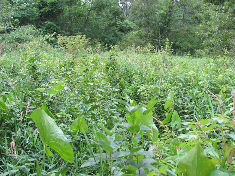
Mixed Forb Marsh
System: Palustrine
Subsystem: Herbaceous
PA Ecological Group(s): Basin Wetland
Global Rank:GNR
![]() rank interpretation
rank interpretation
State Rank: S3
General Description
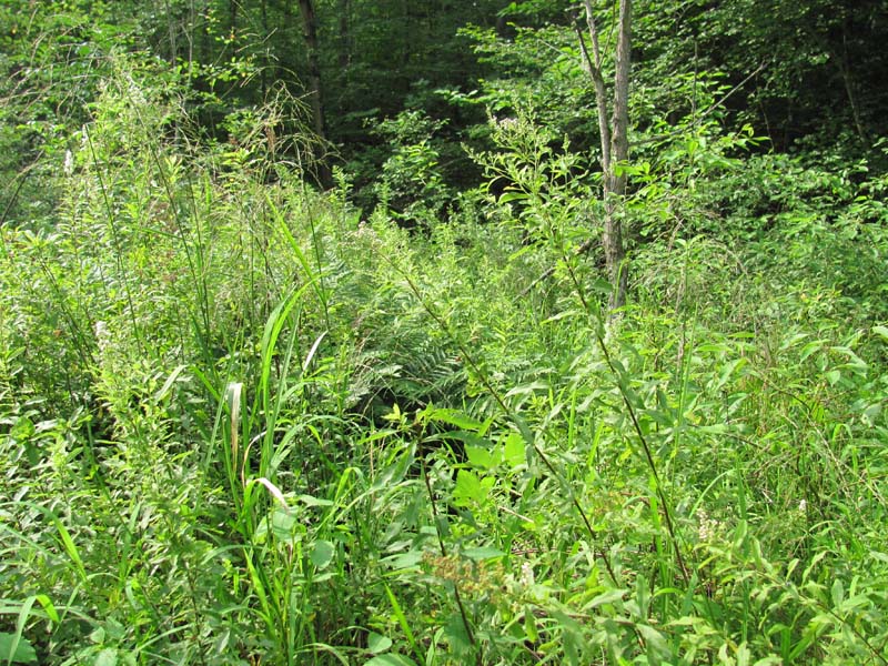
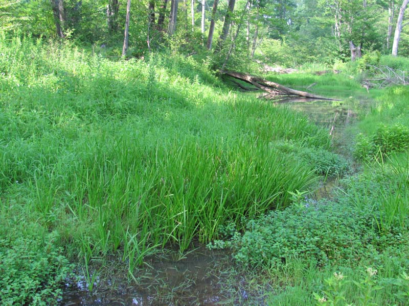
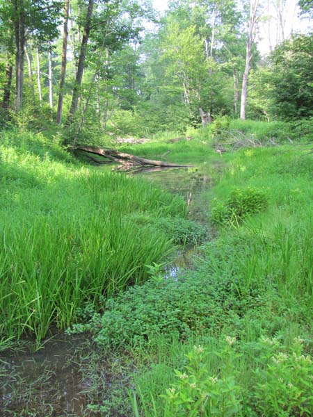
This is a highly variable type which community occurs along lake margins, flooded depressions, and other wetlands that remain inundated throughout the growing season. The plant composition is variable and includes aquatic emergent plants as well as submerged aquatic species. Characteristic species include three-way sedge (Dulichium arundinaceum var. arundinaceum), halberd-leaf tearthumb (Persicaria arifolia), tearthumb (Persicaria sagittata), dock (Rumex spp.), sharp-fruited rush (Juncus acuminatus), beggar-ticks (Bidens spp.), jewelweed (Impatiens capensis), sensitive fern (Onoclea sensibilis), wapato (Sagittaria latifolia), sedges (Carex stricta, C. lacustris, C. lurida, C. crinita, C. stipata, C. tribuloides, C. scoparia, C. projecta, C. comosa, C. hystericina, C. baileyi), sweet-flag (Acorus calamus), and rice cutgrass (Leersia oryzoides). The invasive species purple loosestrife (Lythrum salicaria) and common reed (Phragmites australis ssp. australis) are frequently a major problem in these systems.
Rank Justification
Vulnerable in the state due to a restricted range, relatively few populations (often 80 or fewer), recent and widespread declines, or other factors making it vulnerable to extirpation.
Identification
- Occurs along lake margins, flooded depressions, and other wetlands that remain inundated throughout the growing season
- Substrate is variable, often muck or sandy soil
- Composition is variable and includes aquatic emergent plants as well as submerged aquatic species
Herbs
- Sedge (Carex lacustris)
- Sedge (Carex lurida)
- Short hair sedge (Carex crinita var. crinita)
- Sedge (Carex stipata)
- Sedge (Carex tribuloides)
- Broom sedge (Carex scoparia)
- Sedge (Carex comosa)
- Sedge (Carex hystericina)
- Three-way sedge (Dulichium arundinaceum var. arundinaceum)
- Halberd-leaf tearthumb (Persicaria arifolia)
- Tearthumb (Persicaria sagittata)
- Sedge (Carex baileyi)
- Sharp-fruited rush (Juncus acuminatus)
- Beggar-ticks (Bidens spp.)
- Jewelweed (Impatiens capensis)
- Sensitive fern (Onoclea sensibilis)
- Wapato (Sagittaria latifolia)
- Sedge (Carex projecta)
- Rice cutgrass (Leersia oryzoides)
Exotic Species
* limited to sites with higher soil calcium
Vascular plant nomenclature follows Rhoads and Block (2007). Bryophyte nomenclature follows Crum and Anderson (1981).
International Vegetation Classification Associations:
USNVC Crosswalk:None
Representative Community Types:None
NatureServe Ecological Systems:
High Allegheny Wetland (CES202.069)
Southern and Central Appalachian Bog and Fen (CES202.300)
NatureServe Group Level:
None
Origin of Concept
Fike, J. 1999. Terrestrial and palustrine plant communities of Pennsylvania. Pennsylvania Natural Diversity Inventory. Pennsylvania Department of Conservation and Recreation, Bureau of Forestry, Harrisburg, PA. 86 pp.
Pennsylvania Community Code*
HF : Mixed Forb Marsh
*(DCNR 1999, Stone 2006)
Similar Ecological Communities
This type is distinguished from the various graminoid-dominated marsh types by its broad-leaf dominants. The Herbaceous Vernal Pond type is related to this, but occurs exclusively in upland depressions that dry out substantially to completely in the dry season. This type is distinguished from the various forb and graminoid-dominated marsh types by species composition and landscape position. It is distinguished from the graminoid-dominated marsh types by the dominance of broad-leaved species. Although reed canary-grass (Phalaris arundinacea) and bluejoint (Calamagrostis canadensis var. canadensis) may occur in this community type, they are not dominant. If one of these species or a combination of the two dominates the community, the community may be better represented by Bluejoint – Reed Canary-grass Marsh. If tussock sedge (Carex stricta) strongly dominates the community, then the community would better be represented by Tussock Sedge Marsh. The Rice Cutgrass – Bulrush Vernal Pool or Wool-grass – Mannagrass – Mixed Shrub Vernal Pool types may resemble the Mixed Forb Marsh type but these two occurs exclusively in upland depressions that dry out substantially to completely in the dry season. The Mixed Forb Marsh community may also resemble the Freshwater Tidal Mixed High Marsh and Riverbank Freshwater Tidal Marsh communities. However, the presence of tidal marsh species such as wild-rice (Zizania aquatica), salt-marsh water-hemp (Amaranthus cannabinus), and swamp beggar’s-ticks (Bidens bidentoides) in these types differentiates from the more Mixed Forb Marsh.
Fike Crosswalk
Mixed Forb Marsh
Conservation Value
This community can serve as habitat for odonate and bird species and may host rare plant species such as cyperus-like sedge (Carex pseudocyperus), backward sedge (Carex retrorsa), downy willow-herb (Epilobium strictum), purple fringeless orchid (Platanthera peramoena), and bedstraw (Galium trifidum). This community also serves as a buffer for sediment and pollution runoff from adjacent developed lands by slowing the flow of surficial water causing sediment to settle within this wetland.
Threats
Alteration to the hydrological regime and development are the major threats to this community (e.g., impoundments, beaver dams) and can lead to habitat destruction and/or shifts in community function and dynamics. Clearing and development of adjacent land can lead to an accumulation of agricultural run-off and pollution, sedimentation, and insolation/thermal pollution. Invasive plant species such as purple loosestrife (Lythrum salicaria), narrow-leaved cat-tail (Typha angustifolia), and common reed (Phragmites australis ssp. australis) can occur in this community.
Management
A natural buffer around the wetland should be maintained in order to minimize nutrient runoff, pollution, and sedimentation. The potential for soil erosion based on soil texture, condition of the adjacent vegetation (mature forests vs. clearcuts), and the topography of the surrounding area (i.e., degree of slope) should be considered when establishing buffers. The buffer size should be increased if soils are erodible, adjacent vegetation has been logged, and the topography is steep as such factors could contribute to increased sedimentation and nutrient pollution. Direct impacts and habitat alteration should be avoided (e.g., roads, trails, filling of wetlands) and low impact alternatives (e.g., elevated footpaths, boardwalks, bridges) should be utilized in situations where accessing the wetland can not be avoided. Care should also be taken to control and prevent the spread of invasive species within the wetland. Alterations to groundwater sources should be minimized.
Research Needs
There is a need to collect plot data to characterize variations and guide further classification of this community.
Trends
These wetlands are probably less common due to wetland draining/filling and clearing of the adjacent lands leading to sedimentation. The relative trend for this community is likely stable or may be decreasing slightly due to hydrological alterations.
Range Map
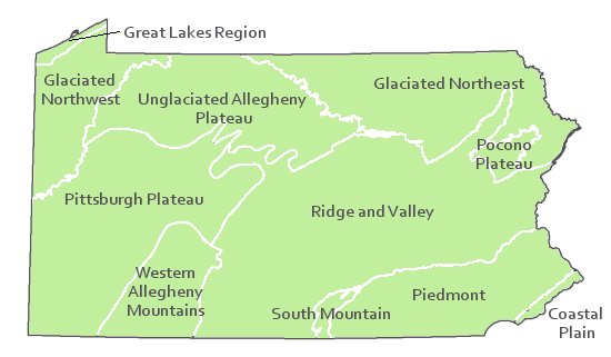
Pennsylvania Range
Statewide
Global Distribution
New York, Pennsylvania, and West Virginia
Byers, E. A., J. P. Vanderhorst, and B. P. Streets. 2007. Classification and conservation assessment of high elevation wetland communities in the Allegheny Mountains of West Virginia. West Virginia Natural Heritage Program, West Virginia Division of Natural Resources, Elkins.
Eastern Ecology Working Group of NatureServe. No date. International Ecological Classification Standard: International Vegetation Classification. Terrestrial Vegetation. NatureServe, Boston, MA.
Edens, D. L. 1973. The ecology and succession of Cranberry Glades, WV. Ph.D. dissertation, North Carolina State University, Raleigh.
Fike, J. 1999. Terrestrial and palustrine plant communities of Pennsylvania. Pennsylvania Natural Diversity Inventory. Pennsylvania Department of Conservation and Recreation. Bureau of Forestry. Harrisburg, PA. 86 pp.
Hall, M. E. 2005. Classification and gradient analysis of plant communities at Short Mountain Wildlife Management Area, Hampshire County, West Virginia. M.S. thesis, Western Carolina University, Cullowhee, NC. 108 pp.
Horvath, Jamie L., Timothy A. Block, and Ann F. Rhoads. 2008. Description of the population, canopy cover, and associated vegetation of the globally rare sedge Carex polymorpha (Cyperaceae) in Nescopeck State Park, Pennsylvania. In Sedges: Uses, Diversity, and Systematics of the Cyperaceae, eds. R. Naczi and B. Ford. Missouri Botanical Garden Press, St. Louis, MO.
Khan, Nancy R., Ann F. Rhoads, and Timothy A. Block. 2005. Characterization and assessmant of the Floristic Resources in Evansburg State Park. Report submitted to DCNR, Bureau of State Parks.
Khan, Nancy R., Ann F. Rhoads, and Timothy A. Block. 2008. Vascular flora and community assemblages of Evansburg State Park, Montgomery County, Pennsylvania. Bulletin of the Torrey Botanical Club 135(3): 438-458.
NatureServe 2010. NatureServe Explorer: An online encyclopedia of life Version 7.1. NatureServe, Arlington, VA. Available http://www.natureserv.org/explorer (accessed: 23 November 2011).
Pennsylvania Department of Conservation and Natural Resources (DCNR). 1999. Inventory Manual of Procedure. For the Fourth State Forest Management Plan. Pennsylvania Bureau of Forestry, Division of Forest Advisory Service. Harrisburg, PA. 51 ppg.
Rhoads, Ann F. and Timothy A. Block. 1999. Natural Areas Inventory of Bucks County, Pennsylvania. Bucks County Commissioners, Doylestown, PA.
Rhoads, Ann F. and Timothy A. Block. 2002. Nescopeck State Park; Inventory of PNDI-listed Plants and Plant Communities. Report submitted to DCNR, Bureau of State Parks.
Rhoads, Ann F. and Timothy A. Block. 2003. Lower Morrisville Road Wetlands, Natural Resourced Inventory ahd Management Recommendations. Report submitted to the Falls Township Board of Supervisors.
Rhoads, Ann F. and Timothy A. Block. 2004. Nockamixon State Park Natural Resources Inventory. Report submitted to DCNR, Bureauof State Parks.
Rhoads, Ann F. and Timothy A. Block. 2008. Natural Areas Inventory Update, Montgomery County, Pennsylvania. Montgomery County Planning Commission, Norristown, PA.
Rhoads, Ann F. and Timothy A. Block. 2008. Vegetation of Ridley Creek State Park. Report submitted to DCNR, Bureau of State Parks.
Stone, B., D. Gustafson, and B. Jones. 2006 (revised). Manual of Procedure for State Game Land Cover Typing. Commonwealth of Pennsylvania Game Commission, Bureau of Wildlife Habitat Management, Forest Inventory and Analysis Section, Forestry Division. Harrisburg, PA. 79 ppg.
Walbridge, M. R. 1982. Vegetation patterning and community distribution in four high-elevation headwater wetlands in West Virginia. M.S. thesis, West Virginia University, Morgantown.
Cite as:
Davis T. 2022. Pennsylvania Natural Heritage Program. Mixed Forb Marsh Factsheet. Available from: https://naturalheritage.state.pa.us/Community.aspx?=16007 Date Accessed: April 20, 2024